Download
3D Flyover
Add to list
More
16.7 km
~3 hrs 58 min
382 m
Loop
“Ringinglow West Loop offers a scenic 17 km hike through moorlands, woodlands, and historical landmarks near Sheffield.”
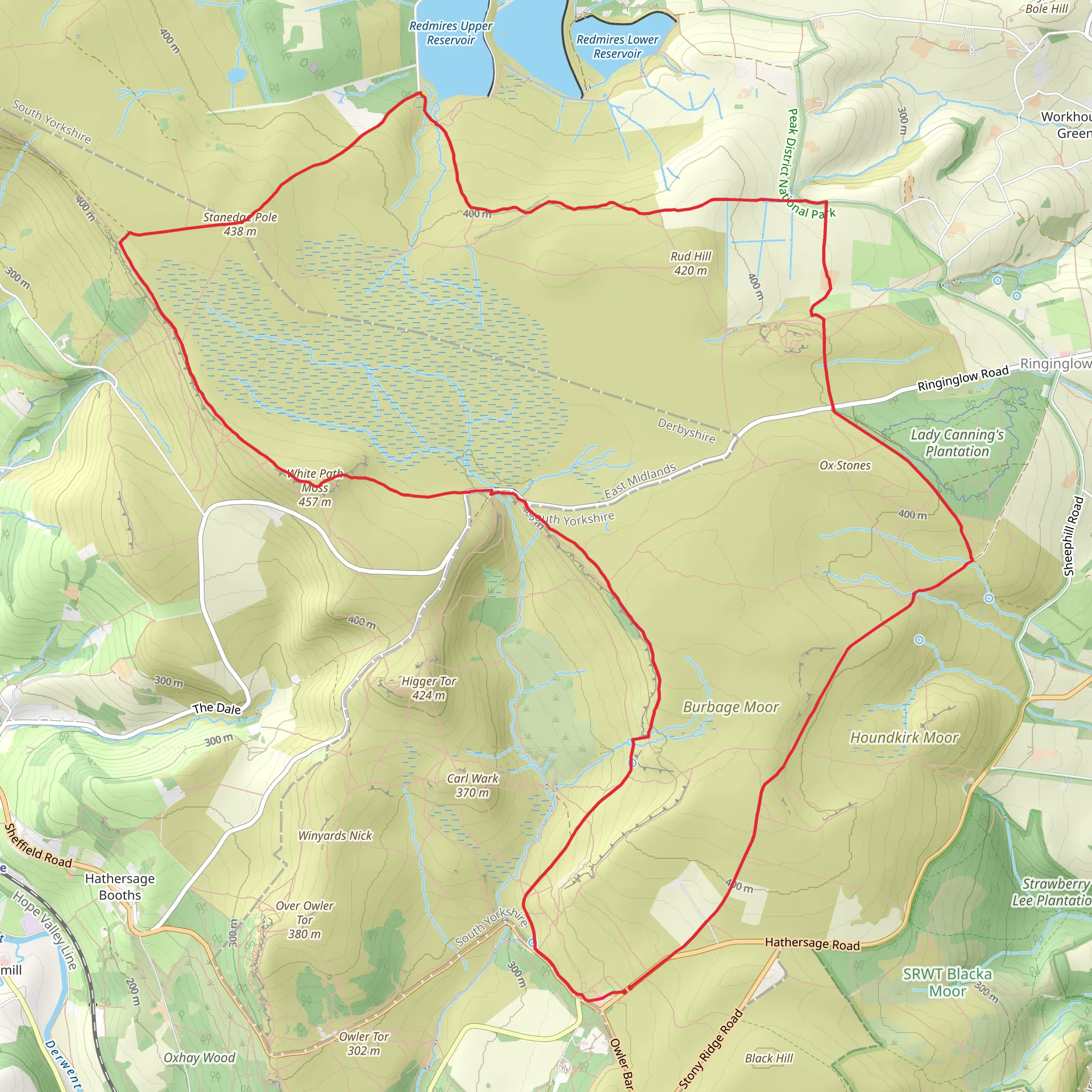
Starting near Sheffield, England, the Ringinglow West Loop is a captivating 17 km (approximately 10.5 miles) loop trail with an elevation gain of around 300 meters (about 985 feet). This medium-difficulty trail offers a blend of natural beauty, historical landmarks, and diverse wildlife, making it a rewarding experience for hikers.
Getting There
To reach the trailhead, you can drive or use public transport. If driving, head towards Ringinglow Road, Sheffield, where you can find parking near the Norfolk Arms pub. For those using public transport, take a bus from Sheffield city center to the Norfolk Arms stop, which is conveniently close to the trailhead.
Trail Overview
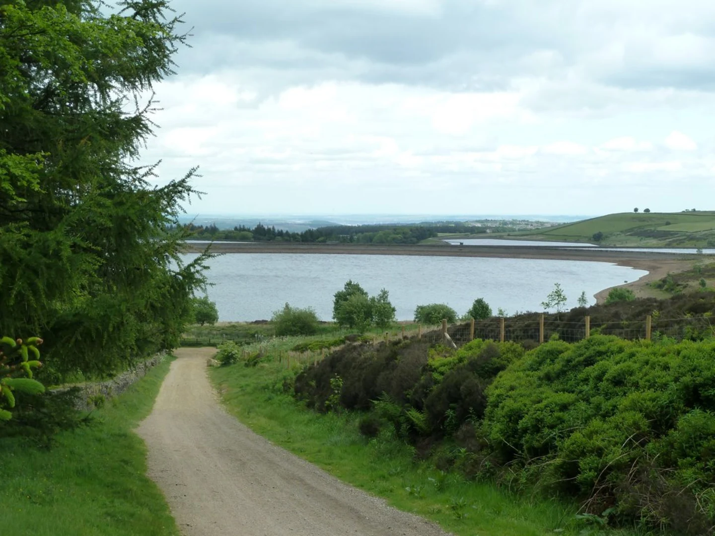
The trail begins near the Norfolk Arms pub, a historic establishment that has served travelers since the 19th century. From here, the path leads you through a mix of open moorland, ancient woodlands, and rolling hills, providing a variety of landscapes to enjoy.
Key Sections and Landmarks
Ringinglow to Burbage Moor
The initial section takes you westward towards Burbage Moor. This area is known for its rugged beauty and panoramic views. As you ascend, you'll gain approximately 100 meters (328 feet) in elevation over the first 3 km (1.9 miles). Keep an eye out for the remnants of old millstones scattered across the moor, a nod to the area's industrial past.
Burbage Moor to Houndkirk Road
Continuing on, the trail intersects with Houndkirk Road, an ancient packhorse route. This section is relatively flat, allowing you to catch your breath and enjoy the surrounding heather and gorse. The road itself has historical significance, having been used for centuries to transport goods between Sheffield and the Peak District.
Houndkirk Road to Lady Canning's Plantation
After about 6 km (3.7 miles), you'll reach Lady Canning's Plantation, a popular spot for mountain bikers and hikers alike. The plantation is a mix of coniferous and deciduous trees, providing a habitat for various bird species. This section involves a gentle descent of around 50 meters (164 feet) over 2 km (1.2 miles).
Lady Canning's Plantation to Porter Clough
The trail then leads you through Porter Clough, a picturesque valley with a babbling brook. This area is rich in wildlife, including deer and various bird species. The path here is narrow and can be muddy, so sturdy footwear is recommended. You'll descend another 50 meters (164 feet) over the next 2 km (1.2 miles).
Porter Clough to Ringinglow
The final stretch takes you back towards Ringinglow, passing through open fields and farmland. This section is relatively flat, with a gentle ascent of about 100 meters (328 feet) over the last 4 km (2.5 miles). As you approach the end of the loop, you'll pass by the historic Ringinglow Roundhouse, a former toll house dating back to the 18th century.
Navigation and Safety
For navigation, it's advisable to use HiiKER, which provides detailed maps and real-time updates. The trail is well-marked, but weather conditions can change rapidly, so always be prepared with appropriate clothing and gear.
Flora and Fauna
Throughout the hike, you'll encounter a variety of flora, including heather, gorse, and ancient oak trees. Wildlife is abundant, with opportunities to see deer, rabbits, and a wide range of bird species, from kestrels to woodpeckers.
Historical Significance
The Ringinglow West Loop is steeped in history, from the ancient packhorse routes to the industrial remnants on Burbage Moor. The Norfolk Arms pub and Ringinglow Roundhouse add a historical dimension to your hike, offering a glimpse into the area's rich past.
This trail offers a perfect blend of natural beauty, historical intrigue, and moderate physical challenge, making it a must-visit for any hiking enthusiast.
What to expect?
Activity types
Comments and Reviews
User comments, reviews and discussions about the Ringinglow West Loop, England.
4.43
average rating out of 5
7 rating(s)
