Download
Preview
Add to list
More
88.3 km
~5 days
1698 m
Multi-Day
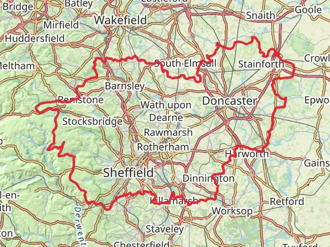
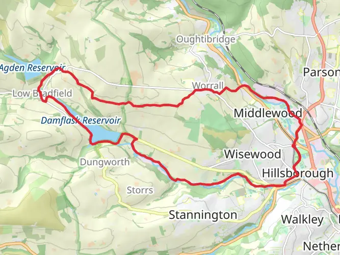
The Sheffield Railway Station to Huddersfield Railway Station is a 88.3 km trail that starts in Sheffield, Sheffield, England. Based on our data, the hike is graded as Easy. For information on how we grade trails, please read measuring the difficulty of a hiking trail on hiiker. Also, check our latest community posts for trail updates. This hike can be completed in approx 4 days. Caution is advised on trail times as this depends on multiple variables. For more info read about how we calculate hike time.

What to expect?
Activity types
Frequently asked questions
How long does the Sheffield Railway Station to Huddersfield Railway Station hike take to complete?
The Sheffield Railway Station to Huddersfield Railway Station hike is 88.28 km long, so most walkers treat it as a multi-day route rather than a single outing. A typical schedule is 3 to 5 days, depending on pace, daily mileage, and how often stops are made at intermediate Penistone Line stations such as Penistone or Marsden.
Is the Sheffield Railway Station to Huddersfield Railway Station hike difficult?
The Sheffield Railway Station to Huddersfield Railway Station hike is graded easy, but it is still a substantial long-distance walk with 1,698 m of total ascent over 88.28 km. The easier rating reflects the generally manageable terrain and station-to-station format, not a short day walk, so stamina matters more than technical hiking skill.
Can the Sheffield Railway Station to Huddersfield Railway Station hike be split into shorter sections?
Yes. The Sheffield Railway Station to Huddersfield Railway Station hike follows the Penistone Line corridor, a station-to-station trail between Sheffield and Huddersfield with intermediate rail stops along the way. That makes it practical to break the full 88.28 km into shorter day walks and rejoin the route by train rather than completing it all in one trip.
What towns and landmarks does the Sheffield Railway Station to Huddersfield Railway Station hike pass?
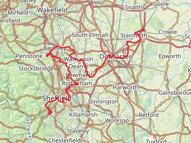
The Sheffield Railway Station to Huddersfield Railway Station hike follows the Penistone Line Trail corridor from Sheffield to Huddersfield and passes through a mix of urban edge, valley, and Pennine landscapes. Notable places associated with the route include Penistone, Marsden, Wincobank above the Don Valley, and Castle Hill at Almondbury near the Huddersfield end.
Is the Sheffield Railway Station to Huddersfield Railway Station hike well suited to train travel?
Yes. The route starts at Sheffield Railway Station and finishes at Huddersfield Railway Station, and the Penistone Line Trail is specifically designed as a station-to-station walk linked by rail. That setup makes it unusually convenient for point-to-point hiking, section walking, and early finishes if weather or timing changes.
What kind of terrain is on the Sheffield Railway Station to Huddersfield Railway Station hike?
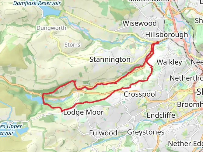
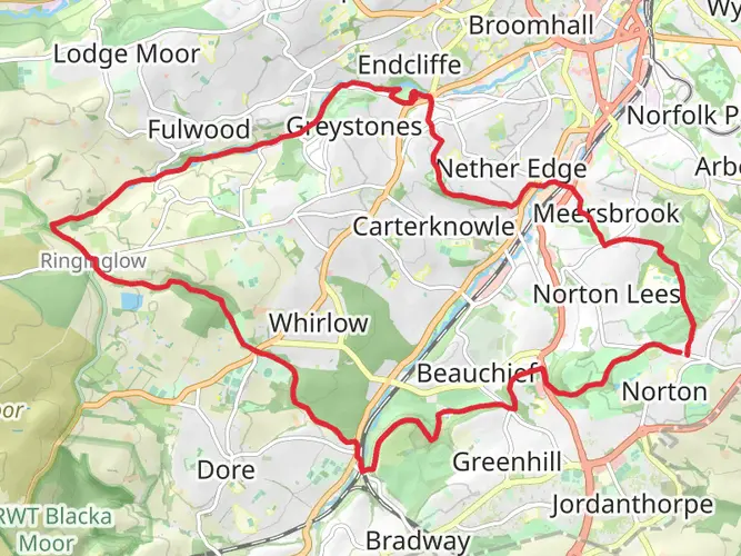
The Sheffield Railway Station to Huddersfield Railway Station hike uses a mix of urban walking, well-used footpaths, tracks, and sections alongside the railway, with a gradual transition into more open Pennine country closer to Marsden and Huddersfield. Across the full route there is 1,698 m of climbing, so there are plenty of ups and downs even though the overall difficulty is rated easy.
Comments and Reviews
User comments, reviews and discussions about the Sheffield Railway Station to Huddersfield Railway Station, England.
5.0
average rating out of 5
1 rating(s)