Download
3D Flyover
Add to list
More
113.7 km
~5 days
2424 m
Multi-Day
“Embark on the Jack Mytton Way for a historical hike through Shropshire's stunning, diverse landscapes.”
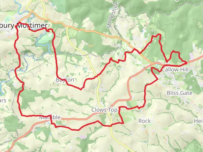
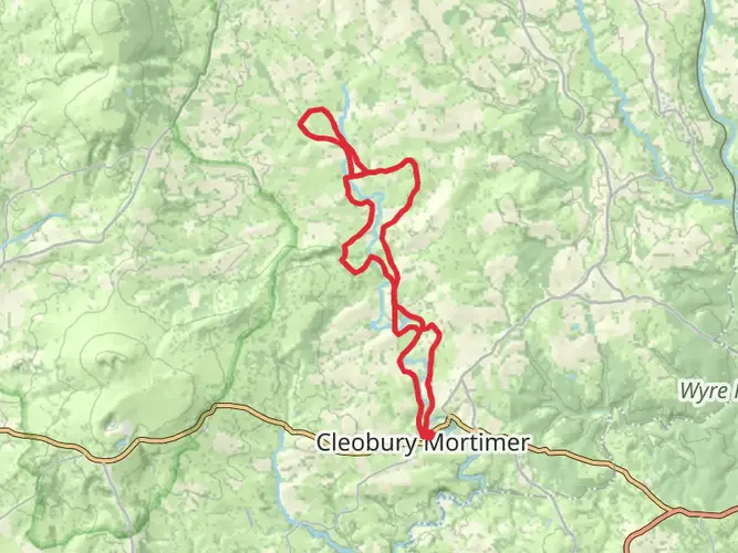
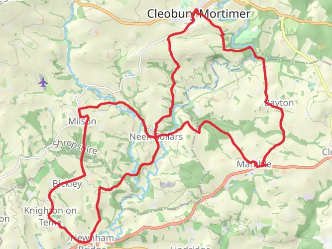
The Jack Mytton Way is a captivating trail that meanders through the picturesque Shropshire countryside in England, offering hikers a unique blend of natural beauty, historical intrigue, and a moderate challenge. Spanning approximately 114 kilometers (about 71 miles) with an elevation gain of around 2400 meters (roughly 7874 feet), this point-to-point route is a delightful journey through a region steeped in history.
Getting to the Trailhead
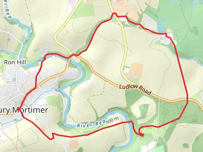
To embark on the Jack Mytton Way, you'll start near the town of Cleobury Mortimer in Shropshire. If you're arriving by public transport, the nearest train stations are in Ludlow and Kidderminster, from which you can take a bus or taxi to Cleobury Mortimer. For those driving, parking is available in the town, and from there, you can navigate to the trailhead using the HiiKER app to ensure you're on the right path from the get-go.
Navigating the Trail
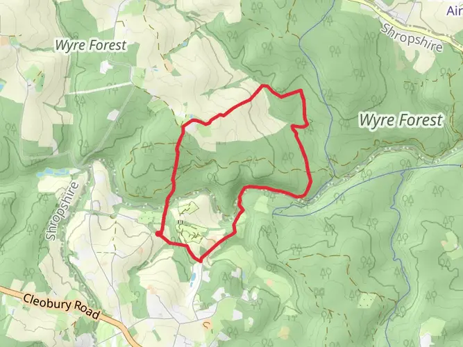
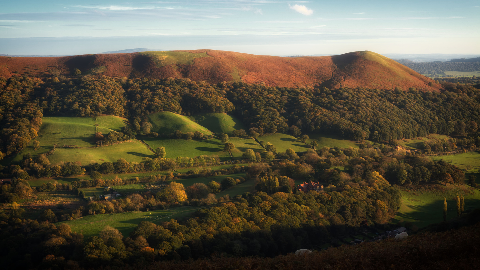
As you set out on the trail, you'll be greeted by the rolling Shropshire Hills, an Area of Outstanding Natural Beauty. The route takes you through a variety of landscapes, including quiet country lanes, bridleways, and footpaths. The terrain is a mix of flat and hilly sections, with the elevation gain spread out across the length of the trail, making it a medium difficulty hike suitable for those with a reasonable level of fitness.
Historical Significance and Landmarks
The trail is named after the 19th-century figure John 'Jack' Mytton, a notorious local squire known for his eccentric and extravagant lifestyle. As you traverse the path, you'll encounter numerous historical landmarks that offer a glimpse into the region's rich past. Notable sites include the remains of Roman forts, medieval castles like the impressive Stokesay Castle, and ancient churches nestled in small, charming villages.
Approximately halfway through the hike, near the 57-kilometer (35-mile) mark, you'll reach the market town of Church Stretton. Here, you can explore the Carding Mill Valley and the Long Mynd, a heath and moorland plateau that provides stunning panoramic views and a chance to spot wildlife such as wild ponies and diverse bird species.
Nature and Wildlife
The Jack Mytton Way is a haven for nature enthusiasts. The trail takes you through woodlands, along riverbanks, and across open moorland. Keep an eye out for the abundant wildlife, including deer, badgers, and foxes. Birdwatchers will be delighted by the variety of birds, from common woodland species to raptors soaring above.
Preparation and Planning
Before setting out, ensure you have a detailed map of the trail, which can be accessed through the HiiKER app. This will be invaluable for navigation, as the trail is well-marked but can be tricky in places. The app will also help you locate nearby amenities, such as accommodations and shops, for resupplying or finding a place to rest.
Given the length of the trail, it's advisable to plan for several days of hiking, with stops at the quaint villages and towns along the way for overnight stays. The weather in Shropshire can be unpredictable, so pack appropriate clothing for all conditions, and don't forget your waterproof gear.
Access and Amenities
The trail is accessible year-round, but the best time to hike is from spring to autumn when the weather is milder, and the countryside is in full bloom. Along the route, you'll find a range of accommodations, from cozy bed and breakfasts to camping sites, allowing you to experience the local hospitality.
In terms of amenities, the larger towns along the way, such as Bridgnorth and Church Stretton, offer a good selection of shops, pubs, and restaurants. It's a good idea to stock up on supplies here, as some of the more remote sections of the trail have limited facilities.
The Jack Mytton Way is a journey that offers more than just a physical challenge; it's an exploration of England's heartland, where every step takes you through living history and breathtaking landscapes. Whether you're a seasoned hiker or someone looking to delve into the world of long-distance walking, this trail promises an unforgettable adventure.

What to expect?
Activity types
Frequently asked questions
How long is the Jack Mytton Way and how many days does it usually take to walk?
The Jack Mytton Way is 113.66 km long, or about 71 miles, with 2,424 m of total ascent. Most walkers break a route of that length into around 5 to 8 days, depending on pace, daily mileage, and whether the hillier sections around the Shropshire Hills are split into shorter stages.
Where does the Jack Mytton Way start and finish in Shropshire?
The Jack Mytton Way starts in Cleobury Mortimer and runs across south and mid Shropshire to Llanfair Waterdine near the Welsh border. The route also has a link from Rushbury back to Cleobury Mortimer, which creates options for a shorter circuit as well as the main point-to-point journey.
What towns and landmarks does the Jack Mytton Way pass through?
The Jack Mytton Way passes through a string of well-known Shropshire places including Cleobury Mortimer, Church Stretton, Clun, and Much Wenlock. It also crosses the Clee Hills and passes close to Bridgnorth, Broseley, and Highley, giving the route a mix of hill country, market towns, and quieter rural sections.
Is the Jack Mytton Way easy or suitable for less experienced long-distance hikers?
The Jack Mytton Way is graded easy, which makes it one of the more approachable multi-day routes in Shropshire. Even so, 113.66 km and 2,424 m of climbing still add up to a substantial outing, so it suits hikers who are comfortable with several consecutive days on bridleways, country lanes, and uneven rural paths.
Can the Jack Mytton Way be done as a circular walk or only as a point-to-point route?
The main Jack Mytton Way is a point-to-point trail from Cleobury Mortimer to Llanfair Waterdine. There is also a link from Rushbury back to Cleobury Mortimer, which means the route can be adapted into a shorter circuit rather than walked only as a one-way crossing of Shropshire.
Is the Jack Mytton Way waymarked and what kind of terrain is on the route?
The Jack Mytton Way is a recognized long-distance route through Shropshire and is generally followed on rural bridleways, tracks, and quiet country lanes rather than technical mountain terrain. Walkers can expect a mix of off-road sections and lane walking, with rolling ground and hillier stretches around the Clee Hills and the wider Shropshire Hills area.
How do you get to the Jack Mytton Way trailhead at Cleobury Mortimer without a car?
Cleobury Mortimer is the usual starting point for the Jack Mytton Way. The nearest rail options are Ludlow and Kidderminster, and Cleobury Mortimer is served by the 292 bus route, making it possible to reach the trailhead by combining train and local bus rather than driving.
Comments and Reviews
User comments, reviews and discussions about the Jack Mytton Way, England.
4.5
average rating out of 5
4 rating(s)