Download
3D Flyover
Add to list
More
47.9 km
~2 days
1556 m
Multi-Day
“Embark on the historic Mortimer Trail, a scenic hike weaving through England's rolling hills and rich past.”
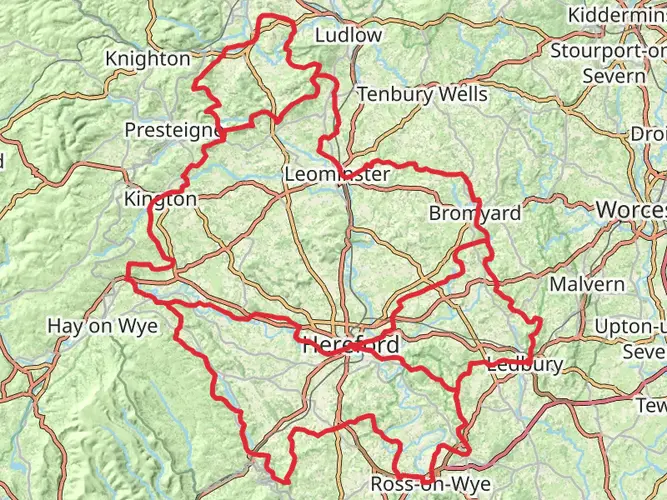
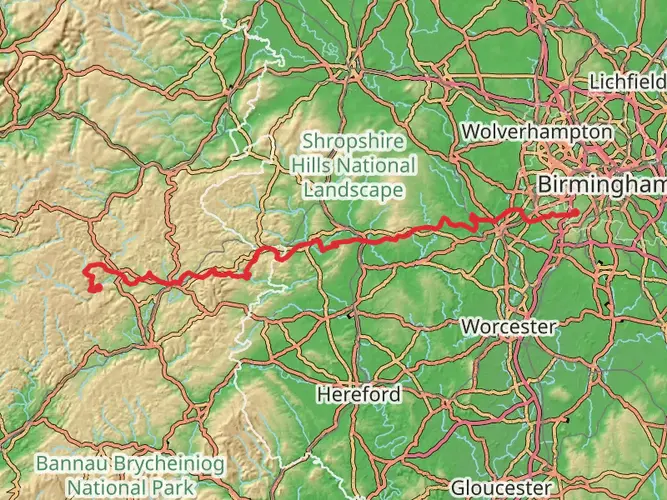
The Mortimer Trail invites hikers to a journey through the rolling hills and woodlands of the English countryside, stretching approximately 48 kilometers (30 miles) with an elevation gain of around 1500 meters (4921 feet). This point-to-point trail, nestled near Shropshire, England, offers a medium difficulty rating, making it accessible to hikers with a reasonable level of fitness.
Getting to the Trailhead
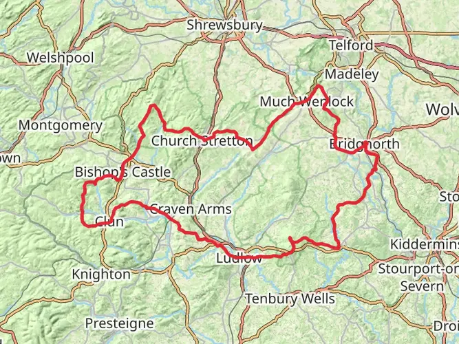
To reach the starting point of the Mortimer Trail, hikers can drive to the vicinity of Ludlow, a market town in Shropshire. The trailhead is located just a short distance from here. For those relying on public transport, Ludlow is well-served by trains and buses, with the nearest train station offering connections to major cities. From the station, local buses or taxis can take you to the trailhead.
Navigating the Trail
The Mortimer Trail is well-marked, but carrying a reliable navigation tool like HiiKER is recommended to keep track of your progress and ensure you're on the right path. The trail meanders through varied landscapes, including dense woodlands, open farmland, and river valleys, offering a diverse hiking experience.
Landmarks and Scenery
As you embark on the Mortimer Trail, you'll be greeted by the historic landscape of Herefordshire and Shropshire. The trail is named after the Mortimer family, Norman Marcher Lords who once dominated these lands. The route takes you through the medieval hunting forests of Mocktree and Deerfold, where the echoes of the past seem to resonate through the ancient trees.
One of the significant landmarks along the trail is the ruins of Richard's Castle, one of the first Norman castles built in England, dating back to around 1050. The castle's remnants provide a tangible connection to the region's storied past.
Wildlife and Nature
The Mortimer Trail is a haven for wildlife enthusiasts. The varied habitats along the route support a rich array of birdlife, including buzzards and woodpeckers. Deer are often sighted in the woodlands, and the quieter stretches of the trail may reveal the presence of badgers and foxes.
Seasonal Considerations
The trail can be hiked year-round, but each season offers a unique experience. Spring brings carpets of bluebells and wild garlic in the woodlands, while autumn showcases a spectacular display of colors. Summer offers longer daylight hours for hiking, and winter, though colder, can provide crisp, clear days ideal for enjoying the views.
Preparation and Planning
Before setting out, ensure you have adequate supplies, as there are limited facilities along the trail. Water sources are not always readily available, so carry enough to sustain you between refill points. The trail includes some steep sections, so sturdy hiking boots are recommended. Weather in the English countryside can be unpredictable, so pack layers and waterproof gear.
Conclusion
The Mortimer Trail is a journey through history, nature, and the serene beauty of the English countryside. With its moderate difficulty, it's a rewarding experience for those looking to explore the heart of the borderlands between England and Wales.

What to expect?
Activity types
Frequently asked questions
How long is the Mortimer Trail and how many days does it usually take to walk?
The Mortimer Trail is 47.88 km long, or about 30 miles, with 1,556 m of climbing. Most hikers split it into 2 or 3 days because it is a point-to-point route between Ludlow and Kington and includes repeated hill and ridge sections rather than one single long ascent.
Where does the Mortimer Trail start and finish?
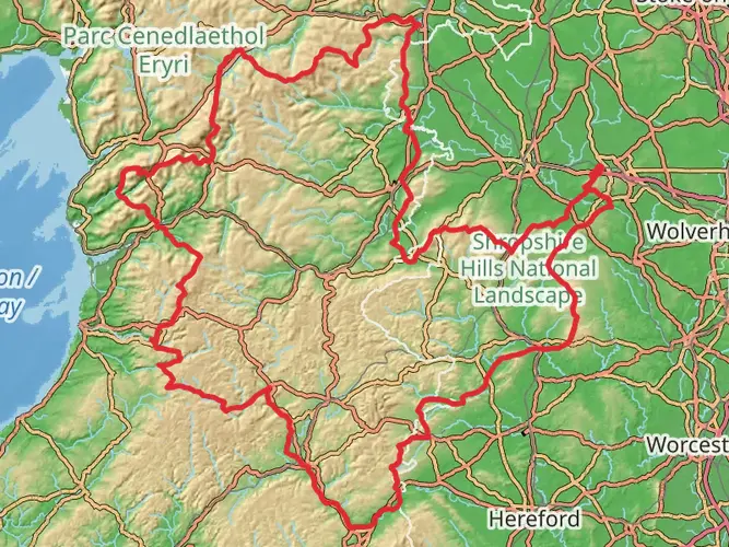
The Mortimer Trail links Ludlow in Shropshire with Kington in Herefordshire. It is commonly walked from Ludlow to Kington, starting near Ludlow Castle and finishing in the border town of Kington, although the route can also be done in reverse.
What are the main landmarks and high points on the Mortimer Trail?
Key landmarks on the Mortimer Trail include Ludlow Castle at the eastern end, Mortimer Forest above Ludlow, High Vinnalls, and the Iron Age hill fort at Croft Ambrey. The route follows a chain of hills, ridges, valleys, and woodland that reflect the old Mortimer borderlands between Shropshire and Herefordshire.
Is the Mortimer Trail easy or suitable for less experienced long-distance hikers?
The Mortimer Trail is graded easy, but it is still a 47.88 km multi-day walk with 1,556 m of elevation gain, so it suits hikers who are comfortable spending long hours on foot. The route is more approachable than many mountain trails, yet the cumulative climbing over 30 miles can feel demanding across a full weekend.
Can the Mortimer Trail be reached by public transport?
Yes. Ludlow has a railway station with rail connections into the wider network, which makes the Shropshire end practical without a car. Kington does not have a train station, but it is served by bus routes, so the Mortimer Trail is one of the more public-transport-friendly linear walks in the area.
Is the Mortimer Trail dog friendly?
Dogs can be taken on public rights of way along the Mortimer Trail, but this is a rural route through farmland and woodland where livestock, gates, and stiles are likely. In practice, that means the trail is better suited to calm, experienced trail dogs that can cope with long distances and close control around stock.
Comments and Reviews
User comments, reviews and discussions about the Mortimer Trail, England.
4.69
average rating out of 5
13 rating(s)