Download
Preview
Add to list
More
190.0 km
~10 days
3715 m
Multi-Day
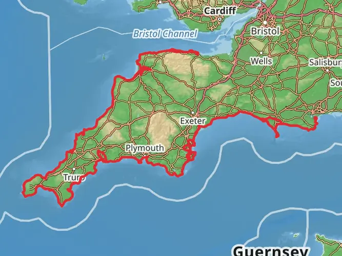
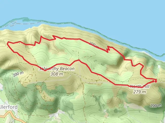
The Minehead to Bath Abbey in Somerset is a 190.0 km trail that starts in Somerset West and Taunton, Somerset, England. Based on our data, the hike is graded as Medium. For information on how we grade trails, please read measuring the difficulty of a hiking trail on hiiker. Also, check our latest community posts for trail updates. This hike can be completed in approx 8 days. Caution is advised on trail times as this depends on multiple variables. For more info read about how we calculate hike time.

What to expect?
Activity types
Frequently asked questions
How long does the Minehead to Bath Abbey in Somerset hike take to complete?
Minehead to Bath Abbey in Somerset is a 189.96 km multi-day hike with 3,715 m of total ascent, so most walkers split it over about 10 days. The staged route breaks down into ten days ranging from 13.8 km to 25.8 km, with estimated walking times from just under 3 hours to nearly 6 hours per stage.
How difficult is the Minehead to Bath Abbey in Somerset hike?
Minehead to Bath Abbey in Somerset is rated medium, but the challenge comes from both its length and cumulative climbing. The route covers 189.96 km in total and gains 3,715 m, with some of the hillier early stages including a 19.7 km opening day with 707 m of ascent and a 19.1 km stage with 636 m of ascent.
Where does the Minehead to Bath Abbey in Somerset hike start and finish?
The route starts in the Minehead area on the Somerset coast and finishes in central Bath at Bath Abbey. The staged itinerary begins near Alcombe, Minehead, and ends on the final 16.8 km stage in Bath close to St James's Parade, placing the finish right in the city center beside the abbey.
Can the Minehead to Bath Abbey in Somerset hike be walked in sections?
Yes. Minehead to Bath Abbey in Somerset is well suited to section hiking because it is laid out as a ten-stage route. The stages link places including Old Cleeve, Holford, Kingston St Mary, Burrowbridge, Huish Episcopi, Glastonbury, Meare, Wells, Radstock, and Bath, making it practical to break the walk into shorter trips.
Is the Minehead to Bath Abbey in Somerset hike dog friendly?
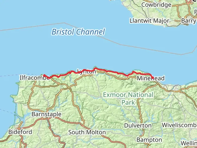
Dogs are allowed on parts of the route that use the King Charles III England Coast Path near Minehead, but they must be kept under control, and near livestock they must be on a short lead. Somerset Council also notes that extra local or seasonal restrictions can apply in some places, so dog access may vary along this coast section.
Are there any tidal or access issues on the Minehead to Bath Abbey in Somerset hike?
Yes. On the coastal section near the start, Somerset Council identifies Minehead to Blue Anchor as one of the beach sections that can become impassable at high tide. That means the opening part of Minehead to Bath Abbey in Somerset may need tide awareness or use of signed alternative inland routing where applicable.
Where can I park for the Minehead to Bath Abbey in Somerset hike?
For the Minehead start, parking is straightforward because Minehead station has a pay-and-display car park beside it, with additional parking available in town. At the Bath end, city-center parking is more limited, and Bath’s Park and Ride services are commonly used for access into the abbey area.
What are the longest stages on the Minehead to Bath Abbey in Somerset hike?
The longest day on Minehead to Bath Abbey in Somerset is the 25.8 km stage from Huish Episcopi to Glastonbury, with 398 m of ascent. Other long days include 24.5 km from Kingston St Mary to Burrowbridge and 21.3 km from Wells to Radstock, so the route has several full-day sections rather than one single demanding push.
Comments and Reviews
User comments, reviews and discussions about the Minehead to Bath Abbey in Somerset, England.
average rating out of 5
0 rating(s)