Download
Preview
Add to list
More
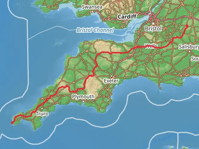
61.9 km
~4 days
1848 m
Multi-Day
“Explore the Quantock Greenway's enchanting paths, from lush woodlands to historic landmarks, for a rewarding Somerset hike.”
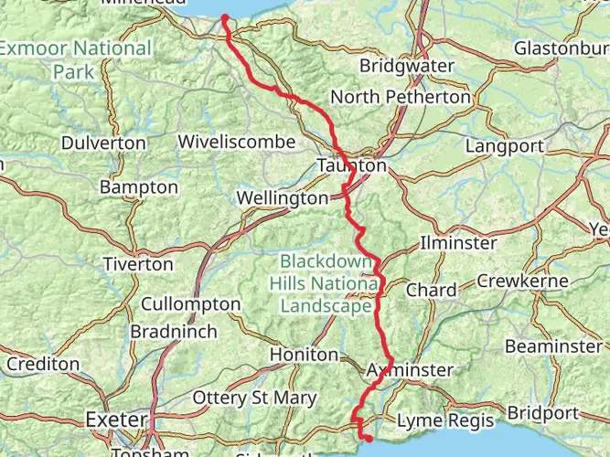
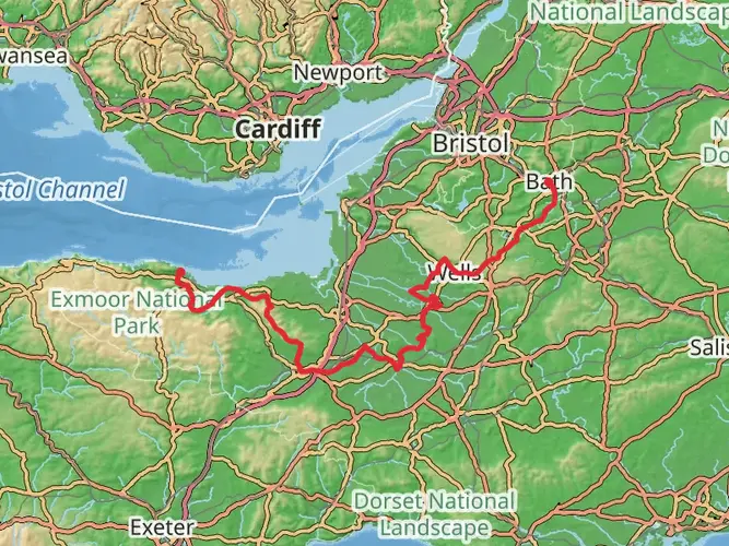
The Quantock Greenway is a captivating loop trail that meanders through the picturesque landscapes of Somerset, England. Spanning approximately 62 kilometers (about 38.5 miles) with an elevation gain of around 1800 meters (nearly 5905 feet), this trail offers a medium difficulty rating, making it accessible to hikers with a reasonable level of fitness.
Getting to the Trailhead
To reach the starting point of the Quantock Greenway, hikers can drive to the vicinity of Somerset, where parking is available. For those preferring public transport, local bus services operate in the area, with stops close to the trailhead. Utilizing HiiKER for navigation will help in pinpointing the exact starting location and in planning the journey to Somerset.
Navigating the Trail
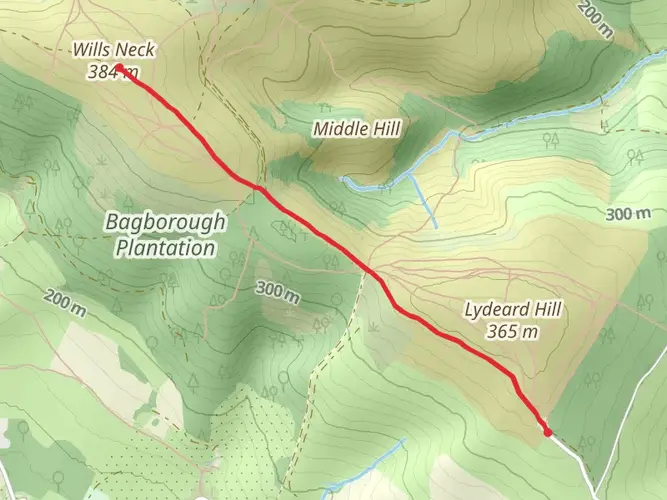
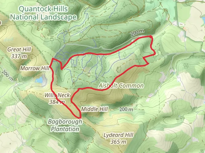
The trail is well-marked, guiding hikers through a variety of terrains including dense woodlands, open heathland, and rolling hills that offer stunning views of the surrounding countryside. The loop can be tackled in sections or as a multi-day hike, with several access points allowing for customizable itineraries.
Landmarks and Scenery
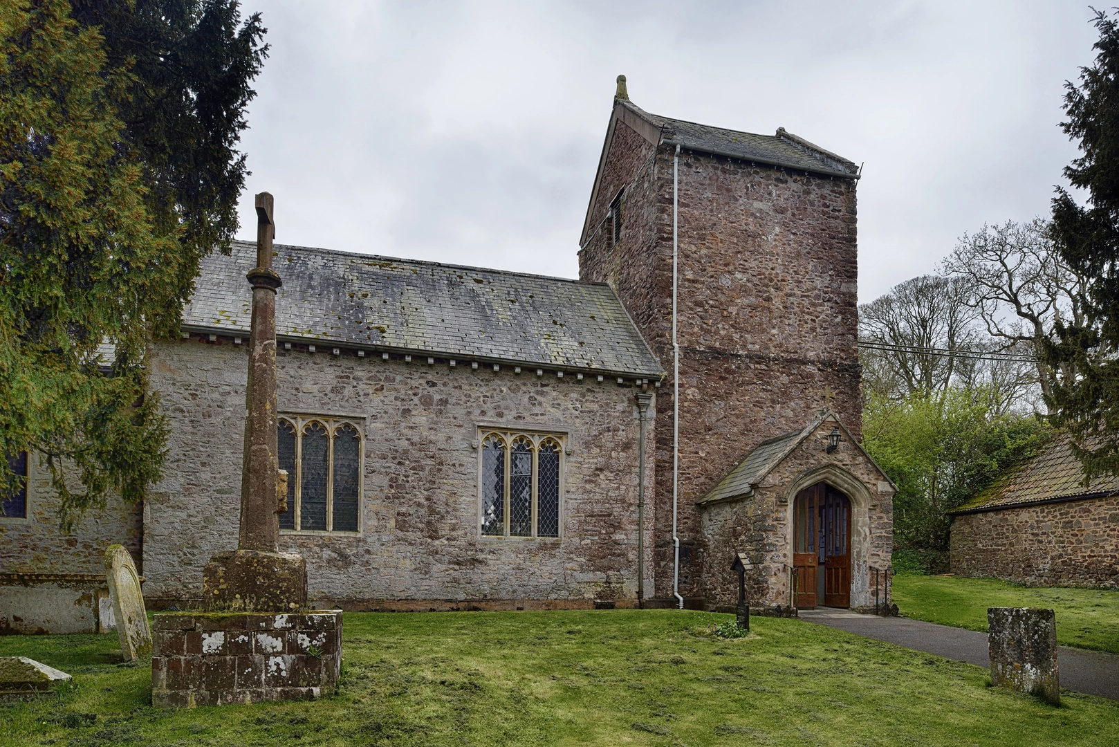
As you traverse the Quantock Greenway, you'll encounter a number of significant landmarks. The trail skirts around the edges of Cothelstone Hill, providing panoramic views across Somerset and the Bristol Channel. Hikers will also pass through the charming village of Bicknoller, with its thatched cottages and quaint streets.
Nature and Wildlife
The Quantock Hills are designated as an Area of Outstanding Natural Beauty, and the trail offers ample opportunities to witness the diverse flora and fauna of the region. Keep an eye out for red deer and the native Quantock ponies grazing among the heather. The area is also a haven for birdwatchers, with buzzards and woodpeckers commonly sighted.
Historical Significance
The Quantock region is steeped in history, with archaeological evidence of Bronze Age and Iron Age settlements. The trail itself may lead hikers past ancient standing stones and earthworks. Additionally, the area was famously frequented by poets Samuel Taylor Coleridge and William Wordsworth, who drew inspiration from the Quantock's enchanting landscapes.
Preparation and Planning
Before setting out, hikers should ensure they are equipped with appropriate gear for variable weather conditions, as the Quantock Hills can be exposed to the elements. It's advisable to carry a map and compass, although HiiKER can serve as a primary navigation tool with its offline maps and detailed trail information. Water sources along the trail are limited, so carrying sufficient water is essential.
With its blend of natural beauty, wildlife, and historical intrigue, the Quantock Greenway is a trail that offers a rich and varied hiking experience. Whether you're seeking a leisurely walk or an invigorating trek, this trail in the heart of Somerset is sure to leave a lasting impression.

What to expect?
Activity types
Frequently asked questions
How long does it take to hike the Quantock Greenway in Somerset?
The Quantock Greenway is 61.95 km long with 1,848 m of climbing, so most hikers complete it over 2 to 4 days rather than in a single push. Strong walkers can cover it faster, but the repeated climbs and descents across the Quantock Hills make it more demanding than the distance alone suggests.
Is the Quantock Greenway a circular walk or do you need transport at the end?
The Quantock Greenway is a loop trail, so it starts and finishes in the same general area in the Quantock Hills. That makes logistics simpler for a multi-day hike, because there is no separate end-point transfer to arrange after covering the full 61.95 km route.
How hard is the Quantock Greenway and is it suitable for beginner hikers?
The Quantock Greenway is rated medium, with nearly 62 km of distance and 1,848 m of elevation gain. It is usually manageable for hikers with decent fitness and some experience of longer hill walks, but it is a bigger undertaking for complete beginners because the route mixes sustained mileage with rolling climbs across open hill terrain.
What are the main landmarks and views on the Quantock Greenway?
Notable points on the Quantock Greenway include Cothelstone Hill, which is known for wide views across Somerset, and the village of Bicknoller on the western side of the Quantocks. The route also passes through classic Quantock scenery, including woodland, heath, and open ridgeline sections with views toward the Bristol Channel.
Can the Quantock Greenway be split into shorter stages instead of hiking it all at once?
Yes. The Quantock Greenway is a multi-day route and works well when broken into shorter stages. At 61.95 km, many hikers divide it into 2 to 4 days depending on pace, overnight plans, and how much climbing they want to take on each day across the Quantock Hills.
What kind of terrain should hikers expect on the Quantock Greenway?
The Quantock Greenway crosses a varied mix of woodland tracks, open heathland, hill paths, and quieter countryside sections. That variety is part of what gives the route its medium rating, because the 1,848 m of ascent is spread across rolling Quantock terrain rather than one single climb.
Comments and Reviews
User comments, reviews and discussions about the Quantock Greenway, England.
4.6
average rating out of 5
10 rating(s)