Download
Preview
Add to list
More
69.4 km
~4 days
1267 m
Multi-Day
“The West Deane Way: a scenic, historic Somerset trail offering diverse terrains and captivating wildlife.”
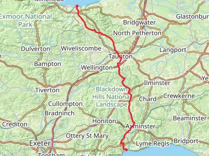
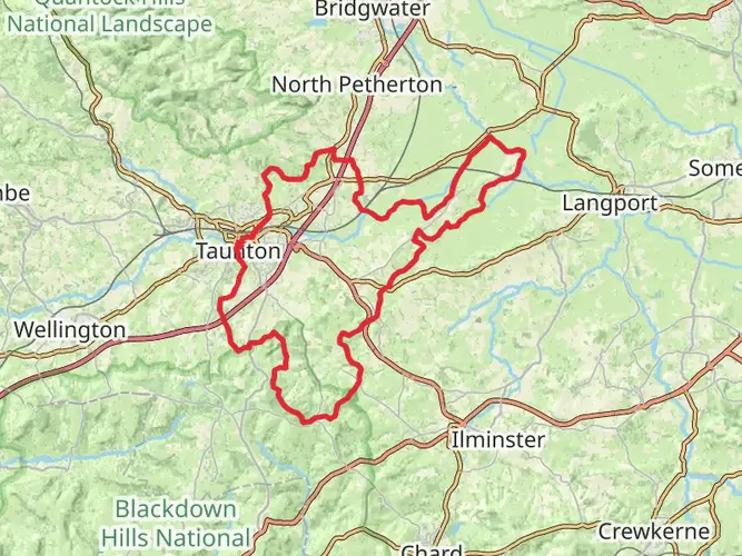
Spanning approximately 69 kilometers (around 43 miles) with an elevation gain of roughly 1200 meters (close to 3937 feet), the West Deane Way is a captivating loop trail situated near Somerset, England. This medium-difficulty hike offers a diverse array of landscapes, from rolling hills to serene river valleys, making it a delightful challenge for both novice and seasoned hikers.
Getting to the Trailhead
The trailhead for the West Deane Way is accessible by both public transport and car. If you're traveling by public transport, the nearest train stations are Taunton and Tiverton, from which you can take a local bus or taxi to the starting point near the village of Bishops Lydeard. For those driving, Bishops Lydeard is just a short distance from the A358, with parking available in the village.
Navigating the Trail
As you embark on the West Deane Way, it's advisable to use a reliable navigation tool like HiiKER to stay on track. The trail is well-marked, but having a digital map can be invaluable, especially at trail intersections or during poor weather conditions.
Landmarks and Historical Significance
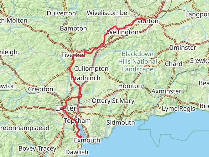
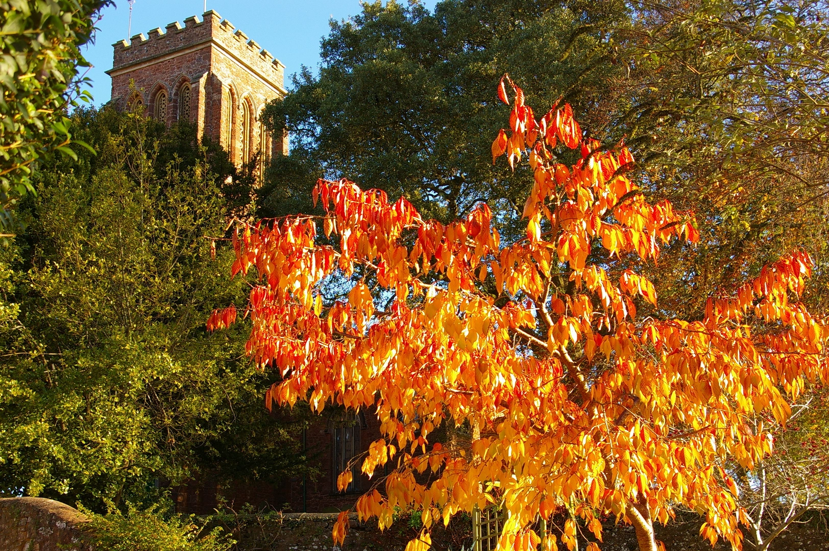
The West Deane Way meanders through the heart of Somerset, an area steeped in history. Along the route, hikers will encounter Cothelstone Hill, offering panoramic views of the Quantock Hills, an Area of Outstanding Natural Beauty. The trail also passes through the historic town of Wellington, where you can explore Wellington Monument, a tribute to the Duke of Wellington and his victory at the Battle of Waterloo.
Natural Beauty and Wildlife
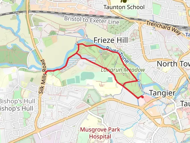
The trail's varied landscapes are home to an abundance of wildlife. Keep an eye out for deer, badgers, and a variety of bird species, particularly in the more wooded sections. The trail also takes you through the serene settings of the River Tone and the Grand Western Canal, perfect spots for a peaceful rest and perhaps a picnic.
Terrain and Elevation
The West Deane Way's terrain is a mix of flat valley bottoms, gentle slopes, and a few steep climbs. The most significant elevation gain occurs as you ascend to the higher points, such as Cothelstone Hill, which stands at around 361 meters (1184 feet) above sea level. The trail's surfaces vary from paved pathways to grassy tracks and can become muddy in wet conditions, so appropriate footwear is essential.
Preparation and Planning
Before setting out, ensure you have adequate supplies, including water, food, and weather-appropriate clothing. The English weather can be unpredictable, so it's wise to prepare for rain or shine. Also, consider the trail's length and plan for overnight stays if you're not aiming to complete it in a single day. There are several accommodation options along the route, from cozy B&Bs to camping sites.
Remember, the West Deane Way is not just a hike; it's an opportunity to immerse yourself in the natural beauty and rich history of Somerset. Whether you're looking to challenge yourself physically or simply enjoy a leisurely walk through the countryside, this trail offers something for every hiker.

What to expect?
Activity types
Frequently asked questions
How long does it take to hike the West Deane Way in Somerset?
The West Deane Way is 69.39 km long with 1,267 m of climbing, so most walkers treat it as a 2 to 4 day route rather than a single-day hike. Strong hikers can cover the full 43-mile circuit faster, but the route is usually more enjoyable when split between villages in the Vale of Taunton Deane.
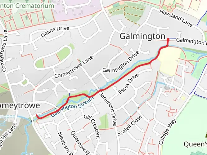
Where does the West Deane Way start and finish?
The West Deane Way is a circular trail in Somerset, so it starts and finishes in the same area. Bishops Lydeard is the usual access point for the route, and it is a practical base because it sits on the western side of Taunton Deane with road links from the A358 and bus connections back toward Taunton.
Can the West Deane Way be reached by public transport?
Yes. Bishops Lydeard is served by bus links from Taunton, including services that stop near the West Somerset Railway station, and Taunton is the nearest main rail hub for onward travel. That makes it possible to reach the West Deane Way without a car, although the exact start point used for the walk can affect the final short connection.
Is there parking for the West Deane Way near Bishops Lydeard?
Parking is available in Bishops Lydeard, including around the village and station area, which makes it one of the most practical places to begin the West Deane Way. Because this is a multi-day 69.39 km route, it is worth checking local restrictions and choosing a long-stay option before leaving a vehicle for more than a few hours.
What are the main landmarks on the West Deane Way?
Two of the best-known landmarks linked with the West Deane Way are Cothelstone Hill and Wellington Monument. Cothelstone Hill gives wide views toward the Quantock Hills, while Wellington Monument stands about 3 km south of Wellington and is a prominent feature on the Blackdown Hills side of the circuit.
Is the West Deane Way difficult?
The West Deane Way is generally considered an easy long-distance walk, but its total length and 1,267 m of ascent still make it a proper multi-day undertaking. The challenge comes less from technical ground and more from covering nearly 70 km over several stages through the Somerset countryside.
Is the West Deane Way a loop trail or a point-to-point walk?
The West Deane Way is a circular route, not a point-to-point trail. The full circuit is about 69.39 km, or roughly 43 miles, which means there is no need to arrange transport back to a separate finish once the walk is complete.
Comments and Reviews
User comments, reviews and discussions about the West Deane Way, England.
4.13
average rating out of 5
8 rating(s)