Download
Preview
Add to list
More
27.7 km
~2 days
338 m
Multi-Day
The Jubilee Way - South Gloucestershire is a 27.7 km trail that starts in Forest of Dean, South Gloucestershire, England. Based on our data, the hike is graded as Easy. For information on how we grade trails, please read measuring the difficulty of a hiking trail on hiiker. Also, check our latest community posts for trail updates. This hike can be completed in approx 6 hrs 7 mins. Caution is advised on trail times as this depends on multiple variables. For more info read about how we calculate hike time.

What to expect?
Activity types
Frequently asked questions
How long does the Jubilee Way - South Gloucestershire take to walk?
Jubilee Way - South Gloucestershire is 27.74 km long with 338 m of climbing, so most hikers split it over 2 days as a short multi-day walk. Strong walkers can complete it in a long day, but the route is commonly treated as an easier point-to-point outing rather than a fast challenge walk.
Where does the Jubilee Way - South Gloucestershire start and finish?
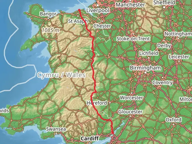
Jubilee Way - South Gloucestershire links Aust, on the south side of the Severn Bridge, with Old Sodbury at the foot of the Cotswold Hills. The route runs west to east across South Gloucestershire, connecting the Severn Estuary side of the county with the limestone escarpment inland.
Is the Jubilee Way - South Gloucestershire difficult?
Jubilee Way - South Gloucestershire is generally considered an easy long-distance walk. The full route has 338 m of elevation gain over 27.74 km, so the climbing is modest and spread across a full-day or 2-day itinerary rather than concentrated in one steep mountain ascent.
What kind of scenery is on the Jubilee Way - South Gloucestershire?
Jubilee Way - South Gloucestershire starts near Aust by the Severn Estuary, then crosses the fertile fields of the Severn Vale toward Thornbury before finishing near Old Sodbury on the edge of the Cotswold escarpment. That gives the walk a mix of estuary-side views, open farmland, and higher ground toward the Cotswolds.
Does the Jubilee Way - South Gloucestershire pass through Thornbury?
Yes. Jubilee Way - South Gloucestershire heads east from the Severn Estuary side of the county toward Thornbury, which is one of the main settlements on the route. Thornbury is a useful midpoint reference for breaking up the 27.74 km walk into shorter sections.
Is the Jubilee Way - South Gloucestershire a circular walk?
No. Jubilee Way - South Gloucestershire is a point-to-point route, not a loop. It runs for 27.74 km between Aust and Old Sodbury, so transport planning matters more than on a circular trail, especially if the walk is done in a single day.
What other trails connect with the Jubilee Way - South Gloucestershire?
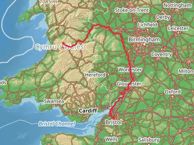
Jubilee Way - South Gloucestershire links with the Cotswold Way and Offa's Dyke Path, and it also connects with other promoted routes in the area including the Severn Way and Frome Valley Walkway. That makes it useful both as a standalone 27.74 km walk and as part of a longer South Gloucestershire hiking trip.
Comments and Reviews
User comments, reviews and discussions about the Jubilee Way - South Gloucestershire, England.
5.0
average rating out of 5
1 rating(s)