Download
Preview
Add to list
More
70.6 km
~4 days
622 m
Multi-Day
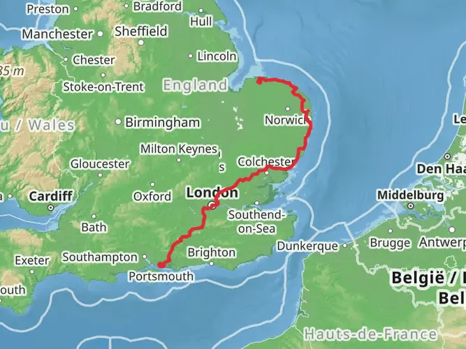
The Stour and Orwell Walk is a 70.6 km trail that starts in , Suffolk, England. Based on our data, the hike is graded as Easy. For information on how we grade trails, please read measuring the difficulty of a hiking trail on hiiker. Also, check our latest community posts for trail updates. This hike can be completed in approx 3 days. Caution is advised on trail times as this depends on multiple variables. For more info read about how we calculate hike time.

What to expect?
Activity types
Frequently asked questions
How long is the Stour and Orwell Walk and how many days does the Stour and Orwell Walk take?
The Stour and Orwell Walk is 70.56 km long with 622 m of total ascent, so it is usually treated as an easy multi-day route rather than a single-day hike. Many walkers split it into 3 to 4 days, depending on pace and where they choose to stop around Ipswich, the Shotley Peninsula, or Cattawade.
Where does the Stour and Orwell Walk start and finish in Suffolk?
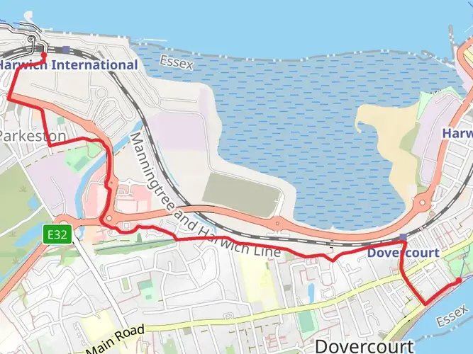
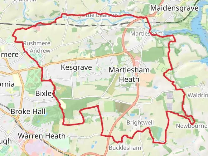
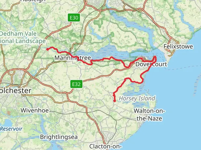
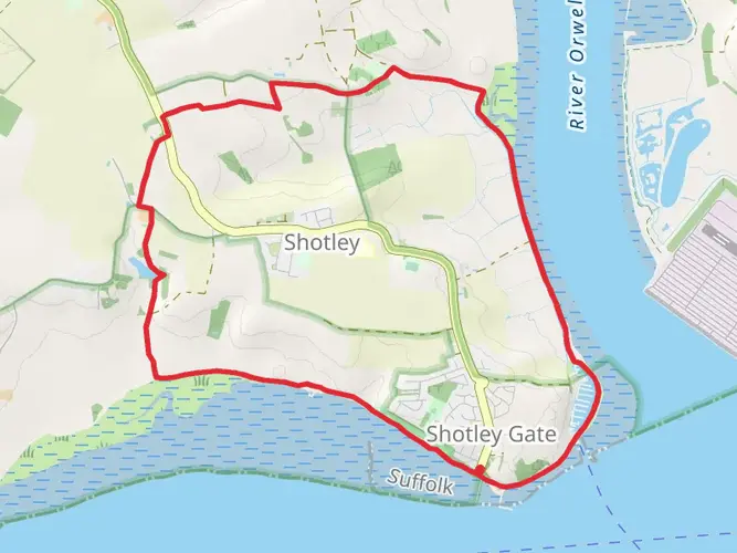
The Stour and Orwell Walk is a linear route in Suffolk linking the estuaries of the Rivers Orwell and Stour. It is commonly described as running between Felixstowe and Cattawade near Manningtree, passing places such as Ipswich, Woolverstone, Shotley Gate, Holbrook, and Stutton along the way.
Is the Stour and Orwell Walk easy or suitable for beginners?
The Stour and Orwell Walk is generally rated easy, which fits its modest 622 m of climbing spread across 70.56 km. The challenge is more about covering long mileage over several days than steep mountain terrain, so it suits walkers comfortable with sustained estuary and countryside walking.
Can the Stour and Orwell Walk be done using trains and public transport?
Yes. The route is well suited to public transport because it is linear and is connected by regular rail services between Manningtree and Ipswich, plus the branch line between Ipswich and Felixstowe. That makes it practical to start at one end of the Stour and Orwell Walk and return by train from the other.
What landmarks and places does the Stour and Orwell Walk pass on the way?
The Stour and Orwell Walk follows the Orwell and Stour estuaries through a string of well-known Suffolk places. Depending on direction, the route passes Felixstowe, Trimley Marshes, Orwell Country Park, Ipswich, Woolverstone, Chelmondiston, Shotley Gate, Erwarton Ness, Holbrook, and Stutton before reaching Cattawade near the Essex border.
Is the Stour and Orwell Walk waymarked and easy to follow?
Yes. The Stour and Orwell Walk is a recognized long-distance route in the Suffolk and Essex Coast and Heaths National Landscape and is waymarked with its own route discs. Navigation is still useful around estuary edges, settlements, and path junctions, but the trail is not an unmarked wilderness route.
Comments and Reviews
User comments, reviews and discussions about the Stour and Orwell Walk, England.
5.0
average rating out of 5
4 rating(s)