Download
Preview
Add to list
More
117.2 km
~6 days
678 m
Multi-Day
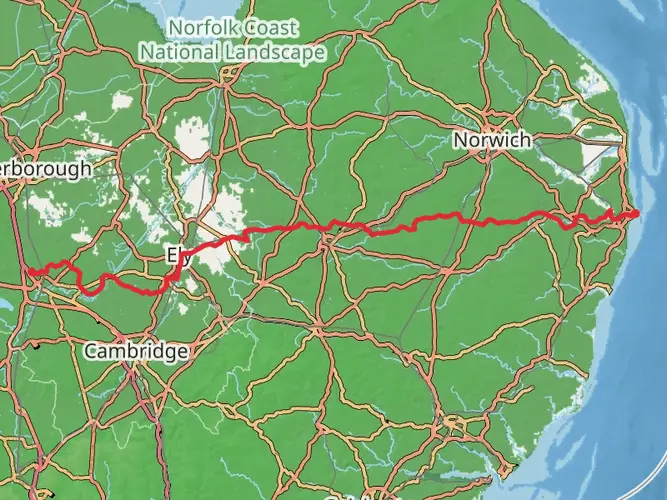
The Waveney Way is a 117.2 km trail that starts in East Suffolk, Suffolk, England. Based on our data, the hike is graded as Easy. For information on how we grade trails, please read measuring the difficulty of a hiking trail on hiiker. Also, check our latest community posts for trail updates. This hike can be completed in approx 4 days. Caution is advised on trail times as this depends on multiple variables. For more info read about how we calculate hike time.

What to expect?
Activity types
Frequently asked questions
How long does it take to walk the Waveney Way in Suffolk?
The Waveney Way is 117.21 km long, so most hikers split it across about 5 to 7 days depending on pace and overnight stops. With only 678 m of total elevation gain and an easy rating, it is more about covering distance day after day than tackling steep climbs.
Is the Waveney Way an easy long-distance walk?
Yes. The Waveney Way is graded easy, with 117.21 km of walking and 678 m of total ascent spread across the full route. That profile points to generally gentle terrain, making it a more approachable multi-day trail than many hillier long-distance walks in England.
Where does the Waveney Way start and finish?
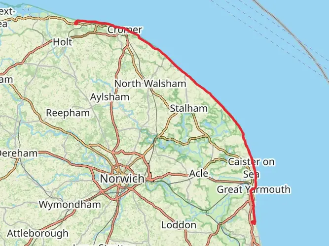
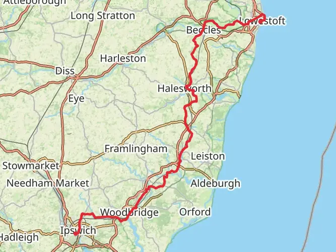
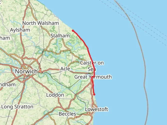
The Waveney Way is a point-to-point route in Suffolk linked with the River Waveney corridor. It is commonly associated with Beccles and the wider Waveney Valley, and the route is listed by Discover Suffolk as a long-distance trail connected with Ness Point in Lowestoft, so end-to-end planning should be treated as a linear walk rather than a loop.
Can the Waveney Way be reached by train?
Yes. Beccles is a practical rail access point for the Waveney Way, and Beccles station is on Station Road in the town center. National Rail lists step-free access to all platforms at Beccles, though the overbridge is steep, and the station has a small car park with 10 spaces.
Is the Waveney Way a circular walk or a multi-day route?
The Waveney Way is a multi-day trail, not a circular walk. At 117.21 km, it is designed as a long-distance route across Suffolk, so transport planning matters more than on a short loop and many hikers arrange a start and finish in different towns.
What kind of terrain should hikers expect on the Waveney Way?
The Waveney Way follows lowland countryside in Suffolk and the Waveney Valley, so the walking is generally gentler than upland national trails. The total elevation gain is 678 m over 117.21 km, which suggests mostly flat to rolling ground with riverside sections, fields, and rural paths rather than sustained steep climbing.
Comments and Reviews
User comments, reviews and discussions about the Waveney Way, England.
4.5
average rating out of 5
2 rating(s)