Download
Preview
Add to list
More
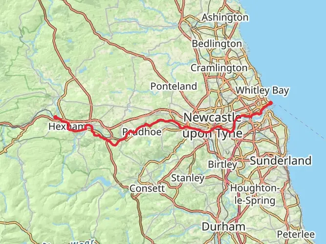
19.5 km
~2 days
366 m
Multi-Day
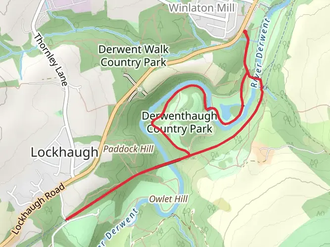
The Swalwell to Knitsley via Derwent Walk is a 19.5 km trail that starts in , Tyne and Wear, England. Based on our data, the hike is graded as Easy. For information on how we grade trails, please read measuring the difficulty of a hiking trail on hiiker. Also, check our latest community posts for trail updates. This hike can be completed in approx 4 hrs 31 mins. Caution is advised on trail times as this depends on multiple variables. For more info read about how we calculate hike time.

What to expect?
Activity types
Frequently asked questions
How long does the Swalwell to Knitsley via Derwent Walk hike take?
Swalwell to Knitsley via Derwent Walk is 19.53 km long with 366 m of elevation gain, so most hikers should allow roughly 4.5 to 6.5 hours of moving time. The route follows the Derwent Walk corridor from the Swalwell end of Derwent Walk Country Park toward Knitsley, and the easy rating points to steady gradients rather than sustained steep climbing.
Where do you park for the Swalwell to Knitsley via Derwent Walk hike?
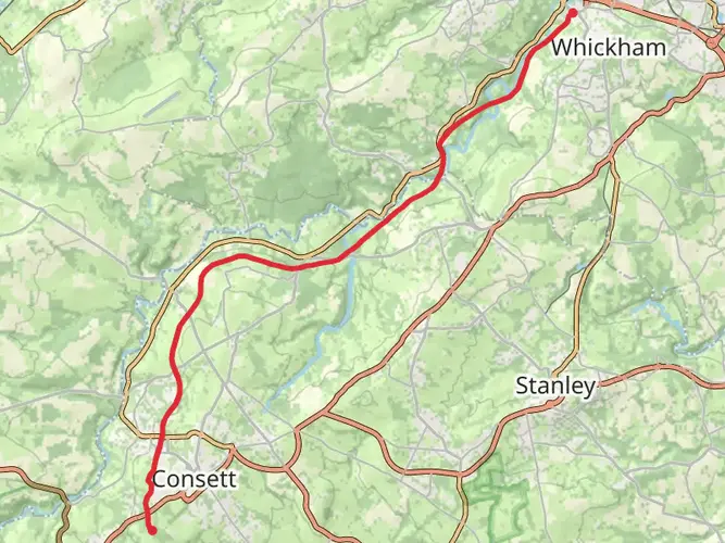
A practical starting point for Swalwell to Knitsley via Derwent Walk is the Swalwell Visitor Centre entrance to Derwent Walk Country Park, off the B6317 beside Blaydon Rugby Club. Gateshead Council notes parking for about 15 cars there, including disabled spaces, which makes it one of the clearest access points at the Swalwell end of the route.
Is the Swalwell to Knitsley via Derwent Walk dog friendly?
Swalwell to Knitsley via Derwent Walk is generally suitable for dogs because the Derwent Walk is a multi-user route where dogs are allowed under control. Gateshead Council also notes dog bins at various points including car parks, which is useful at the Swalwell end, but dogs still need close control around cyclists, wildlife, and other path users.
What is the terrain like on the Swalwell to Knitsley via Derwent Walk hike?
The Swalwell to Knitsley via Derwent Walk route follows much of the old Derwent Valley Railway, so the walking is typically on broad, steady-graded former railway path rather than narrow mountain trail. Around Derwent Walk Country Park, the corridor passes through woodland, meadows, wetlands, and riverside sections, with generally smooth multi-user surfaces that help explain the easy difficulty rating.
Can you get public transport to the Swalwell to Knitsley via Derwent Walk hike?
Public transport is workable at the Swalwell end of Swalwell to Knitsley via Derwent Walk. Gateshead Council states that Derwent Walk can be reached by bus from Gateshead Interchange, which makes it possible to start near Swalwell Visitor Centre and finish farther west toward Knitsley with a return transfer if needed.
What can you see on the Swalwell to Knitsley via Derwent Walk hike?
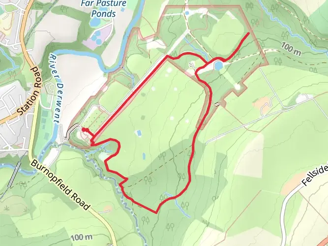
Swalwell to Knitsley via Derwent Walk passes through Derwent Walk Country Park landscapes of woodland, meadow, wetland, and riverside habitat, with regular sightings of birds such as kingfisher, heron, woodpecker, and red kite. At the Swalwell entrance, the route is also associated with the former railway heritage of the Derwent Valley line and the well-known Derwent Walk Express site on Hexham Road.
Comments and Reviews
User comments, reviews and discussions about the Swalwell to Knitsley via Derwent Walk, England.
4.0
average rating out of 5
1 rating(s)