Download
Preview
Add to list
More
161.5 km
~8 days
1602 m
Multi-Day
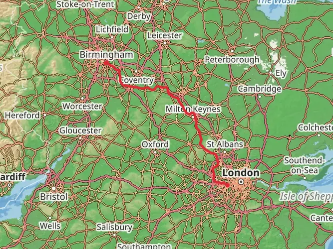
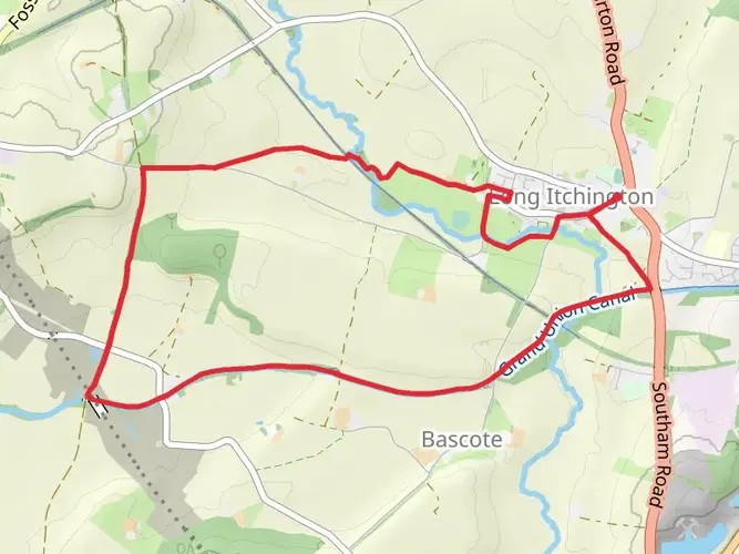
The Warwickshire Cakes and Ale Trail is a 161.5 km trail that starts in Stratford-on-Avon, Warwickshire, England. Based on our data, the hike is graded as Easy. For information on how we grade trails, please read measuring the difficulty of a hiking trail on hiiker. Also, check our latest community posts for trail updates. This hike can be completed in approx 6 days. Caution is advised on trail times as this depends on multiple variables. For more info read about how we calculate hike time.

What to expect?
Activity types
Frequently asked questions
How long does it take to hike the Warwickshire Cakes and Ale Trail?
The Warwickshire Cakes and Ale Trail is 161.52 km long, so most walkers treat it as a multi-day route rather than a single outing. A practical schedule is about 7 to 8 days, which matches the trail’s reputation as a seven-section walk across central Warwickshire.
Is the Warwickshire Cakes and Ale Trail difficult?
The Warwickshire Cakes and Ale Trail is generally rated easy, with 1,602 m of total elevation gain spread across 161.52 km. That points to a long-distance walk with mostly moderate gradients rather than sustained mountain climbing, although the Burton Dassett Hills area is one of the hillier sections on the route.
Where does the Warwickshire Cakes and Ale Trail go?
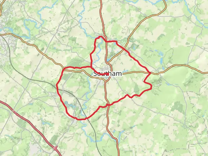
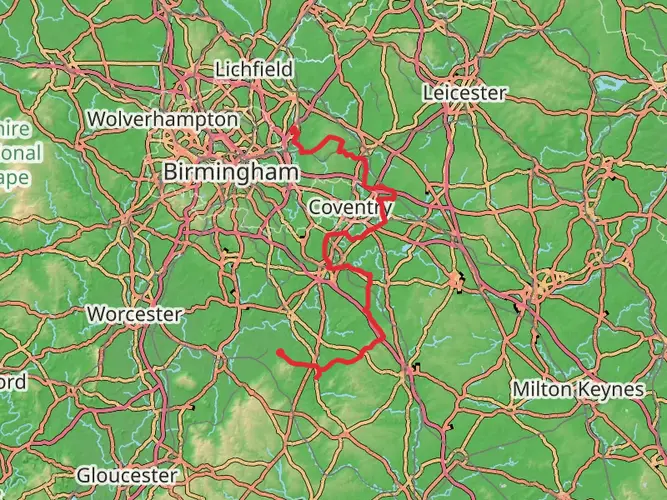
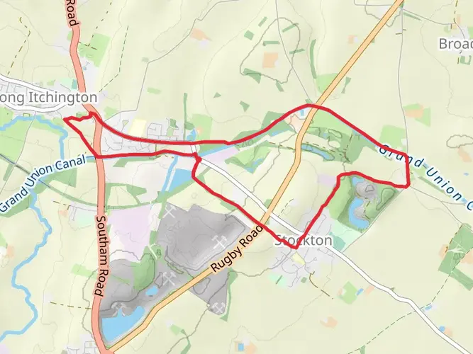
The Warwickshire Cakes and Ale Trail crosses the heart of Warwickshire and is known as a seven-section route through Shakespeare country. Published route descriptions place it through Kenilworth, Offchurch, Harbury, Burton Dassett Hills, the Battle of Edgehill area, and Kineton, linking villages, countryside paths, and pub stops along the way.
Can the Warwickshire Cakes and Ale Trail be walked in sections?
Yes. The Warwickshire Cakes and Ale Trail is commonly described as a seven-section ramble, which makes it well suited to day walks as well as a full end-to-end trip. That format is useful for breaking up the 161.52 km distance into shorter stages between Warwickshire villages and trail access points.
Is the Warwickshire Cakes and Ale Trail dog friendly?
Dogs can usually be taken on public rights of way in Warwickshire, but they need close control and must be kept on a short lead where livestock are present. Because this trail crosses farmland and grazing country, dog access can be affected by field conditions, stock, and stiles on individual sections.
Are there hills on the Warwickshire Cakes and Ale Trail?
The route is not a mountain hike, but it is not completely flat. Across the full trail there is 1,602 m of ascent, and one of the best-known hillier stretches is around Burton Dassett Hills Country Park and the Battle of Edgehill landscape, where the terrain becomes more rolling and exposed.
Can you use public transport for the Warwickshire Cakes and Ale Trail?
Yes, public transport can help with stage walking on the Warwickshire Cakes and Ale Trail. Warwickshire has county bus services linking towns and villages, and route descriptions place the trail near places such as Kenilworth and Kineton, which makes it more practical to plan section hikes without a car.
Comments and Reviews
User comments, reviews and discussions about the Warwickshire Cakes and Ale Trail, England.
5.0
average rating out of 5
1 rating(s)