Download
Preview
Add to list
More
64.9 km
~3 days
558 m
Multi-Day
“Embark on the Coventry Way for a scenic and historic hike through the quintessential English countryside.”
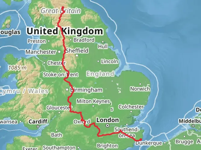
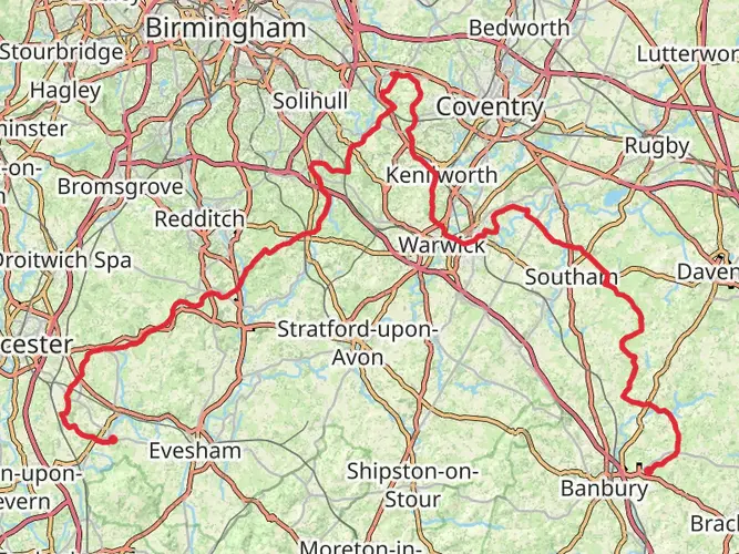
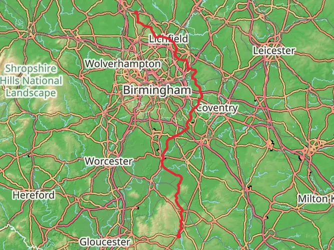
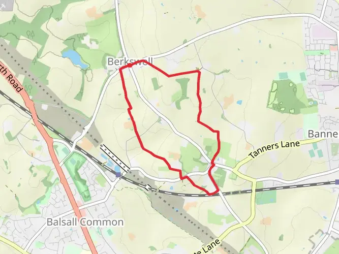
The Coventry Way is a circular long-distance footpath that spans approximately 65 kilometers (around 40 miles) with an elevation gain of roughly 500 meters (about 1640 feet), encircling the historic city of Coventry in the West Midlands of England. This trail offers a medium difficulty rating, making it accessible for hikers with a reasonable level of fitness and experience.
Getting to the Trailhead
The trailhead for the Coventry Way is conveniently located near the West Midlands, England. For those arriving by car, there are several parking options in the nearby towns from which you can start the hike. Public transport users can take advantage of the bus and train services to Coventry, and from the city center, local buses can drop you close to various points along the trail.
Route Overview
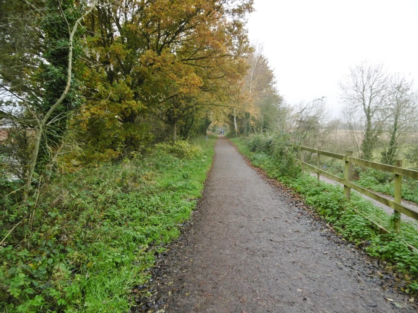
As you embark on the Coventry Way, you'll traverse a variety of landscapes, including rolling farmland, woodlands, and riverbanks. The trail is well-marked with the distinctive Coventry Way circular plaques, which feature a picture of Lady Godiva, making navigation straightforward. For additional navigation support, hikers can use the HiiKER app to access detailed maps and waypoints.
Historical Significance and Landmarks
The region is steeped in history, and the trail offers a chance to explore the heritage of the West Midlands. Notable historical landmarks include the ancient Arbury Estate and the ruins of Astley Castle. The trail also passes through several charming villages, each with their own unique character and history.
Nature and Wildlife
Nature enthusiasts will appreciate the diverse wildlife habitats along the Coventry Way. The trail meanders through several nature reserves, providing opportunities to spot a variety of bird species and other wildlife. The changing seasons bring different flora and fauna to the forefront, from bluebells in the spring to rich autumnal colors in the woodlands.
Trail Sections and Elevation
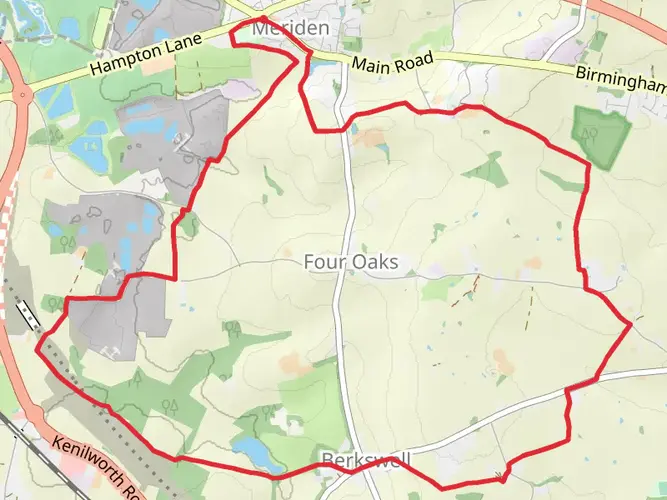
The trail can be tackled in sections, with each offering a different experience and varying degrees of elevation gain. The stretch from Meriden to Kenilworth, for example, includes gentle hills and a climb up to Kenilworth Castle, providing panoramic views of the surrounding countryside. The section alongside the River Avon is flatter, offering a more relaxed pace with picturesque river scenes.
Preparation and Planning
Hikers should be prepared for the British weather, which can be unpredictable. Waterproof clothing and sturdy hiking boots are recommended. The trail is well-suited for day hikes or a multi-day trek with accommodations available in the nearby towns and villages. It's advisable to carry a map and compass or use the HiiKER app for navigation, as some sections may cross through less populated areas where signage is less frequent.
Wildlife and Conservation Areas
The Coventry Way passes through several conservation areas, where hikers are encouraged to respect the natural environment and adhere to the Countryside Code. This includes leaving no trace, keeping dogs under control, and being considerate of wildlife and farm animals.
Amenities and Local Services
Along the route, there are opportunities to visit local pubs and cafes in the villages, providing a taste of the local cuisine and a chance to rest and refuel. It's wise to check opening times in advance and carry sufficient water and snacks, especially when passing through the more rural sections of the trail.
By providing a mix of historical exploration, natural beauty, and a moderate challenge, the Coventry Way is a rewarding experience for hikers looking to immerse themselves in the heart of England's countryside.

What to expect?
Activity types
Frequently asked questions
How long does the Coventry Way take to walk in full?
The Coventry Way is 64.95 km, or about 40 miles, so most hikers complete it over 2 to 4 days. Strong walkers sometimes cover it in a long single day, but the route is usually more comfortable as a short multi-day circuit with stage breaks around villages and access points on the edge of Coventry.
Where does the Coventry Way start and finish?
The Coventry Way is a circular route, so it returns to its starting point. The traditional start and finish is in Meriden, and the full trail loops around the outskirts of Coventry through countryside in Warwickshire and Solihull before coming back to the village.
Is the Coventry Way waymarked and easy to follow?
The Coventry Way is generally well waymarked with distinctive circular markers associated with the route, and it is considered an easy trail overall. Even so, a 64.95 km circuit has many junctions, field edges, lanes, and urban-edge sections, so navigation is easier with a map or offline route guidance.
Is the Coventry Way a hard walk?
The Coventry Way is rated easy, with 558 m of total elevation gain spread across nearly 65 km. That means there are no major mountain-style climbs, but the full route still requires stamina because it is a long-distance circuit rather than a short local walk.
Can the Coventry Way be walked in sections?
Yes. Because the Coventry Way circles close to Coventry and is never very far from the city, it is well suited to section hiking. Many walkers split the 64.95 km route into day walks using villages, road crossings, and public transport links around the edge of Coventry to break it into manageable stages.
What kind of scenery does the Coventry Way pass through?
The Coventry Way circles the rural edge of Coventry and passes mainly through agricultural countryside, with a mix of farmland, hedged field paths, woodland stretches, and some riverside or brook-side walking. Named points of interest associated with the route include Meriden, Astley Castle, and the Arbury area.
How do you get to the Coventry Way without a car?
Coventry Way is practical by public transport because Coventry has a main railway station and bus connections into the city and surrounding settlements. Since the route is circular and passes near multiple access points, walkers can reach a start point such as Meriden or another edge-of-city section by local bus rather than needing to drive the whole circuit.
Comments and Reviews
User comments, reviews and discussions about the Coventry Way, England.
4.57
average rating out of 5
7 rating(s)