Download
Preview
Add to list
More
71.5 km
~4 days
2075 m
Multi-Day
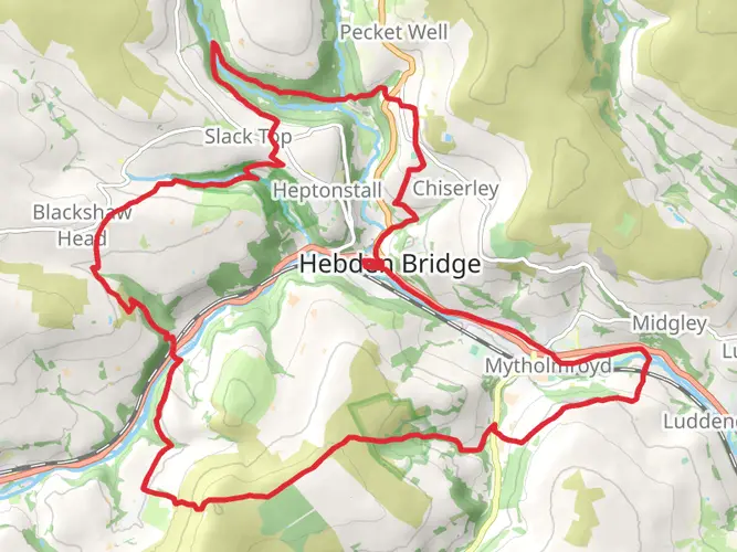
The Mary Towneley Loop via Pennine Bridleway is a 71.5 km trail that starts in Calderdale, West Yorkshire, England. Based on our data, the hike is graded as Easy. For information on how we grade trails, please read measuring the difficulty of a hiking trail on hiiker. Also, check our latest community posts for trail updates. This hike can be completed in approx 3 days. Caution is advised on trail times as this depends on multiple variables. For more info read about how we calculate hike time.

What to expect?
Activity types
Frequently asked questions
How long is the Mary Towneley Loop via Pennine Bridleway and how many days does it take?
The Mary Towneley Loop via Pennine Bridleway is 71.54 km long with 2,075 m of climbing, so it is usually treated as a multi-day route rather than a single-day walk. Many hikers split the loop over 2 to 4 days depending on pace, weather, and how much time is spent on the longer moorland sections around Calderdale, Rochdale, and Rossendale.
Is the Mary Towneley Loop via Pennine Bridleway suitable for beginner hikers?
The route is graded easy overall, but the full loop is still a substantial outing because it covers 71.54 km and gains 2,075 m of elevation. It is better suited to beginners with some endurance and navigation experience, especially on exposed Pennine moorland where the distance matters more than technical difficulty.
Can you walk the Mary Towneley Loop via Pennine Bridleway, or is it only for bikes and horses?
The Mary Towneley Loop can be walked. It forms part of the Pennine Bridleway National Trail, which is designed for walkers, horse riders, and cyclists rather than being limited to one user group. That shared-use status is one of the defining features of the Pennine Bridleway in the South Pennines.
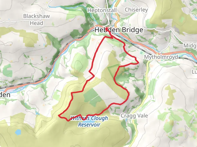
What towns and landmarks are on the Mary Towneley Loop via Pennine Bridleway?
The loop crosses the South Pennines and is closely associated with places including Hebden Bridge, Todmorden, Littleborough, and Waterfoot. Well-known features linked with the route include Stoodley Pike, the Rochdale Canal corridor, Cliviger Gorge, Long Causeway, and the packhorse water trough at Mankinholes.
Is the Mary Towneley Loop via Pennine Bridleway a circular trail?
Yes. The Mary Towneley Loop via Pennine Bridleway is a circular route, so it returns to the starting area rather than finishing point-to-point. That makes it practical for multi-day planning, especially for hikers arranging one car drop, a rail arrival into Calderdale, or a short transfer to the trailhead.
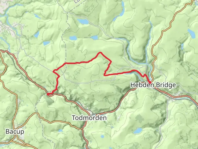
Where is the Mary Towneley Loop via Pennine Bridleway located?
The Mary Towneley Loop via Pennine Bridleway is in the South Pennines, centered on West Yorkshire and extending across neighboring parts of Lancashire and Greater Manchester. The route is commonly associated with Calderdale, Rochdale, and Rossendale, with access from towns such as Hebden Bridge, Todmorden, and Littleborough.
Comments and Reviews
User comments, reviews and discussions about the Mary Towneley Loop via Pennine Bridleway, England.
5.0
average rating out of 5
1 rating(s)