Download
Preview
Add to list
More
38.5 km
~3 days
1407 m
Multi-Day
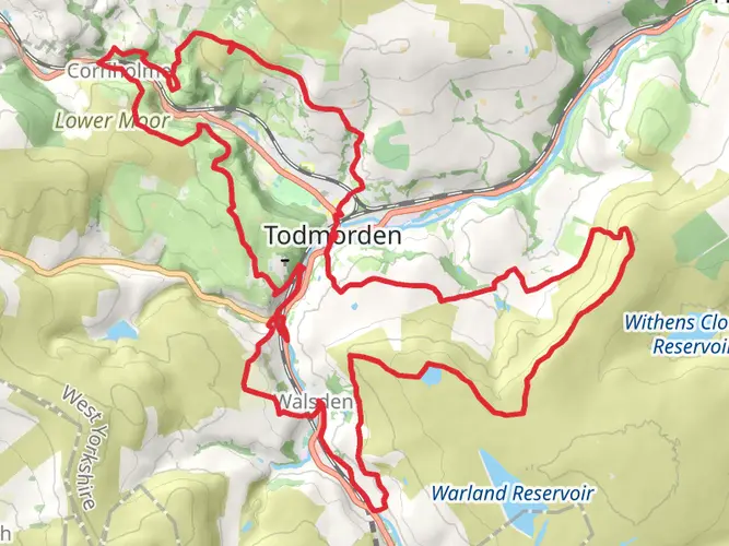
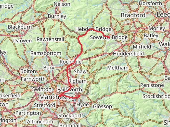
The Todmorden Centenary Way is a 38.5 km trail that starts in Calderdale, West Yorkshire, England. Based on our data, the hike is graded as Medium. For information on how we grade trails, please read measuring the difficulty of a hiking trail on hiiker. Also, check our latest community posts for trail updates. This hike can be completed in approx 2 days. Caution is advised on trail times as this depends on multiple variables. For more info read about how we calculate hike time.

What to expect?
Activity types
Frequently asked questions
How long does the Todmorden Centenary Way take to walk?
The Todmorden Centenary Way is 38.52 km long with 1,407 m of climbing, so it is usually tackled as a demanding long day or a 2-day walk. Strong hikers may finish it in one outing, but the amount of ascent and the moorland terrain make it more realistic as a multi-day route for many walkers.
Is the Todmorden Centenary Way a circular walk around Todmorden?
Yes. The Todmorden Centenary Way is generally described as a circular route based on Todmorden, which makes logistics simpler than a point-to-point trail. That means it can be started and finished in the Todmorden area rather than requiring a car shuttle between separate trailheads.
How difficult is the Todmorden Centenary Way and is it suitable for beginners?
The Todmorden Centenary Way is rated medium, but the numbers make it more serious than an easy introduction: 38.52 km in total and 1,407 m of elevation gain. It suits walkers with solid fitness and some experience of long hill days, especially because the route is in the Pennine landscape around Todmorden where climbs can be steep and weather can change quickly.
Can the Todmorden Centenary Way be reached by train from Todmorden station?
Yes. Todmorden has a railway station with regular rail links on routes including Manchester Victoria, Halifax, Leeds, Burnley, and Blackburn, so the walk is practical without a car. Because the route is a Todmorden-based circuit, the station is a useful access point for starting and finishing on foot in town.
What landmarks and views are on the Todmorden Centenary Way?
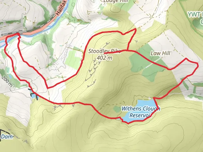
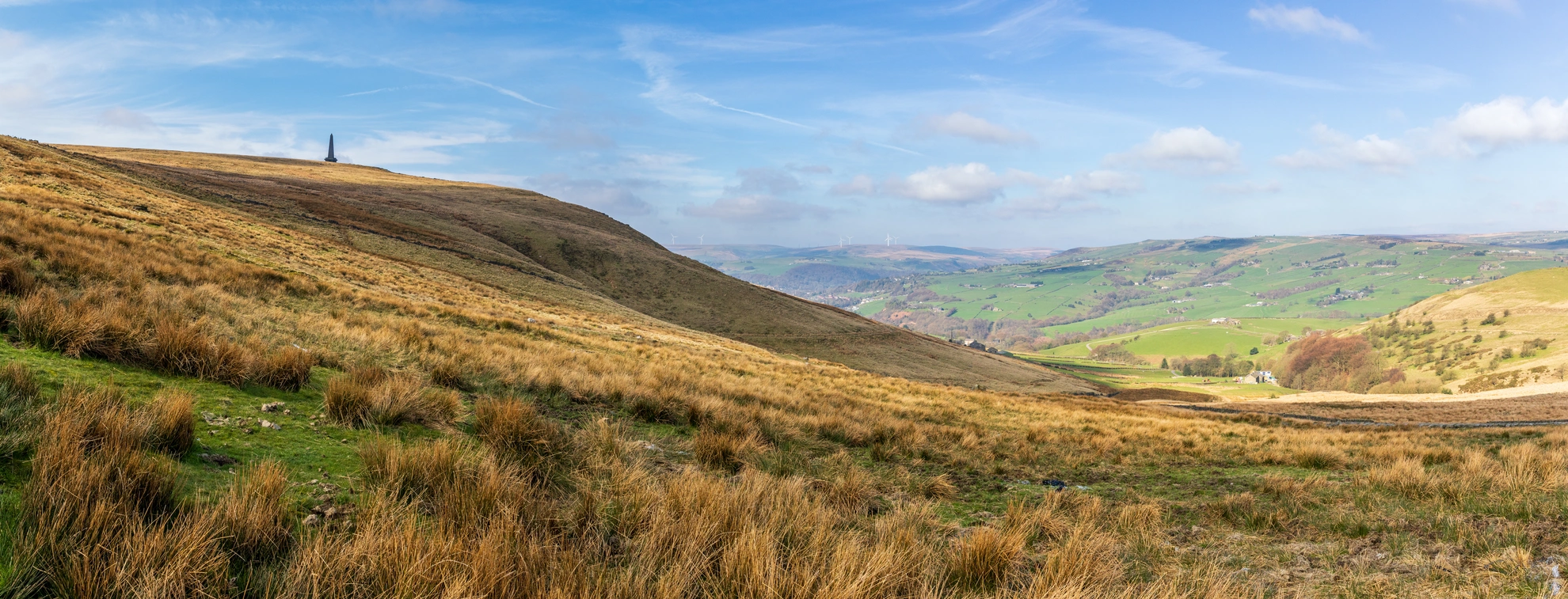
One of the best-known landmarks linked with the Todmorden walking network is Stoodley Pike, the prominent hilltop monument above the Calder Valley. The route is set in the steep-sided Pennine landscape around Todmorden, so walkers can expect moorland scenery, gritstone outcrops, and wide views over the surrounding valleys of West Yorkshire.
Is the Todmorden Centenary Way mostly moorland or low-level walking?
The Todmorden Centenary Way is best thought of as a hill and moorland route rather than a flat valley walk. Todmorden sits among steep Pennine valleys and open uplands, and the trail’s 1,407 m of ascent strongly suggests repeated climbs onto higher ground rather than an easy low-level circuit.
Comments and Reviews
User comments, reviews and discussions about the Todmorden Centenary Way, England.
4.5
average rating out of 5
2 rating(s)