Download
Preview
Add to list
More
269.0 km
~14 days
6388 m
Multi-Day
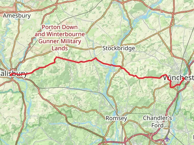
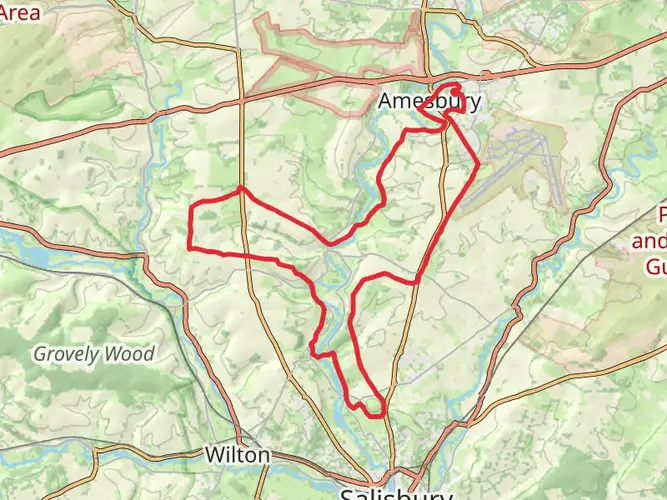
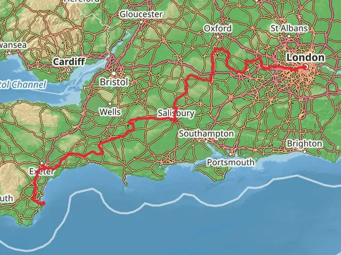
The Great Wessex Way is a 269.0 km trail that starts in Salisbury, Wiltshire, England. Based on our data, the hike is graded as Medium. For information on how we grade trails, please read measuring the difficulty of a hiking trail on hiiker. Also, check our latest community posts for trail updates. This hike can be completed in approx 11 days. Caution is advised on trail times as this depends on multiple variables. For more info read about how we calculate hike time.

What to expect?
Activity types
Frequently asked questions
How long does the Great Wessex Way take to walk end to end?
The Great Wessex Way is a 269.05 km multi-day route, so most hikers split it into roughly 10 to 14 walking days. Published route estimates for the full trail are about 70 to 82 hours on foot, which fits a medium-difficulty trek with 6,388 m of total ascent.
Where does the Great Wessex Way start and finish?
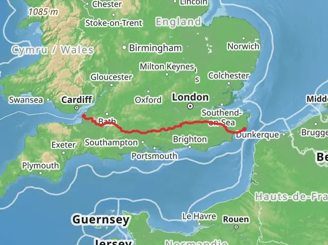
The Great Wessex Way runs west to south from Salisbury in Wiltshire to Lyme Regis on the Dorset coast. The route begins in the cathedral city of Salisbury and finishes at Lyme Regis, with major waypoints along the line including Shaftesbury, Corfe Castle, Lulworth Cove, Bridport, Golden Cap, and the Cobb at Lyme Regis.
What are the main highlights on the Great Wessex Way?
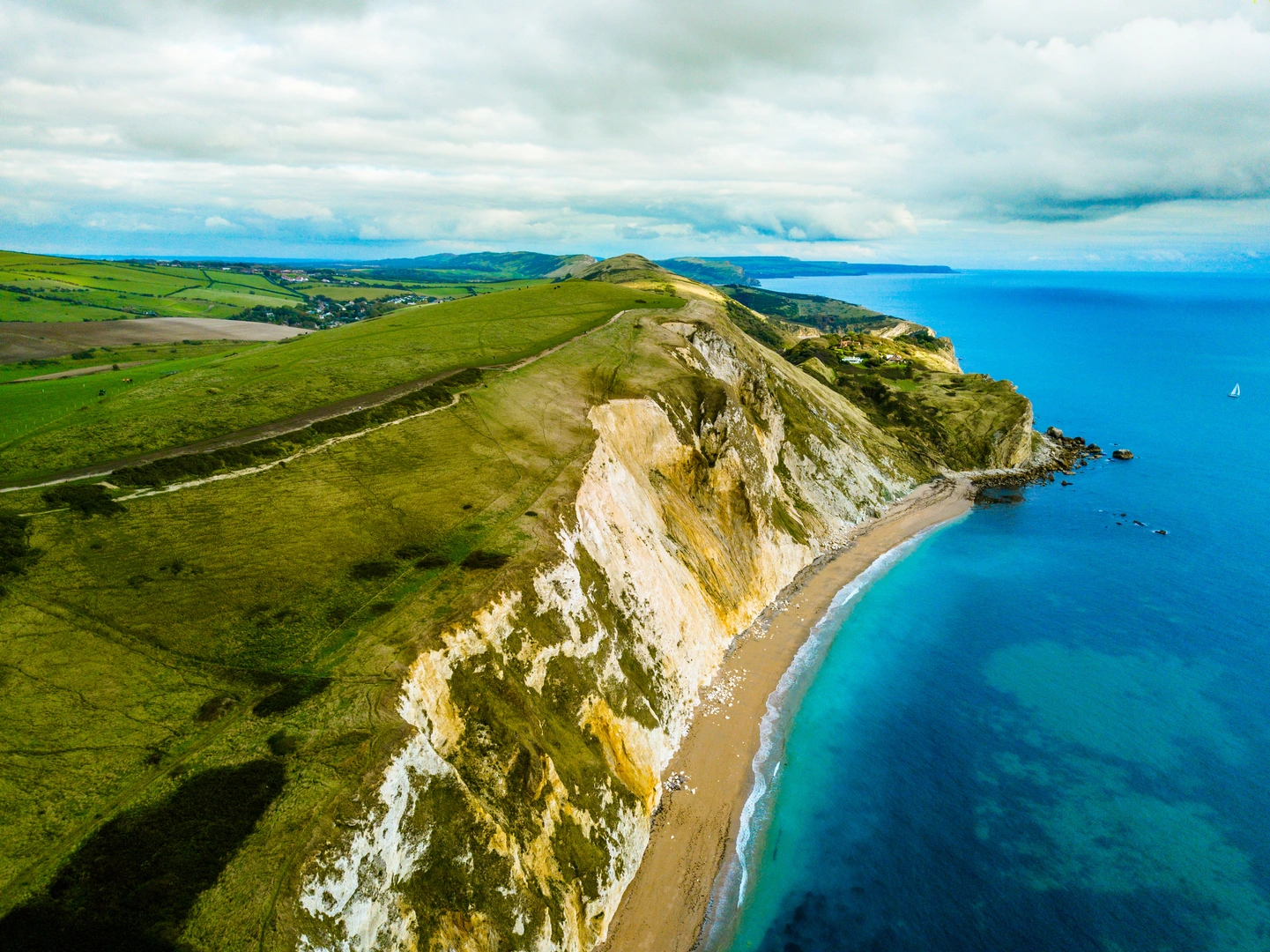
The Great Wessex Way links a long list of standout landmarks across Wiltshire and Dorset. Notable highlights include Salisbury Cathedral, Shaftesbury’s Gold Hill, Hambledon Hill, Corfe Castle, the Jurassic Coast, the lost village of Tyneham, Lulworth Cove, Portland, the Hardy Monument, West Bay, Golden Cap, and Lyme Regis.
Is the Great Wessex Way a hard walk?
The Great Wessex Way is generally rated medium, but the full route is still a serious long-distance hike at 269.05 km with 6,388 m of climbing. The toughest sections are likely to be the repeated chalk downland ascents and the coastal stretches around places such as Swanage, Lulworth, and Golden Cap rather than one single high mountain climb.
How much elevation gain is on the Great Wessex Way?
The Great Wessex Way has 6,388 m of total elevation gain over its 269.05 km length. That amount of ascent is spread across the route’s chalk ridges, downland, and coastal hills, so it feels more like a steady accumulation of climbs than one continuous mountain day.
What kind of terrain is on the Great Wessex Way?
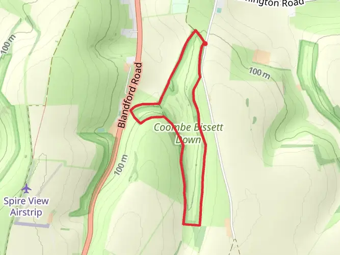
The Great Wessex Way combines inland chalk downland with later coastal walking on the Jurassic Coast. The route passes through landscapes including Cranborne Chase, north Dorset downs, villages and farmland, then reaches cliff and headland terrain near places such as Kimmeridge Bay, Lulworth Cove, Portland, West Bay, Golden Cap, and Lyme Regis.
Has the Great Wessex Way route changed near Lulworth Cove?
Yes. A route amendment was recorded in July 2024 at Lulworth Cove, where the Great Wessex Way was changed to use the cliff path instead of the beach after a significant rock fall. That means hikers should expect the current line near Lulworth to stay on higher ground rather than crossing the shore.
Comments and Reviews
User comments, reviews and discussions about the Great Wessex Way, England.
4.0
average rating out of 5
1 rating(s)