Download
Preview
Add to list
More
54.1 km
~3 days
913 m
Multi-Day
“Embark on the Sarum Way, a historic and scenic English countryside journey imbued with rich heritage and natural splendor.”
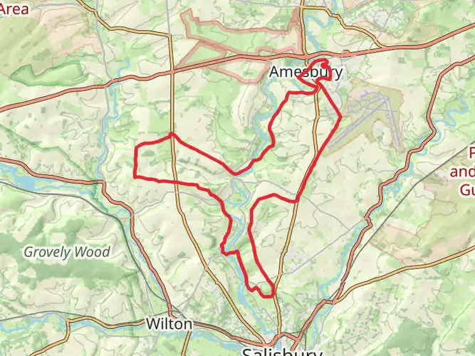
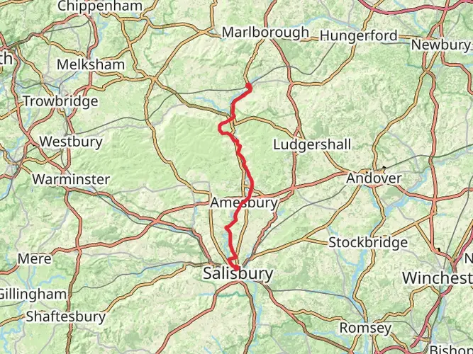
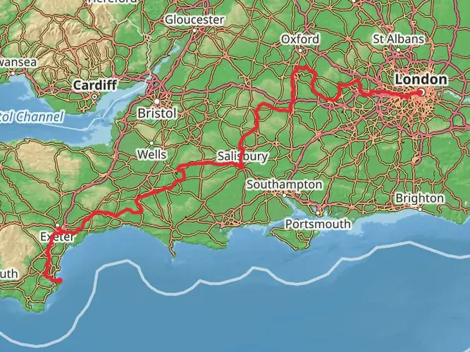
The Sarum Way is a captivating loop trail that spans approximately 54 kilometers (about 33.5 miles) with an elevation gain of around 900 meters (roughly 2950 feet), offering hikers a moderate challenge set amidst the picturesque landscapes near Wiltshire, England. This trail is steeped in history and natural beauty, providing an immersive experience into the English countryside.
Getting to the Trailhead
To begin your journey on the Sarum Way, you'll find the trailhead situated near the historic city of Salisbury in Wiltshire. For those arriving by car, parking is available in the city, from where you can access the trailhead. Public transport users can take advantage of the train services to Salisbury Railway Station or bus services, which provide good links to the city center. From there, the trailhead is just a short walk or taxi ride away.
Navigating the Trail
As you embark on the Sarum Way, it's advisable to use a reliable navigation tool like HiiKER to keep track of your progress and ensure you're following the correct path. The trail is well-marked in most sections, but having a digital map can be invaluable, especially at trail intersections or less clearly defined segments.
Historical Significance and Landmarks
The region around Sarum Way is rich in history, with the trail itself taking you through landscapes that have been shaped by centuries of human habitation. One of the most significant landmarks you'll encounter is the iconic Stonehenge, located just a short detour from the trail. This prehistoric monument dates back to around 3000 BC and is a UNESCO World Heritage Site.
As you continue, the trail will lead you through Old Sarum, the site of the earliest settlement of Salisbury. This Iron Age hill fort was later developed by the Romans, Saxons, and Normans, leaving behind a wealth of archaeological significance. The ruins of the Royal Castle and the outline of the old cathedral are visible reminders of the area's storied past.
Natural Beauty and Wildlife
The Sarum Way meanders through a variety of landscapes, including rolling chalk downlands, woodlands, and river valleys. The trail offers panoramic views of the surrounding countryside, with opportunities to spot local wildlife such as deer, badgers, and a variety of bird species. The flora along the trail changes with the seasons, from vibrant wildflowers in spring to the rich hues of autumn leaves.
Trail Experience
The trail's 54 kilometers can be tackled over several days, with local accommodations available for those wishing to take their time and fully immerse themselves in the experience. The elevation gain is gradual, with the most significant climbs providing rewarding vistas. Along the way, you'll pass through charming villages where you can refuel with local cuisine and perhaps chat with friendly locals.
Preparation and Planning
Before setting out on the Sarum Way, ensure you're adequately prepared with suitable hiking gear, including waterproof clothing, as the English weather can be unpredictable. Carry enough water and snacks, and consider packing a picnic to enjoy at one of the many scenic spots along the route. Always check the weather forecast and trail conditions in advance, and plan your hike accordingly.
Remember, the Sarum Way offers a unique blend of natural beauty and historical exploration, making it a must-visit trail for any hiking enthusiast looking to experience the essence of the English countryside.

What to expect?
Activity types
Frequently asked questions
How long does it take to hike the Sarum Way loop in Wiltshire?
The Sarum Way is 54.11 km, or about 33.6 miles, with 913 m of climbing, so most walkers treat it as a 2 to 3 day route. Strong hikers can complete it in a long day, but the loop is usually more comfortable when split into stages around Salisbury and the surrounding villages.
Where do you start the Sarum Way and where can you park for the hike?
The Sarum Way is a circular route around Salisbury, and Old Sarum is one of the most practical starting points because it sits on the north side of the city and directly on the route. Old Sarum is about 2.1 miles north of central Salisbury off the A345, with parking at the site and the postcode SP1 3SD for navigation.
Can you reach the Sarum Way by train or bus from Salisbury?
Yes. Salisbury railway station is the main rail gateway for the Sarum Way, and Old Sarum, a common access point for the loop, is about 2.1 miles from the station. Buses from Salisbury serve Old Sarum, including routes from the station and city center, so the walk can be started without a car.
Does the Sarum Way pass Stonehenge or Old Sarum?
The Sarum Way is closely tied to the historic landscape around Salisbury and is known for passing Old Sarum and linking into the wider network of paths in the area. Stonehenge is one of the major landmarks associated with the route’s setting, and Old Sarum is a key historic site on the northern side of the circuit.
Is the Sarum Way difficult and suitable for beginner hikers?
The Sarum Way is graded easy, which makes it one of the more approachable long walks in Wiltshire. Even so, 54.11 km and 913 m of ascent is still a substantial outing, so it suits beginners best when walked over multiple days rather than attempted as a single push.
Is the Sarum Way dog friendly?
The Sarum Way can work well for dogs because it uses countryside paths and passes through access points such as Old Sarum, where dogs are accommodated on site. As with many Wiltshire rights of way, dogs may need to be kept under close control around roads, heritage sites, livestock, and field boundaries.
Comments and Reviews
User comments, reviews and discussions about the Sarum Way, England.
4.0
average rating out of 5
10 rating(s)