Download
Preview
Add to list
More
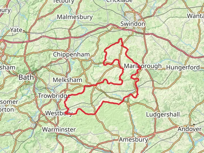
139.9 km
~7 days
1631 m
Multi-Day
“Embark on The Ridgeway, England's historic trail, for a scenic and culturally rich 87-mile trek through ancient landscapes.”
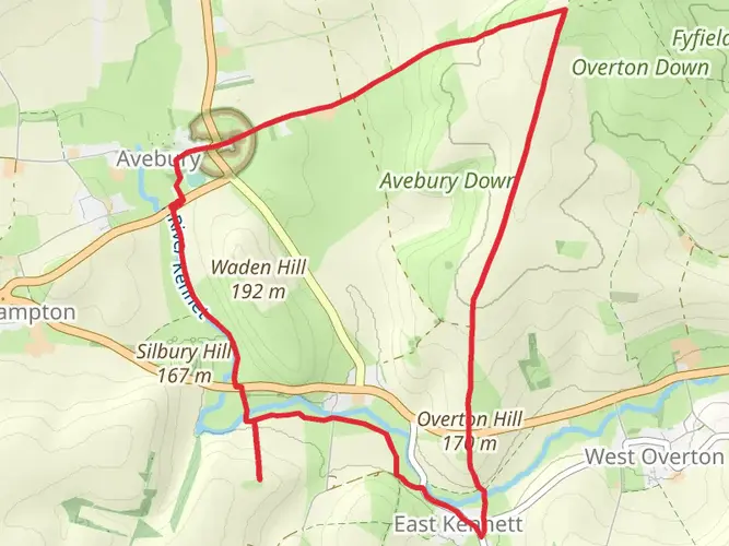
Spanning approximately 87 miles (140 kilometers) and with an elevation gain of around 5,250 feet (1600 meters), The Ridgeway National Trail is one of the oldest walking routes in England. This point-to-point trail begins near Overton Hill, close to Avebury in Wiltshire, and stretches eastward to Ivinghoe Beacon in Buckinghamshire, offering a medium difficulty trek that is steeped in history and rich in natural beauty.
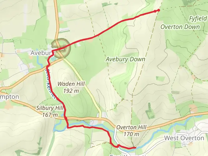
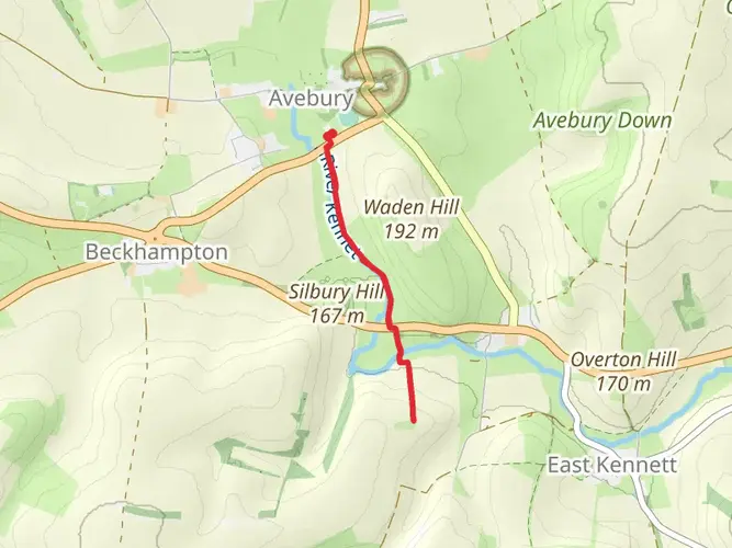
Getting to the Trailhead To start your journey on The Ridgeway, you can reach the trailhead near Overton Hill by public transport or car. The nearest towns with public transport links are Swindon and Pewsey, from where you can take a taxi to the trailhead. If driving, you can park your car at the small parking area near the A4, close to the Sanctuary, a notable landmark near Avebury.
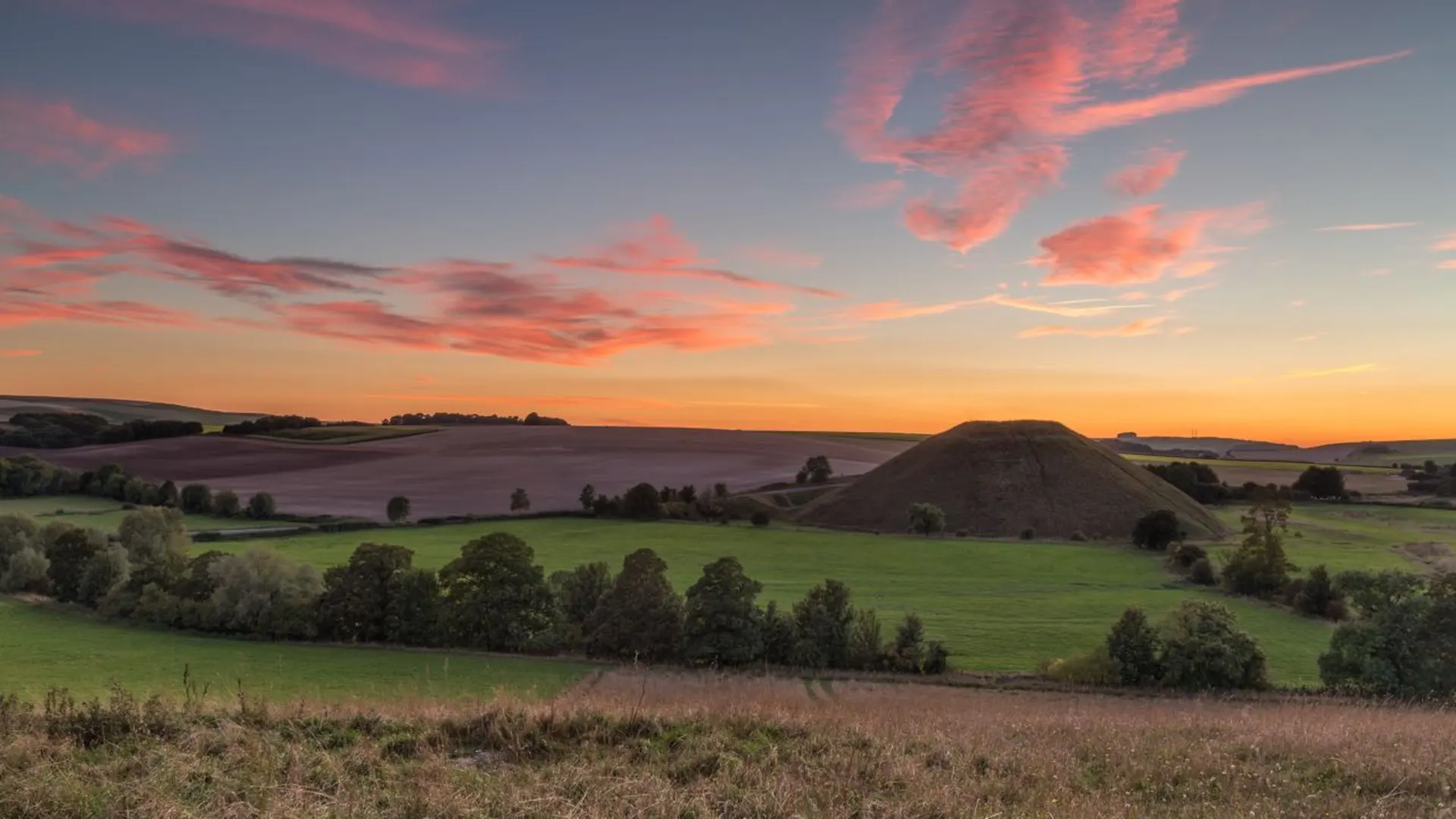
Historical Significance The Ridgeway has been traveled for at least 5,000 years, as it follows a route used since prehistoric times by travelers, herdsmen, and soldiers. It is often referred to as Britain's oldest road. The trail passes through a landscape rich with historical monuments, including the Neolithic stone circles of Avebury, which are a UNESCO World Heritage Site, and the Uffington White Horse, a prehistoric hill figure.
Landmarks and Scenery As you embark on the trail, you'll traverse the North Wessex Downs, an Area of Outstanding Natural Beauty, characterized by rolling chalk hills and lush valleys. The trail offers panoramic views of the surrounding countryside, with the first section leading you through the open downland of Wiltshire.
Around 6 miles (9.7 kilometers) into the hike, you'll encounter Barbury Castle, an Iron Age hill fort that provides a glimpse into the ancient past. Continuing eastward, the trail crosses into Oxfordshire, where the landscape becomes more wooded, offering a different hiking experience.
Wildlife and Nature The Ridgeway is home to a diverse range of wildlife. Keep an eye out for red kites soaring above and listen for the distinctive call of skylarks. The chalk grasslands along the route support a variety of wildflowers and butterflies, particularly in the spring and summer months.
Navigation and Planning To navigate the trail, HiiKER is an excellent tool for planning your hike, offering detailed maps and information on the route. It's advisable to download the map for offline use, as some sections of the trail may have limited mobile reception.
Accommodation and Supplies There are several villages and small towns along the route where you can find accommodation, ranging from campsites to B&Bs. It's wise to book in advance, especially during peak seasons. For supplies, larger towns such as Wantage and Wallingford are situated a short distance from the trail and provide opportunities to stock up on essentials.
Trail Etiquette and Safety Remember to follow the Countryside Code: respect the local wildlife and environment, leave no trace, and keep dogs under control. The weather can be unpredictable, so pack appropriate clothing and check the forecast before setting out. Carry enough water and snacks, and be prepared for some remote sections where amenities are scarce.
End of the Trail The eastern terminus of The Ridgeway is at Ivinghoe Beacon, a prominent hilltop with stunning views over the Vale of Aylesbury. From here, you can arrange for a taxi to the nearby towns of Tring or Aylesbury, where you can access public transport for your onward journey.

What to expect?
Activity types
Frequently asked questions
How long does it take to hike The Ridgeway National Trail end to end?
The Ridgeway National Trail is about 139.88 km, or roughly 87 miles, from Avebury in Wiltshire to Ivinghoe Beacon in Buckinghamshire. Many walkers split it into about 6 days, though a slower schedule is common because the route passes long exposed sections, historic sites, and several villages worth stopping in.
Where does The Ridgeway National Trail start and finish?
The Ridgeway National Trail runs point to point from Avebury and Overton Hill in Wiltshire to Ivinghoe Beacon in Buckinghamshire. The western end is near the Avebury World Heritage Site, while the eastern end finishes on the prominent hill of Ivinghoe Beacon in the Chilterns.
Where can I park for The Ridgeway National Trail at the Avebury or Overton Hill end?
A commonly used trailhead parking area for The Ridgeway National Trail is the informal car park at Overton Hill on the north side of the A4, about 7 km west of Marlborough. It is free to use, but space is limited and turning in and out onto the A4 needs care, especially during busy summer periods.
What are the main landmarks on The Ridgeway National Trail?
The Ridgeway National Trail links some of southern England’s best-known prehistoric and landscape landmarks. Highlights include Avebury Stone Circle, the Uffington White Horse, Barbury Castle, the crossing at the River Thames near Streatley and Goring, and the final climb to Ivinghoe Beacon.
Is The Ridgeway National Trail difficult?
The Ridgeway National Trail is generally considered an easy long-distance walk, with about 1,631 meters of total elevation gain spread across nearly 140 km. Much of the route follows broad tracks and chalk ridge paths, so the challenge usually comes more from the distance and exposure than from steep technical terrain.
What is the terrain like on The Ridgeway National Trail?
The Ridgeway National Trail is known for chalk downland, broad tracks, grassy ridge walking, and more wooded sections in the Chilterns east of the River Thames. The western half is more open and remote, with wide views across the North Wessex Downs, while the eastern half passes closer to villages, woods, and nature reserves.
What is the best time of year to walk The Ridgeway National Trail?
Spring through early autumn is usually the most popular time to walk The Ridgeway National Trail, when the chalk downs, wildflowers, and long views are at their best. Autumn can also be excellent, especially in the wooded Chiltern section near Wendover and Ivinghoe Beacon, where late October and early November are known for strong fall color.
Comments and Reviews
User comments, reviews and discussions about the The Ridgeway National Trail, England.
4.82
average rating out of 5
39 rating(s)