Download
Preview
Add to list
More
75.6 km
~4 days
521 m
Multi-Day
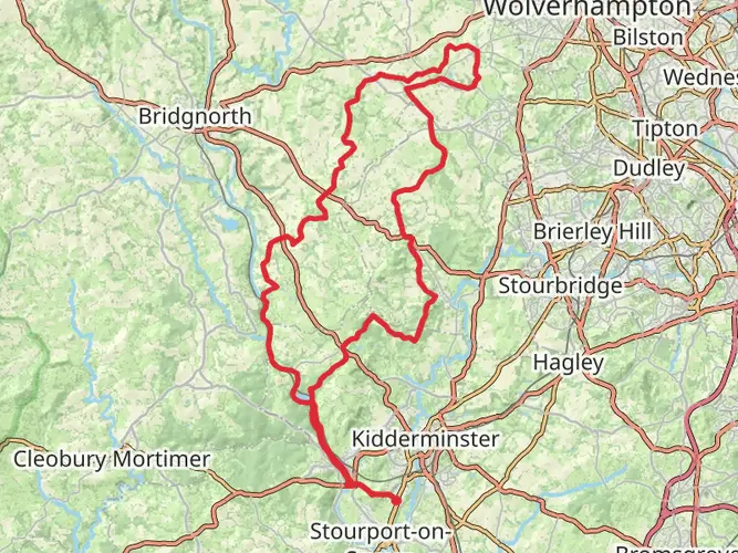
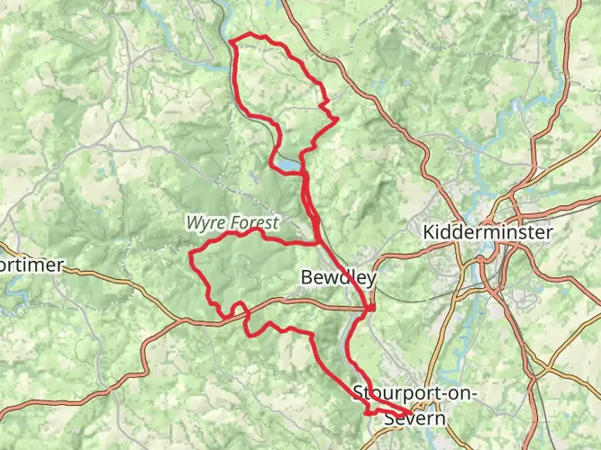
The Staffordshire and Worcestershire Canal Walk is a 75.6 km trail that starts in Wyre Forest, Worcestershire, England. Based on our data, the hike is graded as Easy. For information on how we grade trails, please read measuring the difficulty of a hiking trail on hiiker. Also, check our latest community posts for trail updates. This hike can be completed in approx 3 days. Caution is advised on trail times as this depends on multiple variables. For more info read about how we calculate hike time.

What to expect?
Activity types
Frequently asked questions
How long does the Staffordshire and Worcestershire Canal Walk take to complete?
The Staffordshire and Worcestershire Canal Walk is 75.55 km long with 521 m of total elevation gain, so it is usually tackled as a multi-day route rather than a single outing. Because it follows a canal towpath and is rated easy, many walkers split it into 3 to 5 days depending on pace, stops, and overnight plans.
Where does the Staffordshire and Worcestershire Canal Walk start and finish?
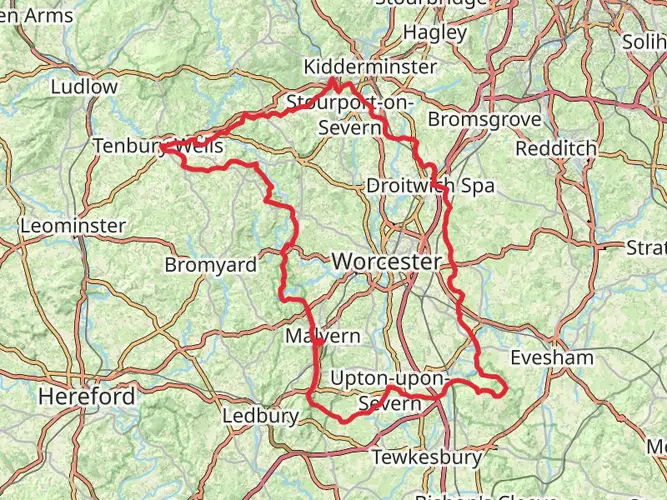
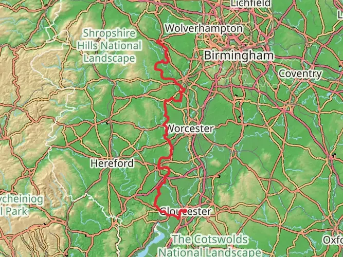
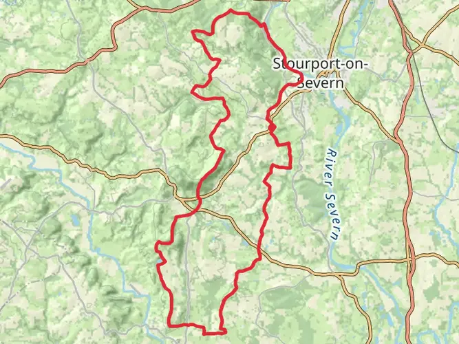
The Staffordshire and Worcestershire Canal links Stourport-on-Severn at the River Severn with Great Haywood Junction, where it meets the Trent and Mersey Canal. Along the way it passes places including Kidderminster, Kinver, and the Wolverhampton area, so the walk can be done in either direction depending on transport and accommodation plans.
Is the Staffordshire and Worcestershire Canal Walk difficult?
The Staffordshire and Worcestershire Canal Walk is rated easy, which fits the generally gentle gradients of a canal-side route. Even so, 75.55 km is still a substantial distance, so the main challenge is endurance over several days rather than steep climbing, with the total ascent coming to 521 m across the full walk.
What is the terrain like on the Staffordshire and Worcestershire Canal Walk?
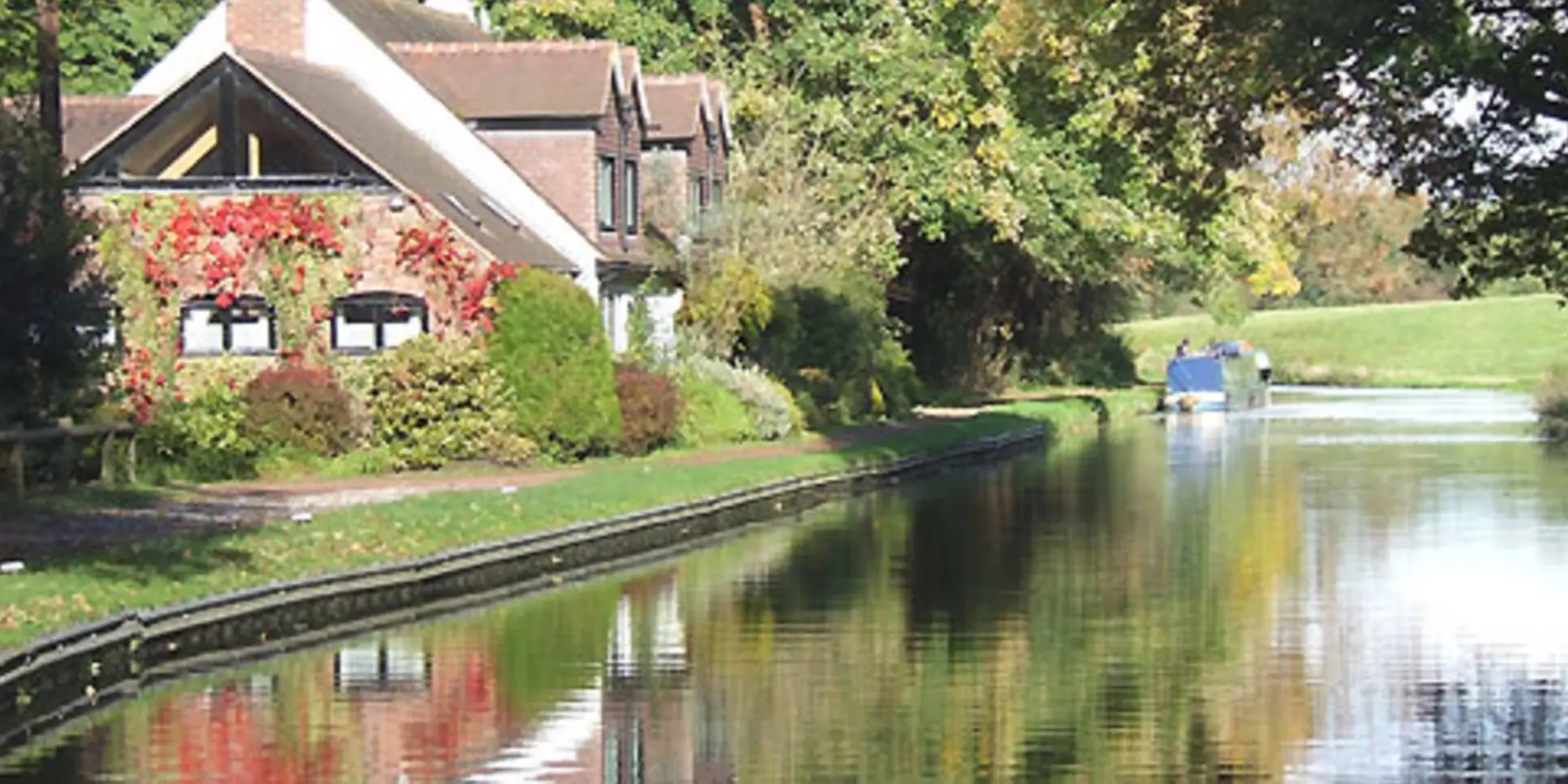
The route mainly follows canal towpaths, so the terrain is usually flat or gently graded and straightforward to follow. Surface quality can vary by section, but the canal runs through open West Midlands countryside and notable spots include the sandstone cuttings near Kidderminster and Kinver, plus the descent through locks toward Stourport Basins.
Is the Staffordshire and Worcestershire Canal Walk dog friendly?
Dogs are generally allowed on Canal and River Trust towpaths, which makes the Staffordshire and Worcestershire Canal Walk a practical option for walkers with dogs. The main considerations are keeping dogs under control around locks, bridges, boats, cyclists, and wildlife, and following the towpath code on shared sections.
What are the main highlights on the Staffordshire and Worcestershire Canal Walk?
Highlights on the Staffordshire and Worcestershire Canal Walk include Stourport Basins at the River Severn end, the sandstone scenery around Kidderminster and Kinver, and Great Haywood Junction at the northern end where the canal meets the Trent and Mersey Canal. Around Great Haywood, the canal also passes close to Shugborough and the historic Essex Bridge area.
Can the Staffordshire and Worcestershire Canal Walk be done using public transport?
Yes, the Staffordshire and Worcestershire Canal Walk is workable with public transport because it passes through or near towns such as Stourport-on-Severn, Kidderminster, and Wolverhampton, with Great Haywood at the northern end. That makes it realistic to join or leave the route partway through rather than committing to the full 75.55 km in one trip.
Comments and Reviews
User comments, reviews and discussions about the Staffordshire and Worcestershire Canal Walk, England.
5.0
average rating out of 5
2 rating(s)