Download
3D Flyover
Add to list
More
108.3 km
~6 days
7401 m
Multi-Day
“The Queyras Tour: a high-altitude Alpine adventure blending breathtaking landscapes with rich cultural history.”
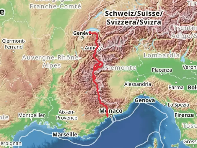
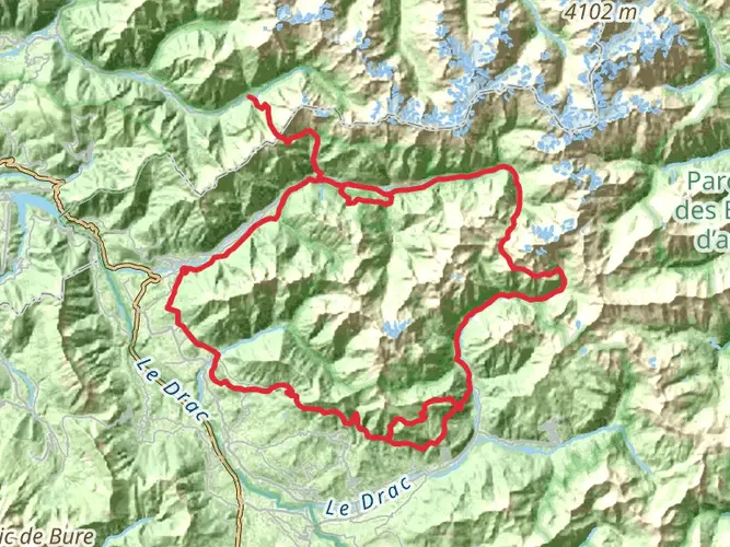
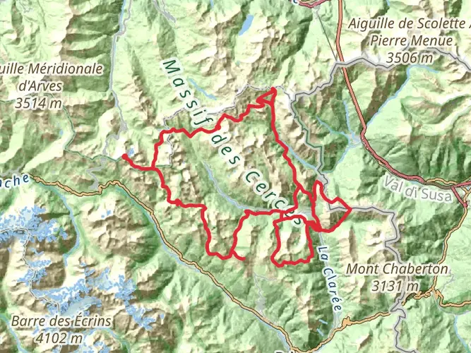
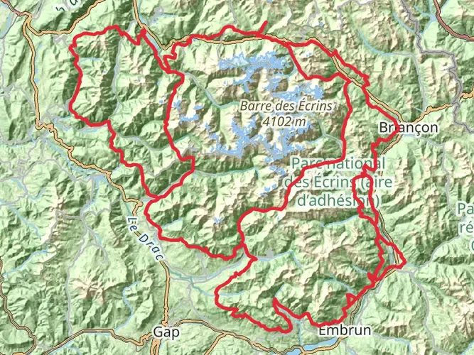
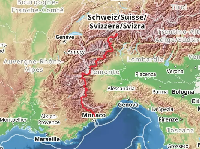
The Queyras Tour is a challenging and rewarding trek nestled in the heart of the French Alps, offering hikers a unique blend of natural beauty, cultural heritage, and physical endurance. Spanning approximately 108 kilometers (about 67 miles) with an elevation gain of around 7,400 meters (approximately 24,278 feet), this point-to-point trail is not for the faint-hearted and is rated as extra difficult due to its steep ascents and rugged terrain.
Getting to the Trailhead
The journey begins near the quaint village of Aiguilles, which is accessible by car or public transport. If you're driving, Aiguilles is about a 3-hour drive from Grenoble, the nearest major city. For those relying on public transportation, regular buses run from the Montdauphin-Guillestre train station to Aiguilles during the summer months. It's advisable to check the latest schedules on the LER line as services can be limited.
Navigating the Trail
Hikers can rely on HiiKER to navigate the trail, ensuring they stay on the correct path throughout their journey. The app provides detailed maps and waypoints, which are essential for a trail of this complexity.
Trail Highlights and Landmarks
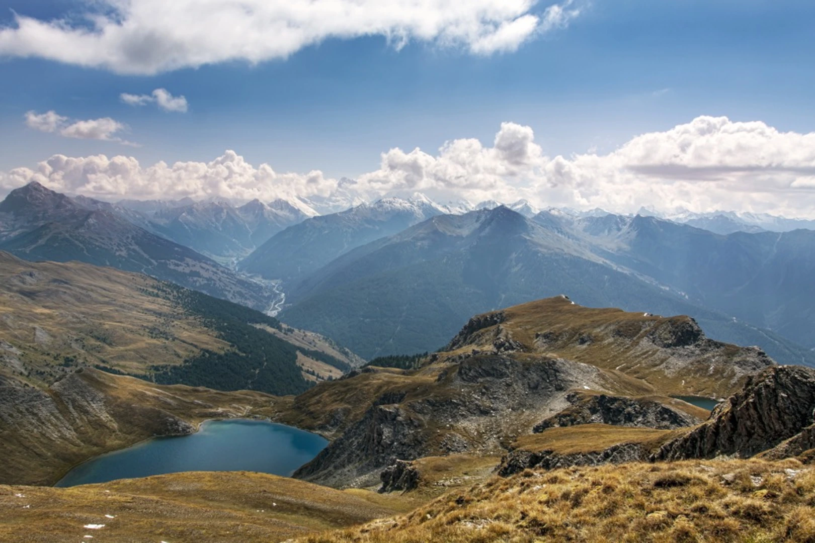
As you embark on the Queyras Tour, you'll traverse a variety of landscapes, from lush forests and alpine meadows to rocky passes and serene lakes. The trail is well-marked, with the GR58 route signs guiding you along the way.
Cultural and Historical Significance
The Queyras region is steeped in history, with its roots dating back to the Roman era. The trail passes through several ancient villages where traditional alpine architecture is preserved. You'll encounter old forts and chapels, remnants of the region's strategic importance in defending borders throughout the centuries.
Wildlife and Nature
The Queyras Natural Park is a sanctuary for wildlife, and hikers may spot marmots, chamois, and even golden eagles. The flora is equally diverse, with a range of alpine flowers blooming in the spring and summer months.
Key Sections of the Trail
Col Agnel Pass: One of the most significant challenges is the ascent to Col Agnel, which at 2,744 meters (about 9,003 feet) is one of the highest mountain passes in Europe. This section offers breathtaking views but requires careful pacing due to the thin air at high altitudes.
Lac Sainte-Anne: Approximately halfway through the trek, you'll reach Lac Sainte-Anne, a stunning glacial lake situated at 2,411 meters (about 7,910 feet). This is a perfect spot for a rest and to take in the serene beauty of the high mountains.
Chapelle de Clausis: Near Saint-Véran, the highest commune in Europe, you'll find the Chapelle de Clausis, a small chapel set against a dramatic alpine backdrop. This area is rich in history and offers a glimpse into the religious significance of the region.
Preparation and Safety
Given the trail's difficulty, hikers should be well-prepared with appropriate gear, including sturdy hiking boots, weather-appropriate clothing, and sufficient food and water supplies. It's also crucial to be prepared for sudden weather changes, which are common in the mountains.
Accommodation and Resupply Points
There are several refuges and gîtes along the trail where hikers can rest and resupply. It's recommended to book these in advance, especially during the peak summer months.
Conclusion
The Queyras Tour is a demanding yet immensely satisfying hike that offers a deep connection with the alpine wilderness and a profound sense of accomplishment upon completion. With careful planning and respect for the trail's challenges, hikers will find this experience to be one of the most memorable in the French Alps.

Frequently asked questions
How long is the Queyras Tour and how many days does the GR58 usually take?
The Queyras Tour is 108.27 km long with 7,401 meters of climbing, so it is a serious multi-day alpine trek rather than a short circuit. Hikers commonly divide the GR58 Tour du Queyras into about 7 to 10 days, depending on daily stage length, weather, and how comfortably they handle repeated high passes.
Is the Queyras Tour the same route as the GR58 in the Queyras?
Yes. The Queyras Tour follows the GR58, the classic Tour du Queyras route through the Parc naturel régional du Queyras. Published route descriptions put the GR58 at about 107 km, which closely matches the 108.27 km total for this hike, so the two names are generally used for the same long-distance circuit.
Where does the Queyras Tour start near Aiguilles and how do hikers reach it without a car?
The Queyras Tour is based near Aiguilles in the Hautes-Alpes. A common public-transport approach is to travel by train to Montdauphin-Guillestre and continue by bus into the Queyras valley toward Aiguilles, which is one of the main access points for the GR58 during the summer season.
How hard is the Queyras Tour and is the GR58 suitable for beginners?
The Queyras Tour is rated Extra Difficult, with 108.27 km of distance and 7,401 meters of ascent. That combination means long days, steep climbs, and sustained alpine terrain, so it is better suited to experienced hikers with strong fitness and mountain judgment than to first-time backpackers.
When is the best time of year to hike the Queyras Tour on the GR58?
The usual hiking season for the Queyras Tour is summer into early fall, when the high passes are most likely to be free of lingering snow. Because the route crosses high alpine terrain in the French Alps, early season conditions can still be wintry on cols, so July through September is generally the most reliable window.
Can dogs go on the Queyras Tour and are there restrictions on the GR58?
Dogs are not automatically allowed everywhere on the Queyras Tour. In the Parc naturel régional du Queyras, dogs must be kept on a leash in alpine pastures, in regulated forests, and near livestock, and they are completely prohibited in the Ristolas-Mont Viso Nature Reserve, even on leash, which matters for some GR58 sections.
What map area does the Queyras Tour cover and which villages does the GR58 pass near?
The Queyras Tour circles through the Queyras massif around Aiguilles and links several of the valley’s best-known mountain villages. GR58 mapping for the route covers the Aiguilles and Saint-Véran area, and the circuit is widely associated with villages such as Aiguilles, Arvieux, Ceillac, and Saint-Véran.
Comments and Reviews
User comments, reviews and discussions about the Queyras Tour, France.
4.89
average rating out of 5
9 rating(s)