Download
3D Flyover
Add to list
More
3.6 km
~1 hrs 3 min
196 m
Loop
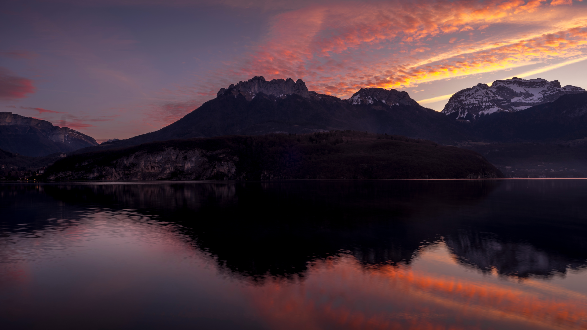
“A compact woodland climb to a chalet balcony, then an easy glide past turquoise lake glimpses and soaring silhouettes.”
This compact loop above Lake Annecy packs a lot into a short distance: a steady climb through mixed Alpine woodland to a balcony-like viewpoint, a classic mountain chalet stop, then a gentle return with frequent openings toward the lake and the Bauges/Aravis silhouettes. At roughly 4 km / 2.5 mi with about 200 m / 656 ft of ascent, it’s “Medium” mostly because the climbing is continuous for the first half and the footing can turn slick after rain.
Getting to the start (car + public transport)
Because the start point wasn’t fully specified (“near …”), the most practical access for this loop is typically from the east side of Lake Annecy, using the well-known trailheads above Talloires-Montmin and the Col de la Forclaz area (a major paragliding launch and landmark). If you share the route’s lon/lat points, I can pin the nearest exact trailhead landmark/address precisely.
- By car: Aim for the Col de la Forclaz (Montmin) area and the signed hiking parking pull-offs near the pass. This is a prominent, easy-to-find landmark on the road between Talloires-Montmin and Faverges-Seythenex. Arrive early in summer and on clear weekends—parking fills quickly due to hikers and paragliders.
- By public transport: Use buses to reach Annecy first (the main hub). From Annecy, local/regional buses commonly run toward Talloires / Menthon-Saint-Bernard depending on season and service patterns; from there, reaching the higher trailhead near Col de la Forclaz usually requires a taxi/rideshare or a longer uphill approach on foot/road. If you tell me the exact start lon/lat, I can match it to the closest stop and the most realistic walk-in.
What the route feels like underfoot
Expect a mix of forest path, occasional rocky steps, and short sections where the trail narrows along steeper side-slopes. In dry conditions it’s straightforward; in wet weather, the combination of roots + limestone rock can be surprisingly slippery. Trekking poles help on the descent if you’re sensitive to knees.
The hike, step by step (with approximate distances)
0.0–1.2 km (0.0–0.75 mi) | +140 m / +460 ft
From the trailhead near the Col de la Forclaz/Talloires-Montmin heights, the loop typically begins with a steady, efficient climb through woodland—often beech, spruce, and fir depending on aspect and elevation. The grade is consistent rather than brutal, but you’ll feel it right away. Look for intermittent breaks in the trees where Lake Annecy flashes into view below—these are good “pace checks” and quick photo stops without losing momentum.
1.2–2.0 km (0.75–1.25 mi) | +60 m / +200 ft
The trail eases slightly as you approach the Chalet du Talabar area. “Chalet” here is the classic Savoyard mountain building type—historically tied to seasonal grazing (alpage), where herders moved livestock upslope in summer. Even when not operating as a staffed refuge, these chalets are important cultural markers of how people used (and still use) these slopes: pasture management, cheese-making traditions, and maintaining open meadows that would otherwise revert to forest.
You’ll often notice the landscape shifting from enclosed forest to more open edges—a transition zone that’s excellent for wildlife.
2.0–2.6 km (1.25–1.6 mi) | rolling, small ups/downs
From the chalet, the loop usually traverses toward Chavoire, with a few gentle undulations. This is where the “short hike, big scenery” payoff tends to happen: openings can frame the lake’s turquoise tone and the surrounding massifs. On clear days, the contrast between the lake basin and the rugged limestone ridges is striking.
2.6–4.0 km (1.6–2.5 mi) | mostly downhill, -200 m / -656 ft back to start
The return leg drops back through forest on a more relaxed grade. Watch for leaf litter over roots—it hides slick surfaces. If the loop uses any shared access tracks, be alert for mountain bikes and occasional service vehicles near chalet zones.
Landmarks, nature, and wildlife to look out for
- Lake Annecy viewpoints: Even brief clearings can be dramatic because the lake sits far below; take care near edges, especially if the ground is damp.
- Alpine woodland + meadow margins: These ecotones are prime for spotting chamois (often early/late), and hearing jay, nutcracker, and other forest birds.
- Raptors overhead: The Col de la Forclaz area is famous for air activity; you may see paragliders and also buzzards/eagles riding the same thermals.
- Spring to early summer flora: Expect a strong showing of wildflowers in sunnier openings; stay on the path to avoid trampling fragile plants and to reduce erosion on thin soils.
Historical and regional context (why this area looks the way it does)
The slopes above the east shore of Lake Annecy sit in a long-used mountain corridor between lake settlements and higher summer pastures. The presence of chalets like Talabar reflects the alpage system—a centuries-old pattern of moving herds upslope

Surfaces
Unknown
Asphalt
Gravel
Grass
Comments and Reviews
User comments, reviews and discussions about the Lake Annecy, Chalet du Talabar and Chavoire Loop, France.
average rating out of 5
0 rating(s)