Download
3D Flyover
Add to list
More
10.0 km
~3 hrs 46 min
1063 m
Out and Back
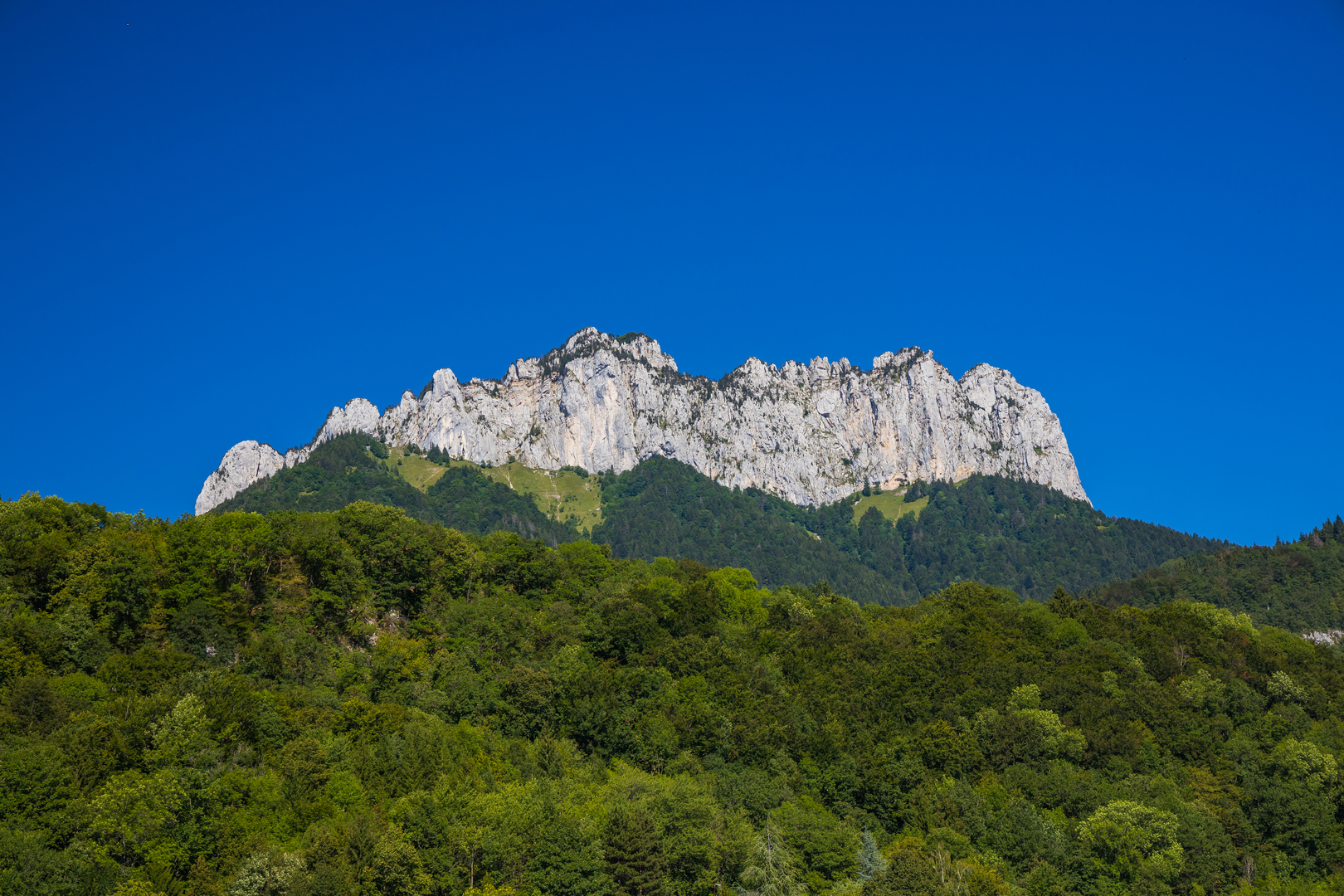
“A steep, airy limestone loop to Pointe Nord and the Dents, rewarding confident scramblers with lake-blue panoramas.”
This is a short, steep, and very committing alpine-style loop/out-and-back in the Bornes Massif above Lake Annecy, linking two standout viewpoints: Pointe Nord (on the Lanfon ridge) and the jagged limestone towers of the Dents de Lanfon. Over roughly 10 km (6.2 mi) you’ll climb about 1,100 m (3,610 ft)—which is why it earns an Extra Difficult rating despite the modest distance. Expect sustained gradients, rocky steps, exposed sections, and terrain that can feel more like a scramble than a “walk,” especially near the ridge and the teeth.
Getting to the start (car + public transport)
Because your start point is listed only as “near,” the most common and practical access for this route is from the Montmin / Col de la Forclaz area above Talloires-Montmin (east of Lake Annecy). The nearest widely known landmark used by hikers is:
- Col de la Forclaz (Talloires-Montmin, Haute-Savoie, France) — the famous paragliding takeoff and viewpoint over Lake Annecy.
By car - Drive to Col de la Forclaz and use the signed parking areas near the pass (these fill early on fair-weather weekends due to paragliders and lake-view visitors). - A second common access is via Montmin village (lower down) if you’re aiming for a quieter start, but it adds road approach and can change the exact route length.
By public transport - From Annecy, you can typically reach the lake-side towns (e.g., Talloires) by bus, but service up to Col de la Forclaz is often limited/seasonal and not always timed for early starts. Plan on: - Bus to the lake edge (Talloires/Talloires-Montmin area), then - A taxi/rideshare or a long uphill road walk to the pass if no direct service is running. Use HiiKER to confirm the exact trailhead you intend to use and to avoid accidentally starting from a different access point (which can add significant elevation and time).
What the hike feels like underfoot
This is classic Haute-Savoie limestone: hard, pale rock; steep forested lower slopes; then broken, grippy but uneven stone higher up. After rain, shaded sections can be slick with mud and polished rock. In early season or after cold nights, lingering snow patches can sit in gullies and on north-facing ledges—small in area but high consequence if they cross an exposed line.
Plan for a pace that reflects the climb: 1,100 m (3,610 ft) in ~10 km (6.2 mi) is a big day even for fit hikers, and the ridge sections reward careful foot placement more than speed.
Route breakdown (approximate distances + elevation)
Exact numbers vary with the chosen trailhead and whether you tag both summits as out-and-backs from the ridge, but the day generally unfolds like this:
1) Trailhead to steep forest climb — ~0 to 3 km (0 to 1.9 mi), +600 m (+1,970 ft) You’ll start on well-used mountain paths that quickly tilt upward through mixed woodland. Expect: - Tight switchbacks - Rooty steps and short rocky pitches - Occasional clearings where the lake begins to appear behind you
This lower section is where most people underestimate the effort—there’s rarely a “warm-up.” If you’re breathing hard early, that’s normal; settle into a sustainable cadence.
2) Transition to open slopes and limestone bands — ~3 to 5 km (1.9 to 3.1 mi), +300 m (+985 ft) As the forest thins, the terrain becomes more alpine: - More rock underfoot - Short, steeper scrambly steps - Increasing exposure in places (a slip would have consequences)
You’ll start to see the character of the Dents de Lanfon—a serrated line of limestone “teeth” that looks dramatic from the lake and even more so up close.
3) Ridge travel: Pointe Nord and the Dents — ~5 to 8 km (3.1 to 5.0 mi), +200 m (+655 ft) This is the crux for many hikers: not because it’s the steepest, but because it’s the most technical and airy. The ridge undulates, and the route often threads around rock features rather than going straight over them.
- Pointe Nord is typically reached via a steep final push on rock and dirt. The payoff is a wide, high balcony over Lake Annecy and the surrounding massifs.
- The Dents de Lanfon section feels sharper and more “mountainous,” with narrow passages and hands-on moments. Treat it like a scramble: three points of contact when needed, and keep spacing between hikers to avoid rockfall.
If you’re uncomfortable with exposure, this is where you’ll feel it most. Wind can also be stronger on the ridge than at the trailhead—bring a layer even on warm days.
4) Descent back to the trailhead — ~8 to 10 km (5.0 to 6.2 mi), mostly downhill The descent is punishing on knees and ankles because it’s steep and often loose. Trekking poles help a lot here. The most common issues are: - Slips on gravelly limestone - Toe-bang in boots on steep drops - Fatigue-related missteps late in the day
Give yourself extra time for the descent; many hikers move slower downhill than expected on this terrain.

Surfaces
Unknown
Ground
Comments and Reviews
User comments, reviews and discussions about the Pointe Nord and Dents de Lanfon, France.
average rating out of 5
0 rating(s)