Download
3D Flyover
Add to list
More
198.4 km
14 days
12446 m
Multi Day
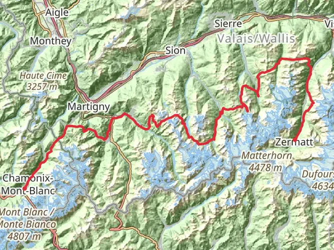
“Embark on a breathtaking alpine odyssey from Mont Blanc to the Matterhorn, braving the historic and rugged Haute Route.”
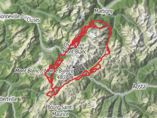
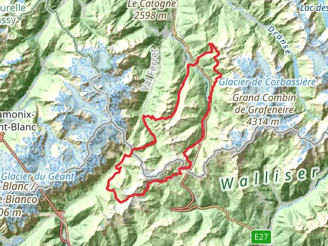
Embarking on the Chamonix to Zermatt Haute Route, hikers will traverse a distance of approximately 204 kilometers (about 127 miles) with an elevation gain of around 11,900 meters (approximately 39,000 feet). This point-to-point trail is a challenging yet rewarding journey that connects the Mont Blanc massif in Chamonix, France, to the iconic Matterhorn in Zermatt, Switzerland.
Getting to the Trailhead
The adventure begins near Bonneville, France. To reach the starting point, travelers can fly into Geneva International Airport and take a bus or train to Chamonix, which is well-connected to major European cities. From Chamonix, local buses or taxis can transport hikers to the trailhead.
Navigating the Trail
Hikers should prepare for a demanding trek that typically takes around 12 to 14 days to complete, depending on pace and weather conditions. It's essential to have a reliable navigation tool such as HiiKER to assist with route finding, as the trail crosses several high mountain passes and glaciers.
Landmarks and Scenery
The Haute Route is renowned for its breathtaking alpine scenery. The trail offers views of some of the Alps' most famous peaks, including Mont Blanc and the Matterhorn. Along the way, hikers will encounter a variety of landscapes, from lush valleys and alpine meadows to rocky ridges and glacial crossings.
Wildlife and Nature
The region is home to diverse flora and fauna. Hikers may spot chamois, ibex, marmots, and eagles. Alpine flowers bloom in a riot of colors during the summer months, adding to the trail's natural beauty.
Historical Significance
The Haute Route has a rich history, originally established as a high-level mountaineering route in the 19th century. The trail passes through areas that have been significant for mountaineering and exploration, with many huts along the route named after pioneers of alpine climbing.
Preparation and Planning
Due to the trail's difficulty and remote sections, it is crucial for hikers to be well-prepared. This includes being physically fit, having proper mountaineering equipment for glacier travel, and being experienced in alpine terrain navigation. It's also important to plan for overnight stays in mountain huts or campsites, which should be booked in advance, especially during the high season.
Safety and Considerations
Weather in the Alps can change rapidly, and hikers should be prepared for all conditions. It's advisable to check the weather forecast regularly and be ready to adjust plans accordingly. Additionally, some sections of the trail may require the use of ropes, crampons, and ice axes, so hikers should have the necessary skills or consider hiring a guide for these parts.
The Chamonix to Zermatt Haute Route is a journey that offers an unforgettable experience for those who undertake it, with its stunning landscapes, rich history, and challenging terrain. Proper preparation and respect for the mountain environment will ensure a safe and enjoyable adventure through the heart of the European Alps.
AI Planner
Days planned around your pace, with somewhere to stay each night.

Surfaces
Unknown
Ground
Asphalt
Grass
Gravel
Dirt
Paved
Cobblestone
Unpaved
Wood
Comments and Reviews
User comments, reviews and discussions about the Chamonix to Zermatt - Haute Route, France.
4.91
average rating out of 5
23 rating(s)