Download
3D Flyover
Add to list
More
14.4 km
~5 hrs 1 min
1282 m
Loop
“Earn the high ridges, linger above treeline, then descend—an airy alpine loop for prepared hikers.”
This is a big, steep alpine loop with sustained climbing and long stretches above treeline—about 14 km / 8.7 mi with roughly 1,300 m / 4,265 ft of ascent. Expect a demanding day where the effort is front-loaded (a long climb to high ridgelines and cols), followed by airy traverses and a knee-testing descent. Plan for 6–8+ hours on the move depending on fitness, conditions, and how long you spend at viewpoints.
Getting to the start (car + public transport)
Because the start point is listed only as “near” (no coordinates provided), the most reliable way to pin down the exact trailhead is to open the route in HiiKER and use its start-point map to identify the nearest road access and parking. For this loop, the practical access is typically from the Col de Vars area (the mountain pass on the D902 between Guillestre and Barcelonnette) or from the Vars ski resort villages (Sainte-Marie / Sainte-Catherine / Les Claux), depending on how the loop is drawn.
By car:
Drive to Col de Vars (D902) and look for roadside parking near the pass facilities/signage. If the loop begins lower in Vars, you’ll instead aim for parking near the Vars Les Claux base area (large resort parking) and connect to the trail network from there. Use HiiKER to match the start point to the closest parking pullout or lot.By public transport:
The nearest larger rail hub is typically Gap (and sometimes Embrun depending on connections), then onward by regional bus toward Guillestre and the Vars valley. Service frequency can be seasonal and limited; once you know the exact start (Col de Vars vs. a Vars village), check the current regional bus timetable and plan for an early departure. If buses don’t align, a taxi from Guillestre to the pass/resort is sometimes the practical last leg.
If you share the lon/lat (or a HiiKER link), I can convert the start to the nearest named place/landmark and tailor the access instructions precisely.
What the terrain feels like
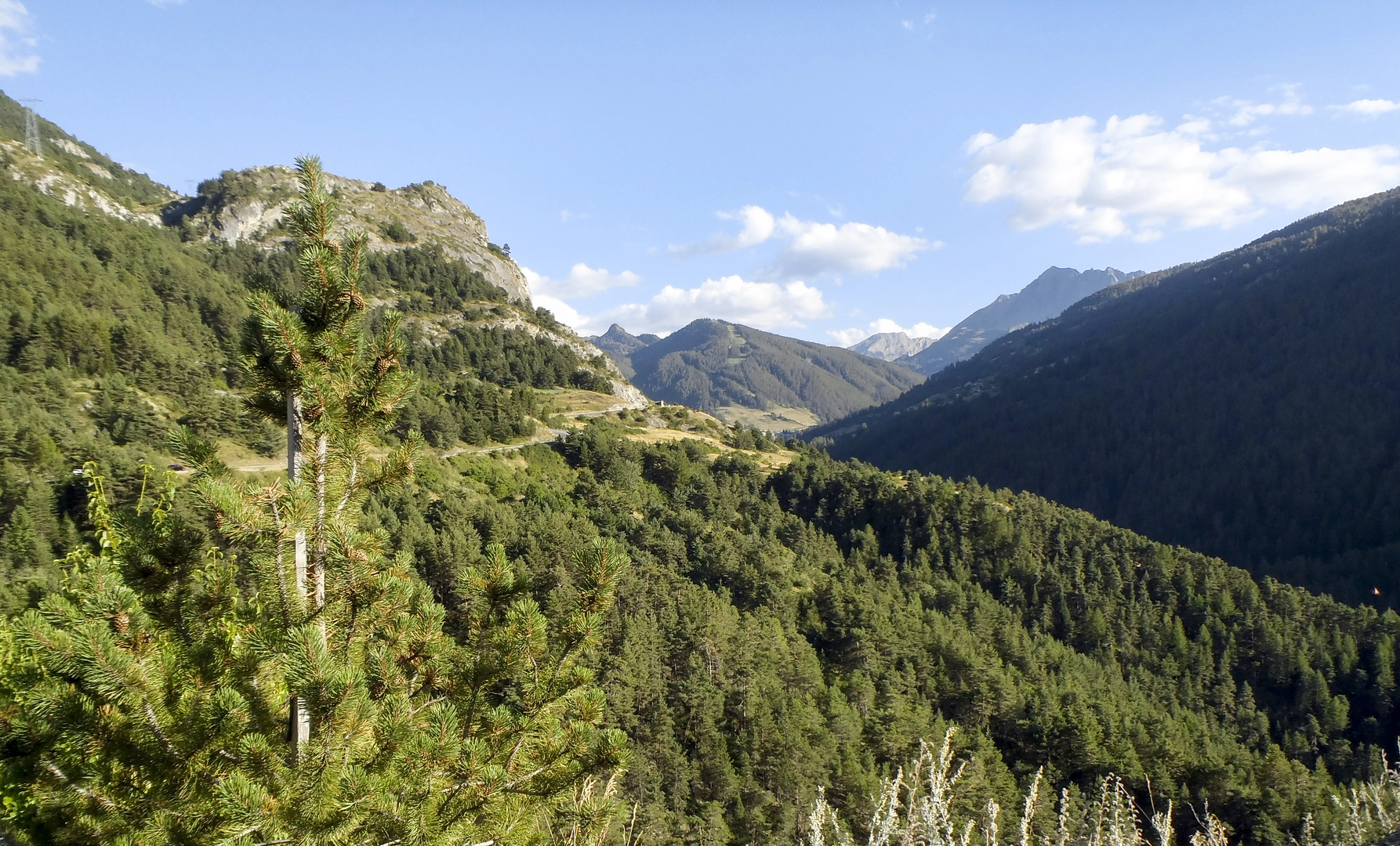
You’re in the southern French Alps (Hautes-Alpes/Ubaye edge): steep grassy slopes, larch and pine lower down, then open alpine bowls, broken rock, and narrow ridgelines higher up. The loop’s character is “earn the ridge, then stay high,” with frequent panoramic views over the Vars valley and toward the Ubaye side.
Underfoot you’ll likely encounter: - Forest paths early on (needles, roots, occasional mud after rain) - Alpine singletrack on grass and scree (slippery when wet) - Rocky sections near the high points/cols (hands may be useful for balance, even if it’s not technical climbing)
Route breakdown with approximate distances + climbing
Exact splits vary with the chosen start, but for a 14 km / 8.7 mi loop with ~1,300 m / 4,265 ft gain, this is a realistic way to think about pacing and effort:
Start to treeline (about 2–4 km / 1.2–2.5 mi, +400–700 m / +1,300–2,300 ft):
A steady climb on established trail or old access tracks. This is where you’ll warm up—don’t go out too fast. In early season, shaded forest can hold snow patches longer than you expect.Treeline to Pointe des Frêtes / high ridge (about 2–3 km / 1.2–1.9 mi, +400–600 m / +1,300–2,000 ft):
The grade typically steepens. You’ll start to feel exposure to wind and sun. Views open dramatically, and the trail may braid across grass and rubble—stay on the most worn line to reduce erosion and avoid unstable scree.High traverse toward Charvet (about 3–5 km / 1.9–3.1 mi, rolling +200–400 m / +650–1,300 ft total):
This is the “alpine payoff” section: undulating terrain, short punchy climbs, and frequent photo stops. In poor visibility, this is also where people drift off-route onto parallel animal tracks—keep HiiKER handy and confirm you’re following the intended ridge/col line.Return via Col du Vars and descent (about 3–5 km / 1.9–3.1 mi, mostly downhill with short rises):
The descent can be deceptively tiring: loose gravel, steep pitches, and tired legs. Trekking poles help a lot here. If the loop drops back into forest, expect a cooler, sometimes slick finish.
Key landmarks and what to look for
Col du Vars (the pass):
A classic Alpine crossing point linking valleys and communities. Mountain passes like this have long been used for trade, seasonal movement, and later for modern road-building that opened the high country to tourism and cycling.Pointe des Frêtes and surrounding ridgelines:
“Frêtes/arêtes” in Alpine place names often hints at sharp ridges. Expect airy viewpoints and wind exposure. On clear days, you’ll get layered horizons of peaks and deep valley relief.Charvet sector:
Often a mix of open alpine slopes and rocky outcrops. This is prime terrain for scanning wildlife and for sudden weather changes—cloud can build fast against ridges.
Nature,

Surfaces
Unknown
Ground
Unpaved
Comments and Reviews
User comments, reviews and discussions about the Pointe des Fretes, Charvet and Col du Vars Loop, France.
5.0
average rating out of 5
1 rating(s)