Download
3D Flyover
Add to list
More
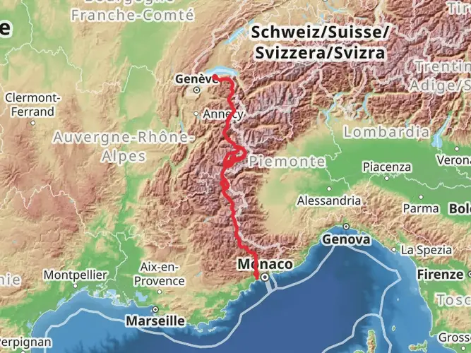
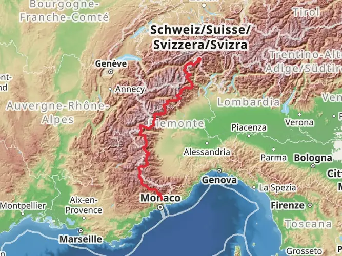
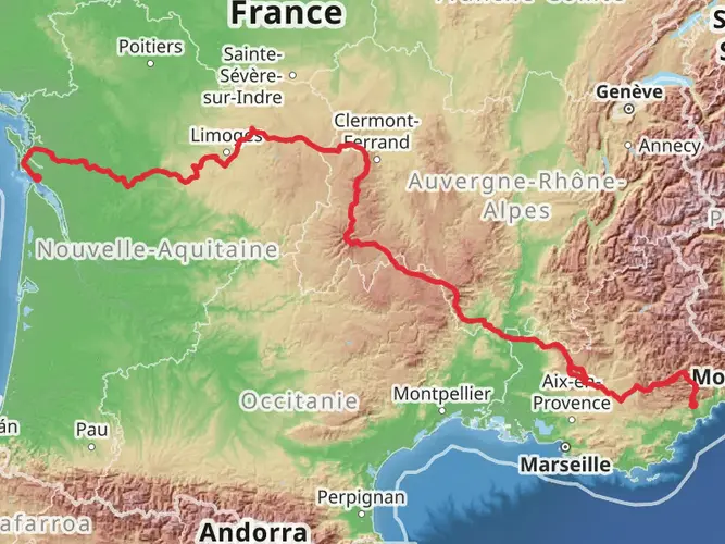
157.8 km
~7 days
4165 m
Multi-Day
“Embark on the historic and scenic Route Napoléon, a fusion of French history and alpine beauty.”
Embarking on the Route Napoléon, hikers will traverse approximately 158 kilometers (about 98 miles) of varied terrain, starting near the perfume capital of the world, Grasse, France. This historic trail, with an elevation gain of around 4100 meters (approximately 13,450 feet), is a point-to-point journey that commemorates the path taken by Napoléon Bonaparte in 1815 upon his return from Elba.
Getting to the Trailhead
To reach the starting point near Grasse, hikers can opt for public transportation or personal vehicles. If arriving by public transport, buses from Nice, Cannes, or other nearby cities are available to Grasse. For those driving, parking is available in the area. It's advisable to use the HiiKER app to navigate to the precise starting location, ensuring a smooth beginning to the adventure.
The Journey Through History
As you set out from Grasse, the trail will lead you through picturesque landscapes and villages that have stood the test of time. The route is steeped in history, following the same path Napoléon took during his march from Elba to Grenoble to reclaim his leadership of France. Along the way, hikers will encounter plaques and monuments that mark significant events from this period.
Terrain and Landmarks
The trail offers a mix of paved roads, forest paths, and mountainous terrain. The initial stages present a gentle ascent through the foothills of the Alps, allowing hikers to acclimate to the elevation. As the trail progresses, the inclines become more challenging, with some steep sections that require a moderate level of fitness.
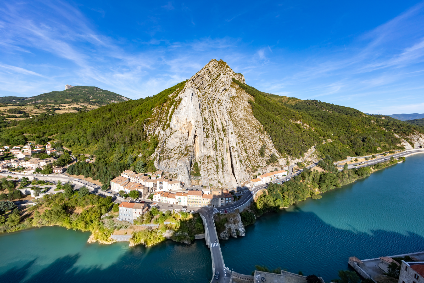
One of the most notable landmarks is the town of Digne-les-Bains, located roughly at the halfway point, which is known for its thermal spas and serves as a great rest stop. Further along, the trail ascends to the Col de Larche pass, offering breathtaking views of the surrounding mountains.
Flora and Fauna
The Route Napoléon is a haven for nature enthusiasts. The diverse landscapes provide habitats for a variety of wildlife, including birds of prey, wild boar, and deer. The trail also winds through areas of lush forest, alpine meadows, and along rivers, showcasing an array of plant life, from fragrant lavender fields to dense coniferous forests.
Preparation and Planning
Hikers should prepare for variable weather conditions, as the altitude can bring about sudden changes. It's essential to pack layers, rain gear, and adequate sun protection. Water sources are available in the villages along the route, but carrying a water filter is recommended for accessing natural water sources.
For navigation, the HiiKER app is an invaluable tool, providing detailed maps and trail information to keep you on the right path. Accommodations, ranging from hotels to mountain huts, are available along the route, but booking in advance is advisable, especially during peak seasons.
Conclusion
The Route Napoléon is not just a physical journey but a walk through a significant chapter of French history. With its moderate difficulty rating, it offers an accessible yet rewarding experience for hikers who are interested in combining their love for the outdoors with a taste of European history.

Frequently asked questions
How long does it take to hike the Route Napoléon from Grasse?
The Route Napoléon is 157.77 km long with 4,165 m of climbing, so it is typically approached as a multi-day point-to-point hike rather than a single outing. A strong pace would usually mean around one to two weeks on foot, depending on daily mileage, weather, and how much time is spent in towns such as Castellane, Digne-les-Bains, and Sisteron.
What is the Route Napoléon route for hikers starting near Grasse?
The hiking route begins near Grasse and follows the historic line associated with Napoléon’s 1815 return through the Alps. On the walking route, the best-documented GR 406 section runs north through places including Castellane, Senez, Digne-les-Bains, Barrême, Malijai, and Sisteron, while the southern section from Grasse toward Valderoure and Malamaire is also waymarked.
Why is the Route Napoléon called the Route Napoléon?
The trail takes its name from the journey Napoléon Bonaparte made in March 1815 after leaving Elba, landing at Golfe-Juan on March 1, 1815, and heading inland toward Grenoble. The modern hiking route was created to follow that historic line as closely as possible while favoring footpaths and quieter terrain over paved roads.
Which towns and villages does the Route Napoléon pass through on foot?
On foot, the Route Napoléon links a series of named Alpine communities rather than staying on one road the whole way. Along the established walking route, places mentioned on the GR 406 and Route Napoléon materials include Grasse, Valderoure, Castellane, Senez, Digne-les-Bains, Barrême, Malijai, Sisteron, Gap, Corps, and Grenoble.
Is the Route Napoléon a difficult hike or suitable for intermediate hikers?
The Route Napoléon is rated medium, but the overall challenge comes from its scale: 157.77 km and 4,165 m of ascent. It suits hikers with solid fitness and some multi-day experience, especially because the terrain mixes roads, tracks, forest paths, and mountain sections over several consecutive days.
What is the most scenic part of the Route Napoléon hike?
The most scenic stretches are generally the Alpine sections north of the Grasse area, where the route moves into the landscapes around Castellane, Senez, and Digne-les-Bains. Official trail descriptions highlight preserved mountain scenery, protected natural areas, views toward the Teillon massif, and historic villages that give the route much of its character.
Comments and Reviews
User comments, reviews and discussions about the Route Napoléon, France.
5.0
average rating out of 5
3 rating(s)