Download
3D Flyover
Add to list
More
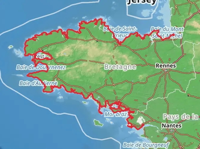
223.8 km
~9 days
3283 m
Multi-Day
“Embark on the GR 380 for a mystical trek through Brittany's history-rich, diverse landscapes.”
The GR 380 - Tour des Monts d'Arrée is a captivating long-distance hike that takes you through the heart of Brittany's rugged countryside. Spanning approximately 224 kilometers (about 139 miles) with an elevation gain of around 3200 meters (approximately 10,500 feet), this trail offers a medium difficulty level, making it accessible to hikers with a reasonable level of fitness and experience.
Getting to the Trailhead
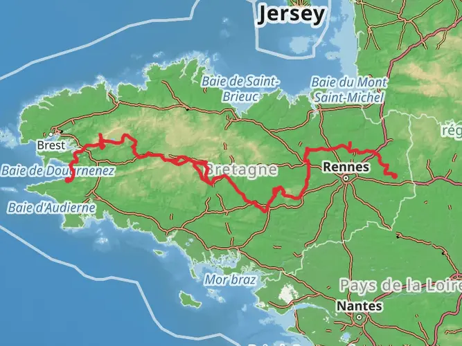
The journey begins near the town of Morlaix, which is easily accessible by car or public transport. If you're arriving by train, Morlaix has a railway station with good connections to major French cities. From the station, local buses or taxis can take you to the trailhead. For those driving, parking is available in the area, and it's advisable to check for the most current parking information and any fees that may apply.
Navigating the Trail
As you embark on the GR 380, the use of a navigation tool like HiiKER can be invaluable for staying on track and aware of your progress. The trail is marked, but having a digital map can help with planning your daily distances and locating nearby amenities.
Landmarks and Natural Beauty
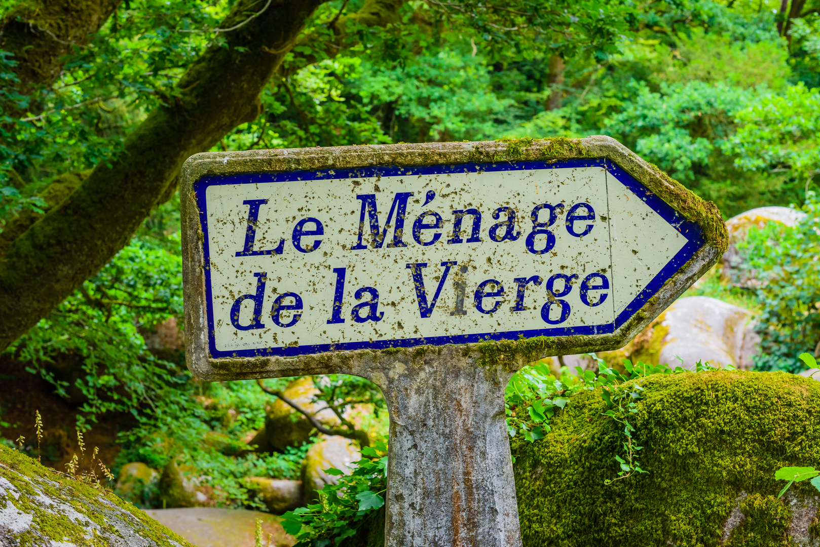
The Monts d'Arrée is a region steeped in history and legend, often associated with the ancient Breton myths of King Arthur. The trail will lead you through a variety of landscapes, from the rugged heathland to serene lakes and dense forests. Notable landmarks include the Roc'h Trevezel and Roc'h Ruz, the highest points in Brittany, offering panoramic views of the surrounding moorland.
Wildlife and Flora
As you traverse the Monts d'Arrée, keep an eye out for the diverse wildlife that inhabits the area. Birds of prey such as kestrels and buzzards are commonly seen soaring above, while the moors and woodlands are home to deer and wild boar. The plant life is equally varied, with heather and gorse adding vibrant splashes of color to the landscape.
Historical Significance
The trail is not just a natural wonder but also a journey through history. You'll encounter ancient megaliths, standing stones, and calvaries that testify to the region's rich cultural past. The Monts d'Arrée has been a place of spiritual significance for centuries, with the Saint-Michel de Brasparts chapel being a highlight, dating back to the 17th century.
Preparation and Planning
Given the trail's length and varied terrain, it's essential to plan your hike carefully. The route can be completed in sections or as a continuous journey, with options for overnight stays in local gîtes, B&Bs, or campsites. Ensure you have suitable hiking gear, including waterproof clothing and sturdy boots, as the weather can be unpredictable. It's also wise to carry enough food and water, although there are opportunities to resupply in the small villages you'll pass through.
Conclusion
The GR 380 - Tour des Monts d'Arrée is a trail that promises an immersive experience in one of France's most mystical and untamed regions. Whether you're drawn by the challenge of the hike, the allure of Breton folklore, or the simple beauty of the natural landscape, this trail is a journey that will leave a lasting impression.

Frequently asked questions
How long does the GR 380 - Tour des Monts d'Arrée take to hike?
The GR 380 - Tour des Monts d'Arrée is 223.79 km long, so most hikers split it into a multi-day trip rather than attempting it in one push. A common pace for a route of this length is roughly 20 to 30 km per day, which puts the full circuit at around 8 to 12 hiking days depending on daily mileage, weather, and overnight stops.
How difficult is the GR 380 - Tour des Monts d'Arrée compared with other long-distance hikes in France?
The GR 380 - Tour des Monts d'Arrée is generally considered an easier long-distance route because it combines a substantial 223.79 km distance with a relatively modest 3,283 m of total ascent. That makes it less relentlessly steep than many mountain GR routes, even though it still requires the stamina and planning needed for a multi-day trek.
What are the main highlights on the GR 380 - Tour des Monts d'Arrée?
The standout scenery on the GR 380 - Tour des Monts d'Arrée is the ridge-and-heath landscape of the Monts d'Arrée inside the Armorique Regional Natural Park. Notable high points in the massif include Roc'h Ruz at 385 m and nearby Roc'h Trevezel, with broad views over moorland, peat bogs, and the distinctive uplands that make this part of Brittany so recognizable.
What kind of terrain can hikers expect on the GR 380 - Tour des Monts d'Arrée?
The GR 380 - Tour des Monts d'Arrée crosses classic Monts d'Arrée terrain: open heath, peatland, rolling uplands, forest sections, and rural tracks through inland Brittany. The route is not especially high by mountain standards, but exposed sections on the ridges can feel wild in wind and rain, and boggy ground is possible in wetter areas.
Is the GR 380 - Tour des Monts d'Arrée a loop trail or point-to-point route?
The GR 380 - Tour des Monts d'Arrée is best treated as a circuit-style multi-day route around the Monts d'Arrée rather than a simple one-way crossing. That format makes logistics easier for hikers who want to start and finish in the same general area of inland Finistère, with Morlaix serving as a practical access town for the region.
What is the best time of year to hike the GR 380 - Tour des Monts d'Arrée?
Late spring through early fall is usually the most practical window for the GR 380 - Tour des Monts d'Arrée, when daylight is longer and the heathland landscapes are at their most vivid. Conditions can still be wet and windy at any time in the Monts d'Arrée, and the area has sensitive bog and heath habitats, so dry spells and stable forecasts make the route more comfortable.
Can beginners hike the GR 380 - Tour des Monts d'Arrée?
The GR 380 - Tour des Monts d'Arrée is one of the more approachable French multi-day routes for fit beginners because its overall difficulty is rated easy and the total ascent is only 3,283 m across 223.79 km. The main challenge is not technical ground but managing several consecutive days of walking, navigation, and overnight planning across a long route.
Comments and Reviews
User comments, reviews and discussions about the GR 380 - Tour des Monts d'Arrée, France.
5.0
average rating out of 5
4 rating(s)