Download
3D Flyover
Add to list
More
11.6 km
~3 hrs 30 min
707 m
Out and Back
“A steep, soul-stirring climb to a lonely lake beneath towering limestone ramparts and shepherds’ huts.”
This difficult out-and-back hike climbs from the Anapia parking area above Lescun to a high mountain lake and a pair of pastoral huts set beneath some of the most dramatic limestone walls in the western Pyrenees. Expect roughly 12 km / 7.5 miles round trip with about 700 m / 2,300 ft of ascent, starting near Parking de Napia / Borde d’Anapia, Lescun, 64490, France, the nearest clearly identified access point to the trailhead coordinates provided. The route sits in the Vallée d’Aspe, within the wider Cirque de Lescun landscape, an area known for steep relief, old shepherding routes, and a strong Pyrenean mountain culture. (fr-be.trails-viewer.com)
The walk begins at about 1,006 m / 3,301 ft and follows a track before narrowing into a mountain path marked in yellow. The first section is relatively gentle, but that ease does not last long. After the early junctions, the trail steepens through forest and broken rocky ground, and the climb becomes sustained for much of the ascent. Although the total distance is moderate, the gradient, rougher footing, and a few exposed-feeling sections make it more demanding than the mileage alone suggests. Official route descriptions place the outing around 11.9 to 12 km with roughly 740 m / 2,428 ft of elevation gain, which aligns well with the estimate you provided. (carrerasdemontana.com)
What to expect on the climb
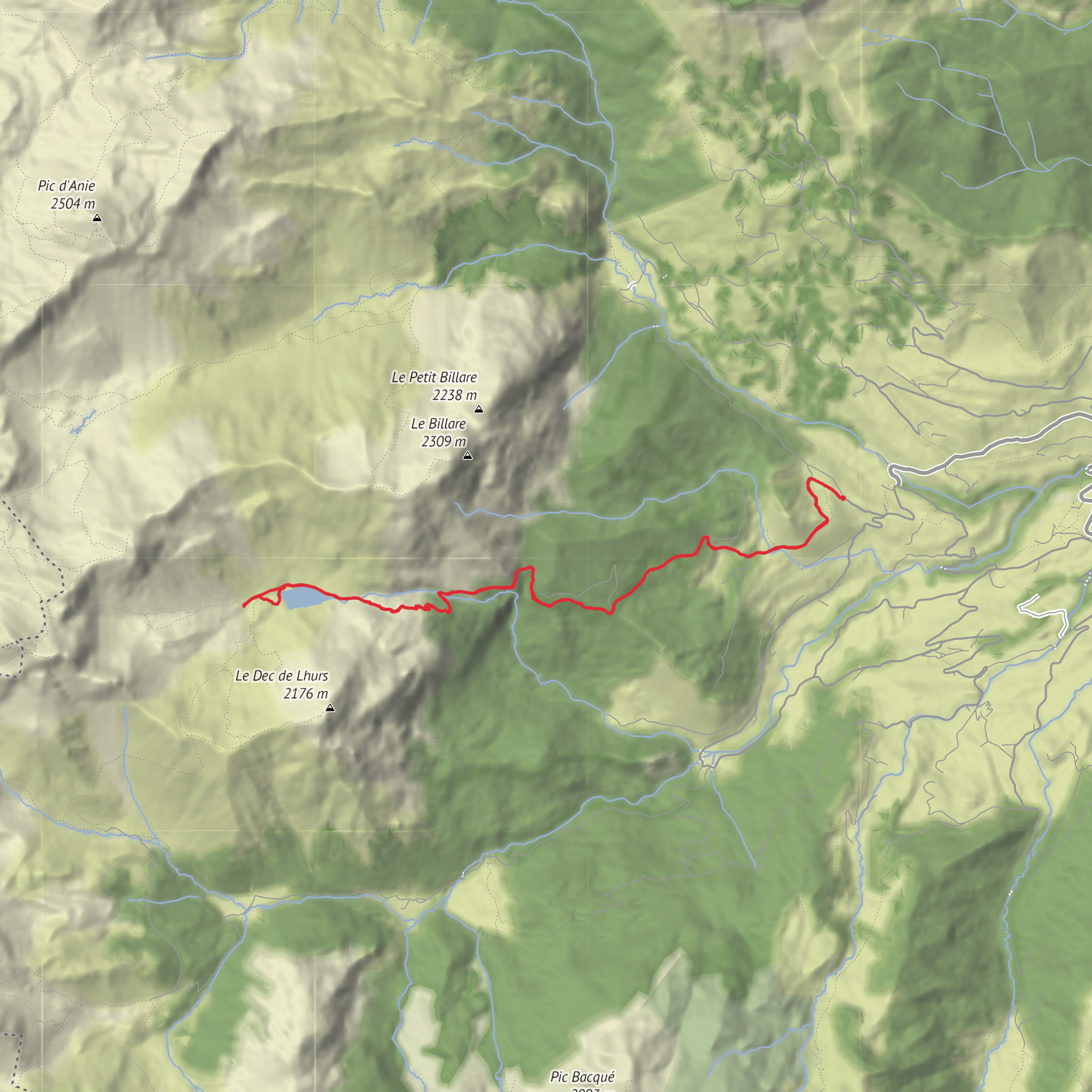
From the parking area, the route heads northwest on a track, then branches onto an older grassy path and later a wider forest track before turning onto a smaller, more damaged trail. This middle section is where the character of the hike changes: the path becomes steeper, more rugged, and more mountainous. One of the notable features is a narrow ledge-like traverse above a drop, followed by ravined terrain and intermittent stream channels. This is not technical mountaineering, but it is a place to move carefully, especially in wet weather, with tired legs, or if hiking with less confident walkers. (visorando.com)
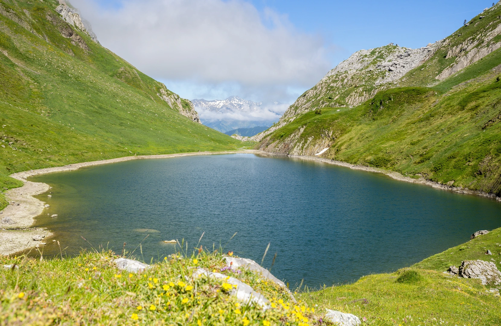
As height is gained, the forest begins to open and the scenery becomes increasingly mineral and dramatic. The route crosses the Landrosque stream area and then climbs in switchbacks through rocky terrain toward the basin holding Lac de Lhurs. The lake appears at around 1,700 m / 5,577 ft, backed by the jagged Ansabère skyline and surrounded by a stark cirque of limestone peaks. Nearby huts add a pastoral note to what is otherwise a severe alpine setting, and one of the cabins is associated with a fountain, a useful landmark on the upper part of the route. (visorando.com)
Landmarks, scenery, and atmosphere
The main landmarks are the forest approach, the narrow ledge section, the Landrosque crossing area, the first shepherd hut, Lac de Lhurs, and the second hut with fountain above the lake. On the ascent there are also intermittent views back toward Lescun and the surrounding mountains of the cirque. The lake itself lies in a compact glacial basin dominated by peaks including Billare, the Penneblanque summits, the Dec de Lhurs, and farther west the Table des Trois Rois area, giving the upper valley a remote borderland feel. (lacsdespyrenees.com)
This is classic western Pyrenean scenery: beech and mixed mountain woodland lower down, then rough pasture, rock, scree, and pale limestone higher up. In spring and early summer, expect flowing water, greener slopes, and wildflowers in the meadows around the pastoral zones. By late summer, some smaller watercourses may be dry, and the terrain can feel hotter and looser underfoot. In autumn, the forested lower slopes can be especially attractive, though shorter daylight hours matter on a hike with a sustained climb. (visorando.com)
Wildlife and nature
The Vallée d’Aspe and Cirque de Lescun are well known for mountain wildlife. Hikers should keep an eye out for large raptors overhead, including vultures common in the Pyrenees, as well as smaller alpine birds around the rocky upper slopes. Mammals are often harder to spot, but the broader region supports species such as chamois and marmot in suitable mountain habitat, while livestock grazing near the huts is part of the living pastoral landscape. As
Surfaces
Unknown
Paved
Comments and Reviews
User comments, reviews and discussions about the Cabanes and Lac de Lhurs from La Borde d'Anapia, France.
average rating out of 5
0 rating(s)
