Download
3D Flyover
Add to list
More
7.7 km
~2 hrs
281 m
Out and Back
“A shady woodland climb unfolds into sunlit pastures and dramatic limestone beneath the Pyrenean cirque.”
This out-and-back walk to Cap de la Baitch Hut is a compact Pyrenean outing with a distinctly pastoral feel: about 8 km / 5 miles round trip with roughly 300 m / 985 ft of ascent, starting at the Refuge de l’Abèrouat above Lescun in the Vallée d’Aspe, Pyrénées-Atlantiques. The start point is best identified as the Refuge de l’Abérouat, Petrelate et Eycun, 64490 Lescun, France, where there is a parking area in front of the refuge. The hut itself sits at about 1,689 m / 5,541 ft, while the trail begins around 1,442–1,450 m / 4,731–4,757 ft, so the climbing is steady but not extreme. (pyrandonnees.fr)
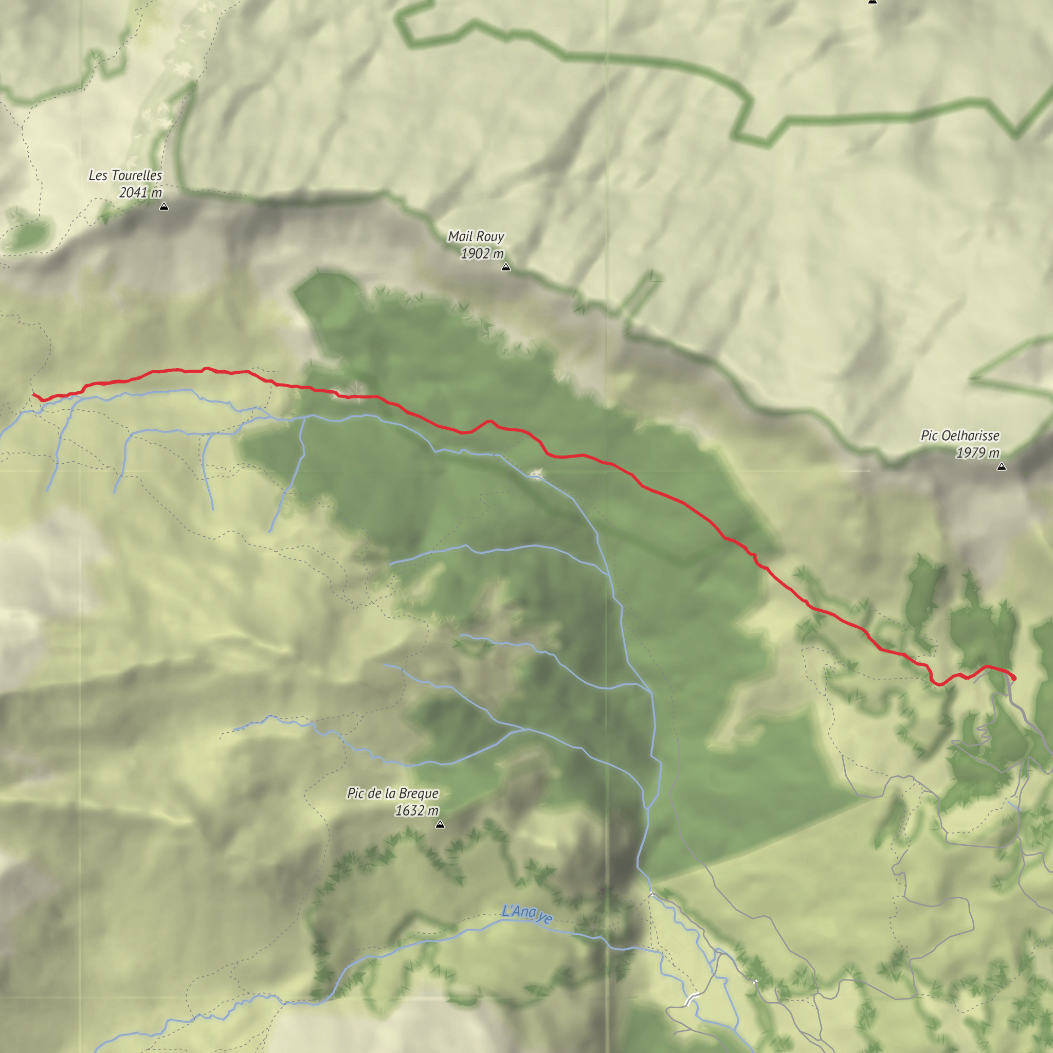
From the refuge, the route follows the GR10, passing the orientation table and heading into the Braca d’Azuns woodland. Early on, the walking is straightforward, but the gradient is enough to keep it in the medium category, especially for hikers who are not used to mountain paths. The trail is generally clear and waymarked, and this is the kind of route where HiiKER is useful for confirming the out-and-back line and checking your position around junctions or in poor visibility. (pyrandonnees.fr)
What the route feels like
The first section moves through forest beneath the Orgues de Camplong, a striking band of “organ-pipe” rock formations that give this short hike much of its character. This wooded stretch offers shade and a cooler start in warm weather, but after rain it can be slick underfoot with roots, damp soil, and patches of mud. Once out of the trees, the route opens onto steeper grassy ground and summer pasture, where the landscape becomes broader and more exposed. (pyrandonnees.fr)
At around 3 km / 1.8 miles from the start, you pass below or near Cabane d’Ardinet, a simple shepherd shelter at roughly 1,570 m / 5,151 ft. From there, the final approach continues uphill across open ground to Cap de la Baitch Hut at about 4 km / 2.4–2.5 miles from the trailhead. Reported ascent times are around 1 hour to 1 hour 15 minutes, depending on pace and stops. (visorando.com)
Landmarks, scenery, and what to watch for
This is a classic Béarn pastoral landscape, with grazing areas used in the estive tradition of seasonal high-mountain livestock grazing. Expect to see cattle, sheep, and sometimes horses in the open sections, especially in summer. If animals are present, give them space, keep a calm pace, and be especially alert around livestock guardian dogs if flocks are being watched. The hut area may also have a shepherd nearby in season, and one route description notes potable water near the hut, though hikers should never rely on a single mountain water source without confirming current conditions before setting out. (pyrandonnees.fr)
The scenery is shaped by the limestone character of the western Pyrenees. The wider area around Pic d’Anie is known for karst terrain—broken limestone, sink features, and rough mineral ground higher up beyond this hut walk. Even though this particular route stays relatively moderate, that geology still influences the look of the landscape, with abrupt rock architecture and dry, stony sections once you leave the forest. (filestore.cicerone.co.uk)
Wildlife is typical of high Pyrenean pasture and woodland margins. Birds of prey may be seen using the thermals above the cirque, while smaller mountain birds are common around the forest edge and meadows. In quieter periods, marmot-like whistles are less likely here than in some higher Alpine-style areas, but the route still rewards slow observation: butterflies in summer, grazing animals, and changing cloud over the cirque are often the main natural highlights. Because the trail crosses active grazing country, boots with decent grip are preferable to light town shoes. The open upper section can also feel much windier than the start near the refuge. (pyrandonnees.fr)
Historical and regional context
The hike
Surfaces
Unknown
Asphalt
Dirt
Comments and Reviews
User comments, reviews and discussions about the Cap de la Baitch Hut from the Refuge de l’Abèrouat, France.
average rating out of 5
0 rating(s)
