Download
3D Flyover
Add to list
More
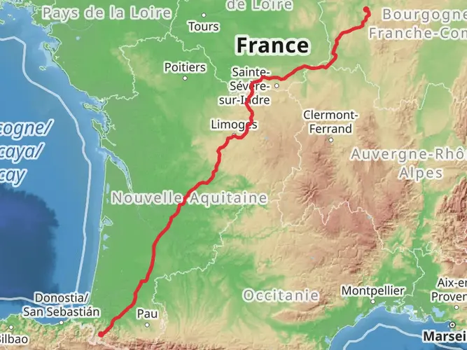
861.7 km
~33 days
14062 m
Multi-Day
“Embark on a historic 863km pilgrimage, steeped in natural beauty and rich cultural tapestry.”
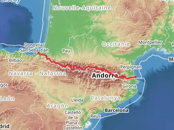
Embarking on the Camino de Santiago Francés, you'll traverse approximately 863 kilometers (536 miles) across the diverse landscapes of France and Spain, culminating in the historic city of Santiago de Compostela. With an elevation gain of around 8900 meters (29,200 feet), the journey begins near the quaint French town of Saint-Jean-Pied-de-Port, nestled in the Pyrenees.
Getting to the Trailhead
To reach the starting point, travelers can fly into Biarritz Airport in France and take a shuttle or local transport to Saint-Jean-Pied-de-Port. Alternatively, if arriving by train, Bayonne is the nearest major railway station, offering direct connections to Saint-Jean-Pied-de-Port. For those driving, parking is available in the town, though it's advisable to arrange long-term parking in advance due to the length of the hike.
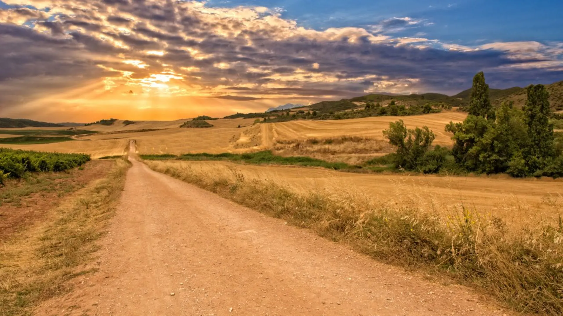
The Journey Through History and Nature
As you set out from Saint-Jean-Pied-de-Port, the initial ascent over the Pyrenees is both challenging and rewarding, offering stunning views. This first section is about 25 kilometers (15.5 miles) and includes a steep climb to the Roncesvalles Pass, a significant historical site where Charlemagne's army suffered defeat in 778.
Continuing through the undulating landscapes of the Navarre and La Rioja regions, you'll encounter vineyards and monasteries, such as the Monastery of Santa María la Real in Nájera, which is a testament to the trail's religious and cultural significance.
Landmarks and Cultural Highlights
The Camino de Santiago Francés is dotted with numerous cathedrals, churches, and historic towns. One of the most notable is the Cathedral of Burgos, a UNESCO World Heritage Site, located roughly 180 kilometers (112 miles) from the start. Farther along, at about 369 kilometers (229 miles) from Saint-Jean-Pied-de-Port, you'll reach León, another city rich in history with its own stunning Gothic cathedral.
Flora and Fauna
The trail's diverse ecosystems host a variety of wildlife. In the Pyrenees, you might spot griffon vultures soaring above or Pyrenean chamois on distant slopes. As you descend into the meseta, the high central plateau of Spain, the landscape shifts to vast fields where you can observe birds of prey and the occasional Iberian hare.
Preparation and Navigation
Given the trail's length and varied terrain, it's essential to be well-prepared with appropriate gear and clothing. Weather can change rapidly, especially in the mountainous regions, so layers are crucial. For navigation, HiiKER is an invaluable tool, offering detailed maps and information on the trail, which is well-marked with the iconic yellow scallop shell and arrows.
Accommodation and Logistics
A network of hostels, known as albergues, provides lodging along the route. It's wise to plan your stages to know where you'll be stopping each night, as some areas have more limited options than others. Many albergues operate on a first-come, first-served basis, so starting your day early can be advantageous.
Concluding the Pilgrimage
As you approach the final stages, the Galician landscape offers lush greenery and a cooler climate. The last 100 kilometers (62 miles) from Sarria to Santiago are the busiest, as many pilgrims start their journey here to qualify for the Compostela, a certificate of completion.
Upon reaching Santiago de Compostela, the trail's end is marked by the grandiose Cathedral of Santiago, where the relics of Saint James are said to be held. Here, you can attend the Pilgrim's Mass, reflect on your journey, and celebrate the completion of this historic and transformative pilgrimage.

What to expect?
Activity types
Frequently asked questions
How long does it take to walk the Camino de Santiago Francés from Saint-Jean-Pied-de-Port?
The Camino de Santiago Francés is 863.29 km long, so most walkers treat it as a multi-week journey rather than a short thru-hike. A common full-route schedule is about 30 to 40 days on foot, depending on daily mileage, rest days, and how the Pyrenees start and later stages through places like León and Lugo are paced.
Does the Camino de Santiago Francés begin in France at Saint-Jean-Pied-de-Port?
Yes. The classic Camino de Santiago Francés is widely started in Saint-Jean-Pied-de-Port in the French Basque Country, before crossing the Pyrenees into Spain. From there, the route continues west all the way to Santiago de Compostela, with the opening mountain stage leading toward Roncesvalles.
What is the total distance of the Camino de Santiago Francés from Saint-Jean-Pied-de-Port?
This Camino de Santiago Francés route covers 863.29 km in total, which is about 536 miles. It is a long multi-day route with roughly 8,960 m of total ascent, so the challenge comes from both the distance and the cumulative climbing over several weeks.
How many stages is the Camino de Santiago Francés usually split into?
The Camino de Santiago Francés is commonly divided into roughly 30 to 33 walking stages, although stage plans vary by guide and daily target. Many standard days fall in the 20 to 30 km range, but the first crossing from Saint-Jean-Pied-de-Port over the Pyrenees is often treated as a tougher, more demanding stage.
Is the Camino de Santiago Francés suitable for beginners?
The Camino de Santiago Francés is often considered one of the more approachable long Camino routes because it is well established and passes through many towns and villages with regular services. Even so, this route is still 863.29 km with 8,960 m of ascent and a medium difficulty rating, so beginners usually do best with training and a realistic stage plan.
How far is the León to Santiago section of the Camino de Santiago Francés?
The León to Santiago section of the Camino de Santiago Francés is commonly walked as the final major western stretch and usually takes around 12 to 15 days. It includes major waypoints such as Astorga, Ponferrada, O Cebreiro, Sarria, and then the final approach into Santiago de Compostela.
Where can hikers park at the Camino de Santiago Francés start in Saint-Jean-Pied-de-Port?
Parking is available in Saint-Jean-Pied-de-Port, the usual start point for the Camino de Santiago Francés, but long-stay arrangements are important because the route is an 863.29 km one-way walk. Since many hikers finish in Santiago de Compostela weeks later, advance planning for long-term parking in town is usually needed.
Comments and Reviews
User comments, reviews and discussions about the Camino de Santiago Francés, France.
4.91
average rating out of 5
74 rating(s)