Download
3D Flyover
Add to list
More
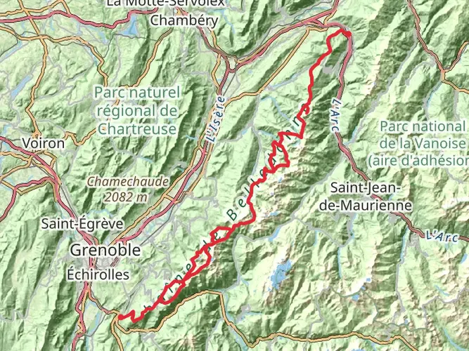
256.0 km
~12 days
9455 m
Multi-Day
“Embark on the historic GR 91 trail, traversing the majestic Vercors Massif's diverse landscapes and rich past.”
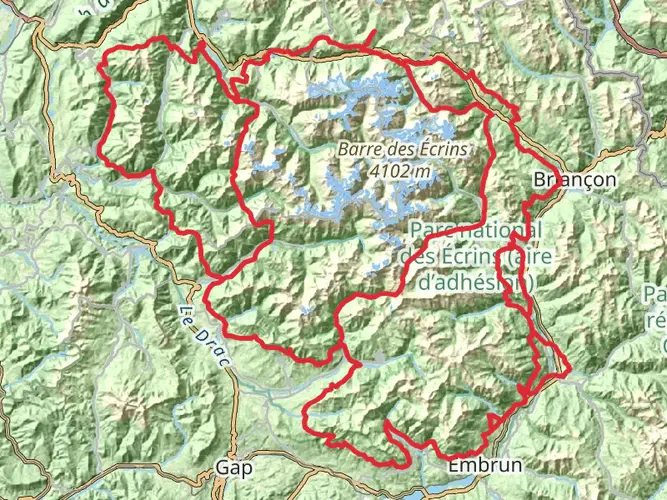
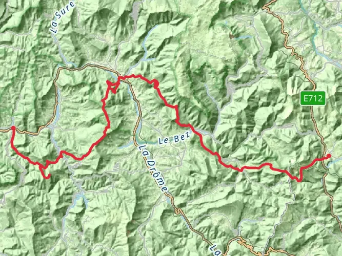
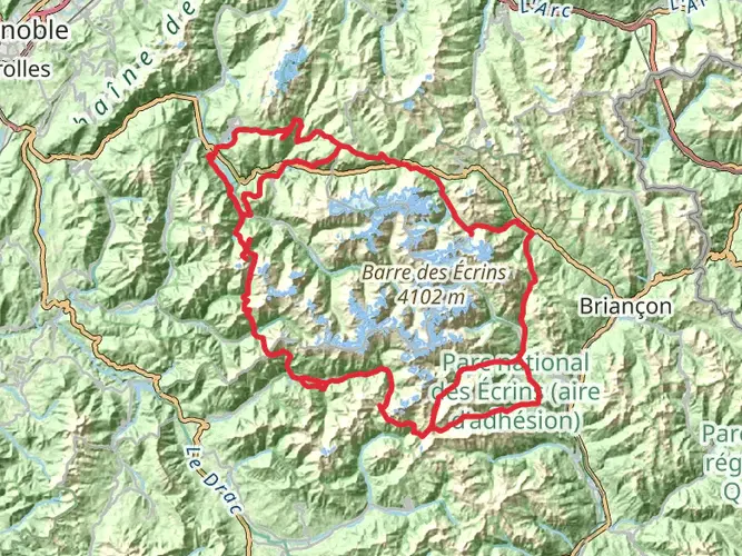
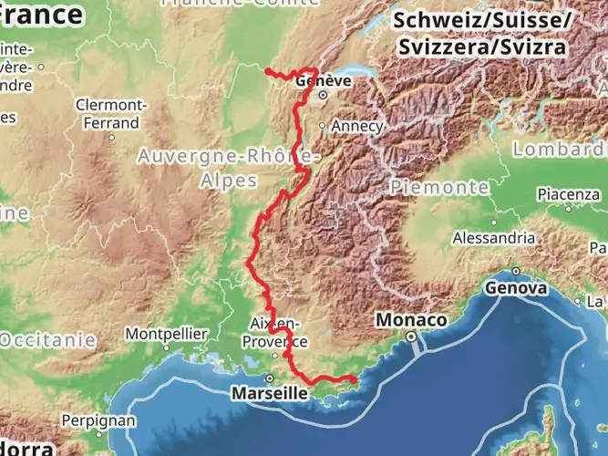
The GR 91 is a long-distance trail that takes you through the heart of the Vercors Massif, a region rich in natural beauty and historical significance. Starting near Villard-de-Lans, France, this trail stretches approximately 256 kilometers (159 miles) and navigates an elevation gain of around 9400 meters (30,840 feet), offering a medium difficulty level that is suitable for hikers with some experience.
Getting to the Trailhead To reach the starting point near Villard-de-Lans, hikers can drive or use public transportation. If driving, Villard-de-Lans is accessible via the A49 motorway. For those preferring public transport, regular buses run from Grenoble, which is well-connected by train to other major French cities.
Navigating the Trail The GR 91 is well-marked with the characteristic red and white stripes of Grande Randonnée trails. For additional navigation support, hikers can use the HiiKER app, which provides detailed maps and GPS coordinates to ensure you stay on the right path.
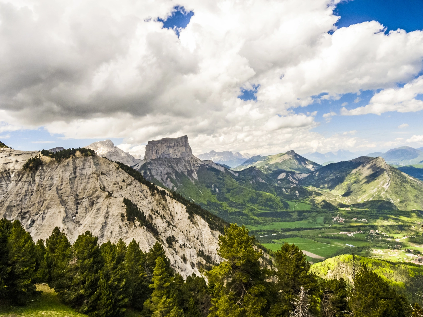
Trail Highlights and Landmarks As you embark on your journey, the trail will lead you through diverse landscapes, from lush forests and alpine meadows to rugged cliffs and limestone plateaus. The Vercors Massif is known for its dramatic scenery and the trail offers panoramic views of the French Alps.
One of the early highlights is the Pas de l'Aiguille, a mountain pass with historical significance as a site of the French Resistance during World War II. Further along, you'll encounter the High Plateaus of the Vercors, the largest nature reserve in France, where you can expect to see a variety of wildlife, including chamois, ibex, and perhaps even golden eagles.
Flora and Fauna The trail traverses through several different ecosystems, each with its unique flora and fauna. In the lower elevations, you'll walk through forests of beech and oak, while higher up, you'll find spruce and larch trees. The alpine meadows burst with wildflowers in the spring and summer months.
Historical Significance The Vercors region played a pivotal role during World War II as a stronghold for the French Resistance. The trail passes by several memorials and museums dedicated to the memory of the resistance fighters. The Vercors also has a rich prehistoric past, with numerous caves that contain ancient artifacts.
Preparation and What to Bring Given the length and varied terrain of the GR 91, it's important to be well-prepared. Hikers should bring a reliable pair of hiking boots, weather-appropriate clothing, and a tent if planning to camp along the route. There are refuges and gîtes for those who prefer more comfortable accommodations. Water sources are available but carrying a water filter is advisable.
Seasonal Considerations The best time to hike the GR 91 is from late spring to early fall when the weather is milder, and the risk of snow is lower. However, the trail can be hiked in sections year-round, with each season offering a different experience.
Remember, the GR 91 is not just a trail; it's a journey through time, nature, and the resilient spirit of the French people. Whether you're looking to immerse yourself in history, challenge yourself physically, or simply enjoy the stunning landscapes of the French Alps, the GR 91 provides an unforgettable adventure.

Frequently asked questions
What is the route of the GR 91 through the Vercors near Villard-de-Lans?
The GR 91 is a 256.02 km long-distance route through the Vercors Massif, starting near Villard-de-Lans and crossing the Vercors on a north-to-south line. It passes through the Hauts-Plateaux du Vercors, follows classic red-and-white GR waymarking, and is known for major landmarks such as Pas de l'Aiguille and the broad limestone plateaus of the reserve.
How difficult is the GR 91 in France?
The GR 91 is a difficult multi-day hike. Over 256.02 km it gains 9,455 m of elevation, which makes it a serious undertaking better suited to experienced hikers who are comfortable with long stages, sustained climbing, and remote mountain terrain in the Vercors.
How much elevation gain does the GR 91 have?
The GR 91 has 9,455 m of total ascent across its full 256.02 km length. That amount of climbing is one of the main reasons the route is rated difficult, especially when combined with repeated ups and downs across the Vercors ridges, passes, and high plateaus.
How long does it take to hike the GR 91?
Most hikers complete the full GR 91 over multiple days rather than as a short trek. With a distance of 256.02 km and 9,455 m of ascent, it is typically planned as a substantial backpacking route through the Vercors, with total time depending on daily stage length, weather, and resupply strategy.
Can the GR 91 be reached by public transport from Grenoble?
Yes. Villard-de-Lans is linked to Grenoble by regional bus services, making public-transport access realistic for the northern part of the GR 91. That is useful for hikers starting near Villard-de-Lans or arranging transport at the beginning of a multi-day crossing of the Vercors.
What are the standout sections of the GR 91 in the Vercors?
One of the best-known sections of the GR 91 is the crossing of the Hauts-Plateaux du Vercors, a vast protected limestone plateau with very limited infrastructure and a notably wild feel. Pas de l'Aiguille is another major highlight, combining mountain scenery with an important French Resistance memorial landscape.
Comments and Reviews
User comments, reviews and discussions about the GR 91, France.
5.0
average rating out of 5
3 rating(s)