Download
3D Flyover
Add to list
More
117.0 km
~5 days
3864 m
Multi-Day
“Embark on the GR 68, a scenic and historical trek through the heart of southern France's Cévennes.”
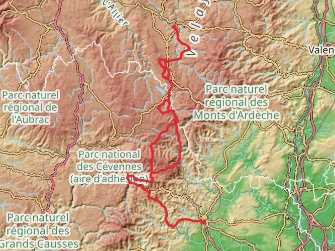
The GR 68, also known as the Tour of the Cévennes, is a captivating journey through the diverse landscapes of southern France. This point-to-point trail spans approximately 117 kilometers (about 73 miles) and navigates an elevation gain of roughly 3800 meters (approximately 12,467 feet), offering a medium difficulty level that is suitable for hikers with some experience.
Getting to the Trailhead
The trailhead for the GR 68 is located near the quaint town of Villefort, which is accessible by both public transport and car. For those opting for public transportation, the nearest train station is in Villefort itself, with regular services connecting to larger cities such as Nîmes and Clermont-Ferrand. From the station, the trailhead is just a short walk away. If driving, Villefort is reachable via the D906 road, and parking is available in the town.
Navigating the Trail
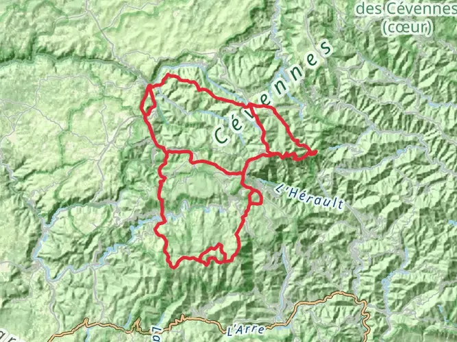
Hikers can rely on the HiiKER app for detailed maps and navigation assistance throughout their journey on the GR 68. The trail is well-marked with the characteristic red and white stripes of Grande Randonnée routes, guiding adventurers through the Cévennes National Park's varied terrain, which includes chestnut groves, granite peaks, and rolling hills.
Landmarks and Natural Beauty
The GR 68 takes hikers through the heart of the Cévennes, a region with a rich tapestry of natural and historical significance. One of the early highlights is the ascent to Mont Lozère, which stands as the highest peak in the Cévennes and offers panoramic views of the surrounding area. The trail then meanders through the picturesque Tarn River Valley, where hikers can marvel at the steep gorges and crystal-clear waters.
Flora and Fauna
The Cévennes is renowned for its biodiversity. Hikers may encounter a variety of wildlife, including the elusive European otter and a myriad of bird species such as the griffon vulture. The trail also passes through areas of lush vegetation, including the UNESCO-listed Causses and Cévennes, where the unique agro-pastoral cultural landscape can be observed.
Historical Significance
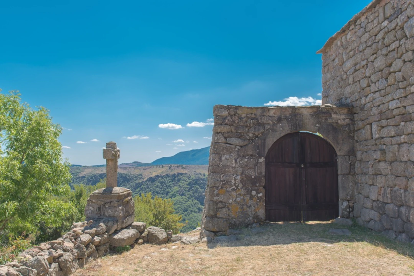
The region is steeped in history, with the GR 68 crossing paths with ancient Roman roads and passing by several historic sites, such as the 12th-century Château de Castanet and the ruins of the Château de Portes, known as the 'Ship of the Cévennes' due to its distinctive shape. The trail also traverses parts of the Camisards' history, where Protestant rebels once fought during the War of the Camisards in the early 18th century.
Preparation and Planning
Hikers should prepare for variable weather conditions and carry appropriate gear for both warm and cooler temperatures. Water sources are available along the route, but carrying a water filter is advisable. Accommodations range from campsites to gîtes (guesthouses), and it's recommended to book these in advance, especially during the peak season.
Conclusion
The GR 68 is a trail that offers a rich blend of natural beauty, wildlife, and historical intrigue. With careful planning and a spirit of adventure, hikers will find this route to be a rewarding experience that encapsulates the essence of the French wilderness.

Frequently asked questions
How long is the GR 68 and how many stages does the GR 68 usually take?
The GR 68 is 117.03 km long with 3,864 m of total ascent, so it is firmly a multi-day route rather than a long day hike. Most hikers split the Tour du Mont Lozère into about 5 to 7 stages, depending on daily mileage, weather, and how much time is spent on the higher ground around Mont Lozère.
What is the total elevation gain on the GR 68 Tour du Mont Lozère?
The GR 68 has 3,864 m of elevation gain over its full 117.03 km circuit. That amount of climbing, combined with repeated ups and downs around the Mont Lozère massif, is a major reason the route is rated difficult even though it is not one of France’s longest GR trails.
Where does the GR 68 start and can the GR 68 be reached by train from Villefort?
The GR 68 starts from Villefort in Lozère. Villefort has a railway station, and the route is described as departing from the commune of Villefort, so the trail is one of the more straightforward Cévennes GR circuits to access by rail as well as by road via the D906.
What is the highest point on the GR 68 and does the GR 68 go onto Mont Lozère?
The GR 68 is the Tour du Mont Lozère, so it circles and climbs through the Mont Lozère massif rather than staying low in the valleys. Mont Lozère is the highest massif in the Cévennes, and commonly published route descriptions place the GR 68 high point at about 1,453 m, with broad granite uplands, heath, and exposed sections near the summit area.
Is the GR 68 difficult and who is the GR 68 best suited for?
The GR 68 is rated difficult. At 117.03 km with 3,864 m of ascent, it is best suited to experienced hikers who are comfortable with several consecutive days of walking, sustained climbing, and more exposed mountain terrain on the Mont Lozère section.
Are dogs allowed on the GR 68 in the Cévennes National Park?
Dogs can be allowed on parts of the GR 68, but the route passes through the Cévennes National Park, where park rules apply and control of dogs is required in protected areas. Because the trail crosses sensitive wildlife habitat and grazing country, dog access should be checked carefully for the exact sections and season before setting out.
What kind of scenery and landmarks are on the GR 68 Tour du Mont Lozère?
The GR 68 crosses classic Cévennes landscapes including granite moorland, rocky outcrops, chestnut country, and high open ground on Mont Lozère. Published descriptions of the route highlight places such as Villefort, Pont-de-Montvert, the Eschino d’Aze ridge, and the broad summit landscapes that make Mont Lozère one of the standout hiking areas in Lozère.
Comments and Reviews
User comments, reviews and discussions about the GR 68, France.
5.0
average rating out of 5
4 rating(s)