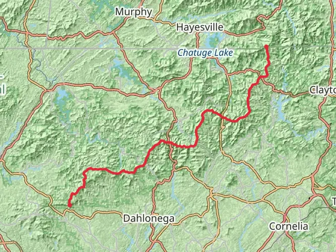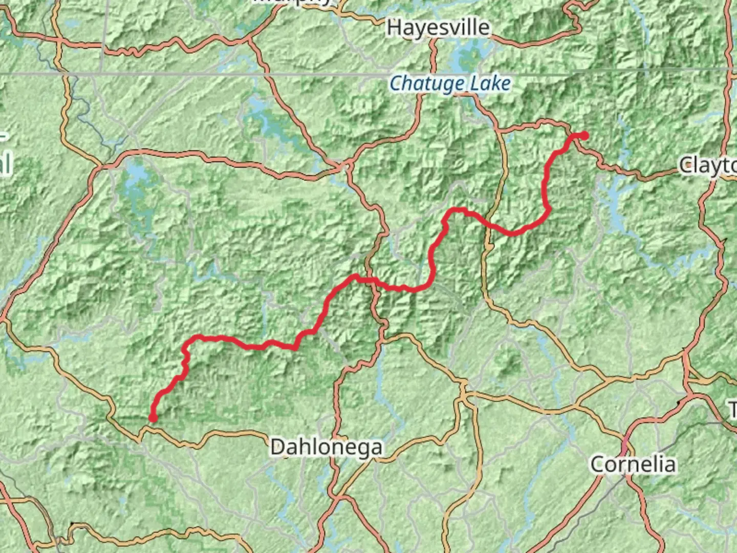
Appalachian Trail Section Hike - Dicks Creek Gap to Amicalola State Park
Download
3D Flyover
Add to list
More
120.7 km
~6 days
4117 m
Multi-Day
“Embark on a breathtaking 75-mile hike through history, wildlife, and stunning Appalachian vistas, a true test for seasoned adventurers.”
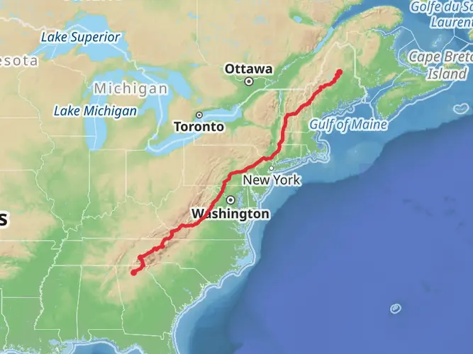
Embarking on the Appalachian Trail Section Hike from Dicks Creek Gap to Amicalola State Park, hikers will traverse approximately 121 kilometers (75 miles) of diverse and challenging terrain. With an elevation gain of around 4100 meters (13,450 feet), this point-to-point journey is not for the faint of heart, earning its difficult rating due to the steep ascents and descents along the way.
Getting to the Trailhead
The starting point of this section hike is near Towns County, Georgia, at Dicks Creek Gap, which is accessible by car. For those relying on public transportation, options are limited, and it's often best to arrange a shuttle service from nearby towns such as Hiawassee.
Navigating the Trail
Hikers can rely on HiiKER to navigate the trail, ensuring they stay on the correct path and are aware of upcoming changes in terrain or elevation. The trail is well-marked with the iconic white blazes, guiding adventurers through the Southern Appalachian Mountains.
Landmarks and Scenery
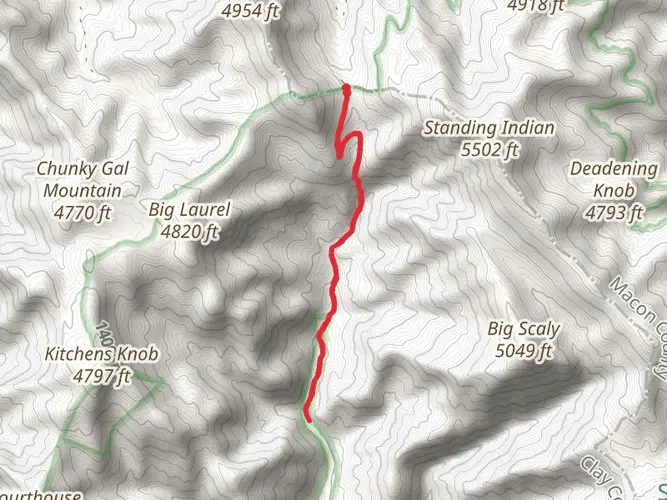
As hikers embark on this journey, they'll be greeted by the lush forests of North Georgia, with a canopy of hardwoods and evergreens providing shade and a habitat for diverse wildlife. The trail meanders through several significant gaps, including Addis Gap and Neels Gap, each offering unique vistas and challenges.
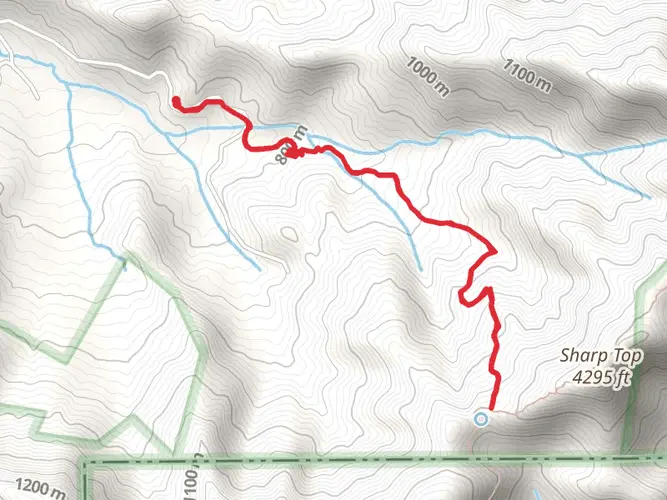
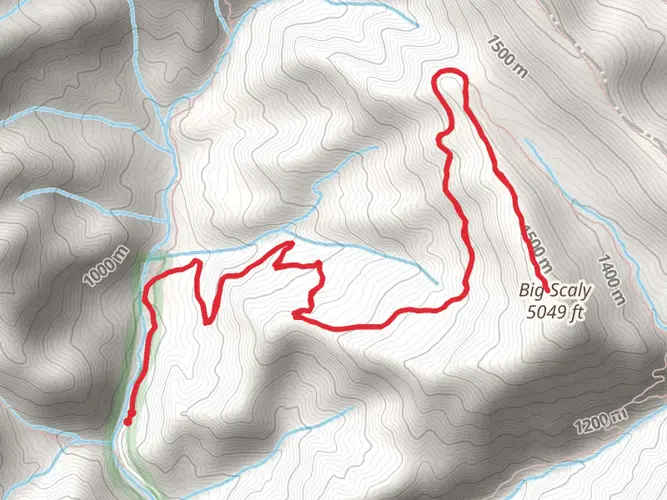
One of the most notable landmarks is Blood Mountain, the highest peak on the Georgia section of the Appalachian Trail, standing at an elevation of 1,445 meters (4,741 feet). The summit offers panoramic views that are particularly breathtaking during the fall when the foliage displays vibrant colors.
Wildlife and Nature
The region is home to an array of wildlife, including black bears, deer, and numerous bird species. Hikers should be aware of bear activity and practice proper food storage and disposal techniques to minimize encounters.
Historical Significance
This section of the Appalachian Trail is steeped in history, with the trail itself being a monument to conservation and outdoor recreation efforts dating back to the 1920s. The trail passes through areas that were once inhabited by the Cherokee people, and later, European settlers who left their mark on the landscape.
Preparation and Planning
Hikers should be well-prepared for this section hike, as it requires a high level of fitness and experience in backcountry navigation and camping. It's essential to carry a detailed map, a compass, and a fully charged GPS device, with HiiKER being a recommended resource for trail information and updates.
Water sources are available along the trail, but all water should be treated before consumption. It's also crucial to pack sufficient food, a first-aid kit, and appropriate gear for changing weather conditions, as the mountains can be unpredictable.
Access and Regulations
The southern terminus of this section hike is at Amicalola State Park, which is a gateway to the southern end of the Appalachian Trail. The park itself offers additional hiking opportunities and amenities for post-hike relaxation.
Hikers should be aware of Leave No Trace principles and adhere to trail regulations to preserve the natural beauty and integrity of the trail for future generations. Permits are not required for this section, but overnight stays in shelters or campsites should be planned in advance due to limited availability.
Conclusion
This section of the Appalachian Trail offers a challenging yet rewarding experience for seasoned hikers. With its rich history, stunning landscapes, and diverse wildlife, it's a journey that encapsulates the essence of the Appalachian Mountains. Proper preparation and respect for the trail will ensure a memorable and safe adventure through one of America's most iconic hiking trails.

Frequently asked questions
How long does the Appalachian Trail Section Hike - Dicks Creek Gap to Amicalola State Park usually take?
This section is 120.67 km, or about 75 miles, with 4,117 meters of climbing, so it is typically done as a multi-day backpacking trip rather than a long day hike. Many strong section hikers break it into roughly 5 to 8 days, depending on pace, pack weight, weather, and how much time is spent around major climbs like Blood Mountain and the final stretch toward Springer Mountain and the Approach Trail.
What are the biggest landmarks on the Appalachian Trail Section Hike - Dicks Creek Gap to Amicalola State Park?
Major landmarks on this route include Neels Gap, Blood Mountain, Springer Mountain, and the Approach Trail into Amicalola Falls State Park. Blood Mountain is the highest point on the Georgia section of the Appalachian Trail at about 4,458 feet, while Springer Mountain is the official southern terminus of the Appalachian Trail and connects to Amicalola by the 8.5-mile Approach Trail.
Where can hikers park for the Appalachian Trail Section Hike - Dicks Creek Gap to Amicalola State Park?
Common parking options for this hike are at Dicks Creek Gap and at Amicalola Falls State Park. The Georgia Appalachian Trail Club lists both Dicks Creek Gap and Amicalola Falls State Park among the established parking locations used for Georgia Appalachian Trail access, and many hikers leave a vehicle at the finish and arrange a shuttle to the starting point.
Is the Appalachian Trail Section Hike - Dicks Creek Gap to Amicalola State Park hard?
Yes. The route is rated difficult and packs 4,117 meters of elevation gain into 120.67 km, which means repeated steep climbs and descents across the North Georgia mountains. Even experienced hikers usually treat it as a demanding point-to-point trip, especially on the approach to high ridges and on the descent toward Amicalola Falls State Park.
Does the Appalachian Trail Section Hike - Dicks Creek Gap to Amicalola State Park include the southern end of the Appalachian Trail?
Yes. Hiking southbound on this section reaches Springer Mountain, which is the official southern terminus of the Appalachian Trail. The route then continues down the separate 8.5-mile Approach Trail to Amicalola Falls State Park, ending at the stone arch behind the park visitor center rather than on the Appalachian Trail itself.
Can dogs go on the Appalachian Trail Section Hike - Dicks Creek Gap to Amicalola State Park?
Dogs are generally allowed on Appalachian Trail sections in Georgia, including the route between Dicks Creek Gap and Springer Mountain, but they must be under control and are not a good fit for every dog on a difficult 120.67 km mountain route. The Amicalola end adds state park terrain and a long, steep Approach Trail, so heat, rock, stairs, and sustained elevation change are the main practical limits.
Comments and Reviews
User comments, reviews and discussions about the Appalachian Trail Section Hike - Dicks Creek Gap to Amicalola State Park, Georgia.
4.53
average rating out of 5
15 rating(s)