Download
3D Flyover
Add to list
More
11.6 km
~2 hrs 40 min
220 m
Loop
“Discover the Turmweg trail's blend of natural beauty and medieval history on a rewarding 12 km hike.”
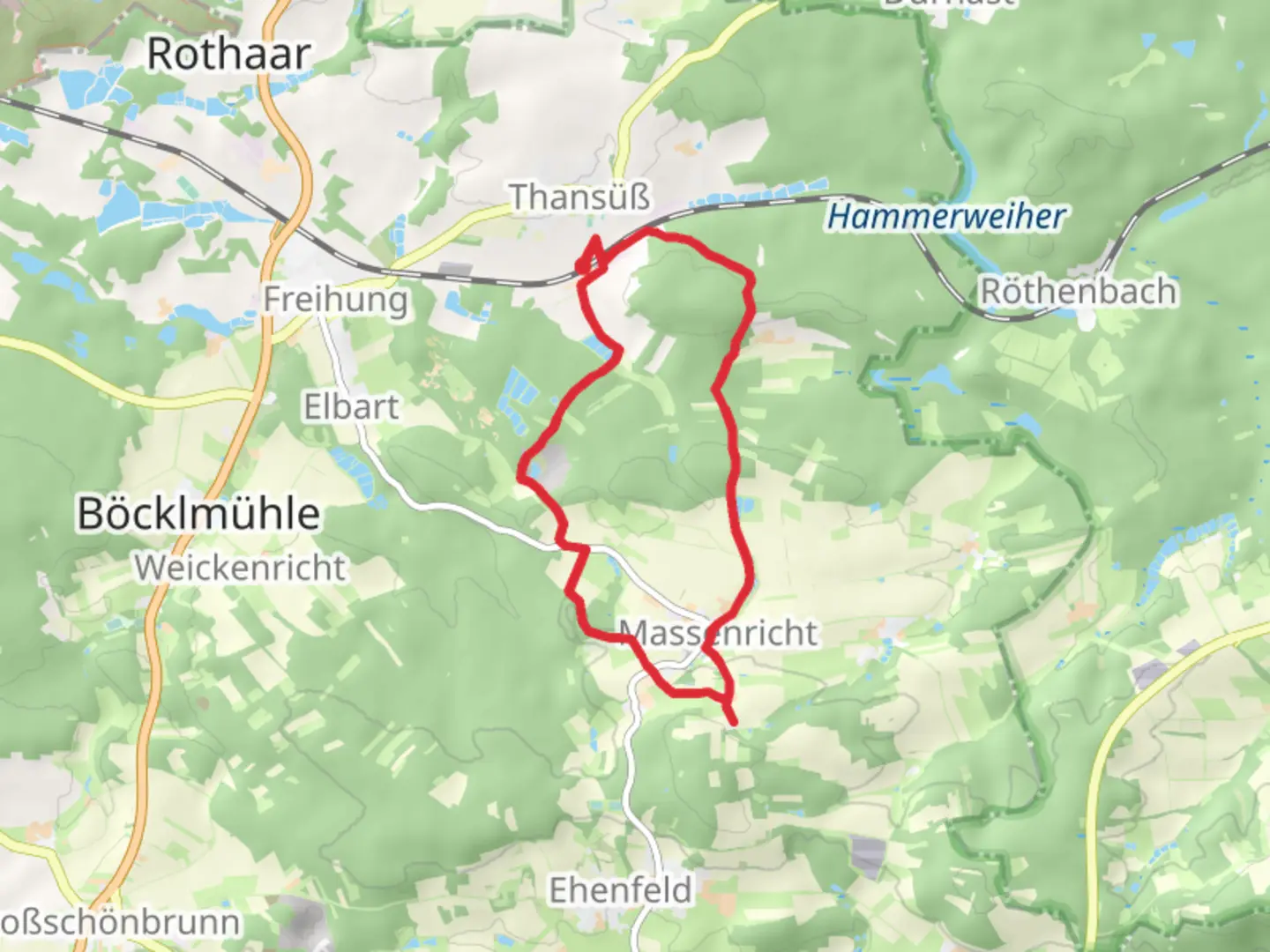
Starting near Amberg-Sulzbach, Germany, the Turmweg trail is a 12 km (approximately 7.5 miles) loop with an elevation gain of around 200 meters (656 feet). This medium-difficulty trail offers a blend of natural beauty and historical intrigue, making it a rewarding experience for hikers of various skill levels.
Getting There
To reach the trailhead, you can drive or use public transport. If driving, head towards Amberg-Sulzbach and look for parking near the town center. For those using public transport, take a train to Amberg station, which is well-connected to major cities like Nuremberg and Regensburg. From Amberg station, local buses or a short taxi ride will get you to the trailhead.
Trail Overview
The Turmweg trail is a loop, meaning you'll start and finish at the same point, making logistics simpler. The trail is well-marked, but it's always a good idea to have a reliable navigation tool like HiiKER to ensure you stay on track.
Key Landmarks and Sections
Amberg-Sulzbach
The trail begins near the charming town of Amberg-Sulzbach, known for its medieval architecture and rich history. As you start your hike, you'll pass through cobblestone streets and might want to take a moment to explore the town's historical landmarks, such as the Amberg City Museum and the Gothic-style St. Martin's Church.
Forested Areas
About 3 km (1.8 miles) into the hike, you'll enter dense forested areas. These sections are particularly beautiful in the fall when the leaves change color. The forest is home to a variety of wildlife, including deer, foxes, and numerous bird species. Keep your eyes peeled and your camera ready.
Elevation Gain
The trail's elevation gain is gradual, making it accessible for most hikers. Around the 5 km (3.1 miles) mark, you'll start to ascend towards the highest point of the trail. The climb is steady but not overly strenuous, offering panoramic views of the surrounding countryside as a reward.
Historical Towers
One of the highlights of the Turmweg trail is the series of historical towers you'll encounter. These towers date back to medieval times and were once part of the region's defensive structures. The most notable is the Sulzbach Tower, located approximately 7 km (4.3 miles) into the hike. This tower offers a fantastic vantage point for photos and a bit of historical context.
Open Meadows and Farmlands
As you descend from the highest point, the trail opens up into meadows and farmlands. This section, around the 9 km (5.6 miles) mark, is relatively flat and offers a different kind of scenic beauty. You'll pass by local farms, where you might see cows grazing and fields of crops swaying in the breeze.
Wildlife and Flora
The Turmweg trail is rich in biodiversity. The forested sections are home to oak, beech, and pine trees, while the open meadows feature wildflowers like daisies and buttercups. Wildlife sightings are common, so keep an eye out for deer, foxes, and various bird species, including woodpeckers and owls.
Final Stretch
The last 3 km (1.8 miles) of the trail bring you back towards Amberg-Sulzbach. This section is relatively easy, allowing you to cool down and reflect on the hike. You'll pass through a mix of forest and open areas before finally arriving back at the trailhead.
Preparation Tips
- Footwear: Sturdy hiking boots are recommended due to the varied terrain.
- Water: Carry at least 2 liters (0.5 gallons) of water, especially in warmer months.
- Snacks: Bring energy-boosting snacks like nuts, fruit, and energy bars.
- Navigation: Use HiiKER for reliable trail navigation.
- Weather: Check the weather forecast before heading out and dress in layers.
The Turmweg trail offers a delightful mix of natural beauty, historical landmarks, and moderate physical challenge, making it a must-visit for hikers in the Amberg-Sulzbach region.

Comments and Reviews
User comments, reviews and discussions about the Turmweg, Germany.
5.0
average rating out of 5
2 rating(s)