Download
3D Flyover
Add to list
More
99.8 km
~4 days
1464 m
Multi-Day
“Embark on a scenic 100km hike through Germany's diverse landscapes, rich in history and nature's marvels.”
Embarking on the Europäischer Wasserscheideweg, hikers will traverse approximately 100 kilometers (about 62 miles) of varied landscapes, with an elevation gain of around 1400 meters (approximately 4600 feet). This point-to-point trail, nestled near Ansbach, Germany, offers a medium difficulty rating and is a journey through both natural beauty and historical significance.
Getting to the Trailhead
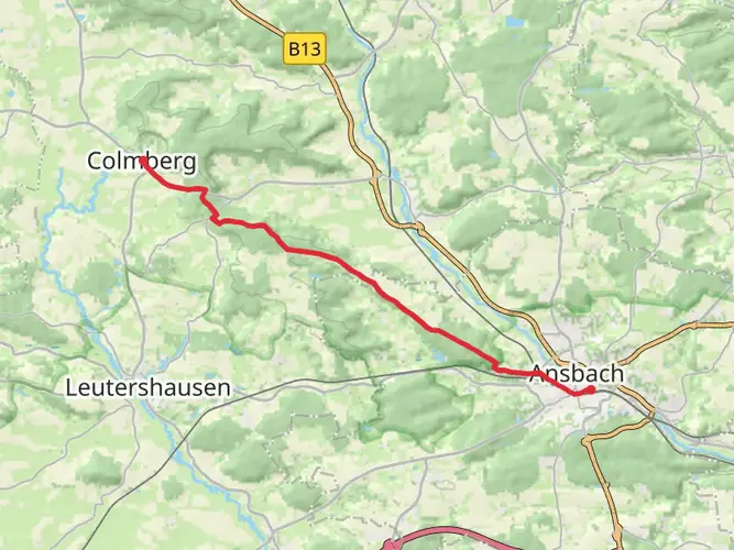
The trailhead is conveniently accessible from Ansbach, a town well-connected by public transport. Hikers can take a train to Ansbach station and then a local bus or taxi to the starting point. For those driving, parking is available near the trailhead, which is situated in the outskirts of Ansbach.
Navigating the Trail
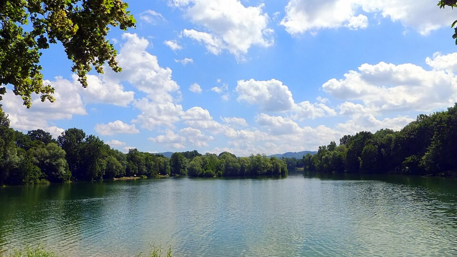
As you set out, the path will lead you through a mosaic of dense forests, open meadows, and rolling hills. The trail is well-marked, but carrying a reliable navigation tool like HiiKER on your mobile device is recommended for real-time tracking and additional trail information.
Historical Significance and Landmarks
The Europäischer Wasserscheideweg is not just a natural escape but also a historical corridor. The trail follows the European watershed, a line that divides the river systems flowing into the North Sea and the Black Sea. This natural divide has been a significant geographical feature since ancient times.
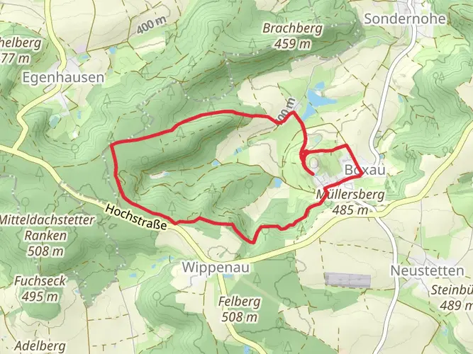
One of the trail's highlights is the encounter with the Altmühlquelle, the source of the Altmühl River, which is a tributary of the Danube. As you progress, you'll pass through quaint villages and towns, each with its own story and historical architecture, such as traditional Franconian half-timbered houses.
Nature and Wildlife
The trail offers an opportunity to immerse in the region's biodiversity. The forests are home to a variety of wildlife, including deer, foxes, and numerous bird species. The changing seasons bring different flora to life, with wildflowers in spring and a palette of autumn colors later in the year.
Trail Challenges and Considerations
While the elevation gain is gradual, there are sections that can be quite steep, so a good level of fitness is beneficial. The trail can be hiked in sections or in its entirety over several days, with accommodation options available in the towns along the route.
Weather can be unpredictable, so hikers should be prepared for changes and carry appropriate gear. Water sources are available, but it's wise to carry enough water and snacks, especially in the more remote stretches.
Conclusion
The Europäischer Wasserscheideweg is a trail that offers a blend of natural beauty, wildlife encounters, and a deep dive into the region's history. With its moderate difficulty, it's accessible to many hikers and promises an enriching experience through the heart of Germany's countryside.

Frequently asked questions
How long is the Europäischer Wasserscheideweg and how many days does the full hike usually take?
The Europäischer Wasserscheideweg is 99.8 km long with 1,464 m of total ascent, so it is generally treated as a multi-day hike rather than a long day walk. The route is commonly described in five stages from Ansbach to Schnelldorf, which makes it a practical 4 to 6 day trip depending on pace and overnight stops.
Where does the Europäischer Wasserscheideweg start and finish?
The Europäischer Wasserscheideweg runs point to point from Ansbach to Schnelldorf across the Frankenhöhe area in Bavaria. In Ansbach, the route begins at the end of Endresstraße, and the trail follows the European watershed westward through the Naturpark Frankenhöhe toward Schnelldorf.
What is the Europäischer Wasserscheideweg in Germany actually following?
The Europäischer Wasserscheideweg follows the European watershed, the drainage divide that separates water flowing north toward the Rhine and North Sea from water flowing south toward the Danube and Black Sea. Along this route near Ansbach and across the Frankenhöhe, that divide is the defining geographic feature of the hike.
Can the Europäischer Wasserscheideweg be reached by public transportation from Ansbach?
Yes. Ansbach is the main access point for the trail, and the route can be reached from Ansbach station on foot via a signed approach. A published station access route leads from Bahnhof Ansbach to the trail start near Endresstraße, making rail arrival a realistic option for starting the hike without a car.
Is the Europäischer Wasserscheideweg difficult?
The Europäischer Wasserscheideweg is generally rated medium difficulty. The challenge comes less from extreme climbing and more from the overall length of 99.8 km, the cumulative 1,464 m of ascent, and the fact that it is a point-to-point route that is usually completed over several days on forest tracks, natural paths, and rolling terrain.
What are the main highlights on the Europäischer Wasserscheideweg near Ansbach?
One of the best-known highlights on the Europäischer Wasserscheideweg is the Altmühlquelle, the source of the Altmühl River, which ultimately drains to the Danube. Early on from Ansbach, the route also passes features such as Büttelberg and Schaafsee before continuing through wooded sections of the Naturpark Frankenhöhe along the watershed line.
Comments and Reviews
User comments, reviews and discussions about the Europäischer Wasserscheideweg, Germany.
4.63
average rating out of 5
8 rating(s)