Download
Preview
Add to list
More
11.2 km
~2 hrs 30 min
164 m
Loop
“Immerse in Bavarian beauty with the Puppling Loop, an 11 km trail through forests, meadows, and history.”
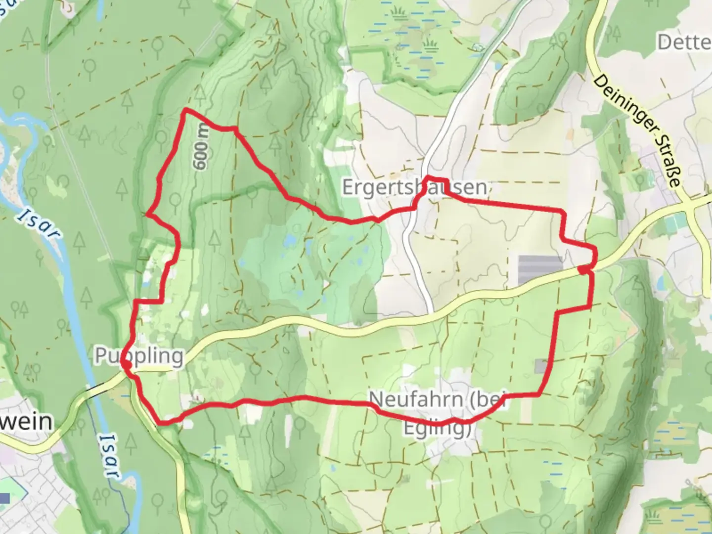
Starting near the picturesque town of Bad Tölz-Wolfratshausen in Germany, the Puppling Loop is an 11 km (approximately 6.8 miles) trail with an elevation gain of around 100 meters (328 feet). This loop trail is rated as medium difficulty, making it suitable for moderately experienced hikers.
Getting There
To reach the trailhead, you can either drive or use public transport. If driving, set your GPS to Bad Tölz-Wolfratshausen and look for parking options near the town center. For those using public transport, take a train to Bad Tölz station. From there, local buses or a short taxi ride can bring you to the trailhead.
Trail Overview
The Puppling Loop offers a diverse hiking experience, winding through lush forests, open meadows, and along the serene banks of the Isar River. The trail is well-marked, but it's always a good idea to have a reliable navigation tool like HiiKER to ensure you stay on track.
Key Landmarks and Points of Interest
- Isar River: Early in the hike, you'll encounter the Isar River, known for its clear waters and tranquil ambiance. This section is particularly scenic, with opportunities to spot local wildlife such as deer and various bird species.
- Forested Areas: As you progress, the trail takes you through dense forests, where the canopy provides a cool respite from the sun. These woods are home to a variety of flora and fauna, including wildflowers and small mammals.
- Open Meadows: Midway through the loop, the trail opens up into expansive meadows. This is a great spot to take a break and enjoy the panoramic views of the surrounding Bavarian countryside.
- Historical Sites: The region around Bad Tölz-Wolfratshausen has a rich history. Keep an eye out for old farmhouses and traditional Bavarian architecture that dot the landscape. Some of these structures date back several centuries and offer a glimpse into the area's past.
Elevation and Terrain
The total elevation gain of 100 meters (328 feet) is spread out over the course of the hike, making for a relatively gentle ascent. The terrain varies from well-trodden paths to more rugged sections, so sturdy hiking boots are recommended.
Wildlife and Nature
The Puppling Loop is a haven for nature enthusiasts. In addition to the deer and birds near the Isar River, you might also encounter foxes, rabbits, and a variety of insects and butterflies in the meadows. The forested areas are rich with oak, beech, and pine trees, providing a diverse ecosystem to explore.
Practical Tips
- Weather: The weather in this region can be unpredictable, so it's wise to check the forecast before setting out and dress in layers.
- Water and Snacks: There are no facilities along the trail, so bring enough water and snacks to keep you energized.
- Navigation: While the trail is well-marked, using HiiKER can help you navigate more confidently and ensure you don't miss any key points of interest.
The Puppling Loop offers a well-rounded hiking experience with its mix of natural beauty, historical significance, and moderate challenge. Whether you're a local or a visitor, this trail provides a wonderful opportunity to immerse yourself in the Bavarian landscape.

What to expect?
Activity types
Comments and Reviews
User comments, reviews and discussions about the Puppling Loop, Germany.
4.33
average rating out of 5
3 rating(s)