Download
3D Flyover
Add to list
More
13.3 km
~2 hrs 59 min
203 m
Loop
“Explore the scenic Breitenguessbach Rundwanderweg, a 13 km loop offering lush forests, historic sites, and panoramic views.”
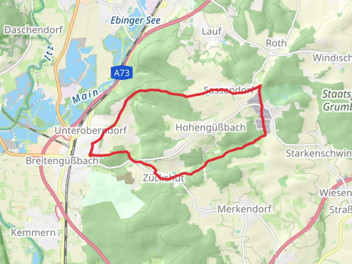
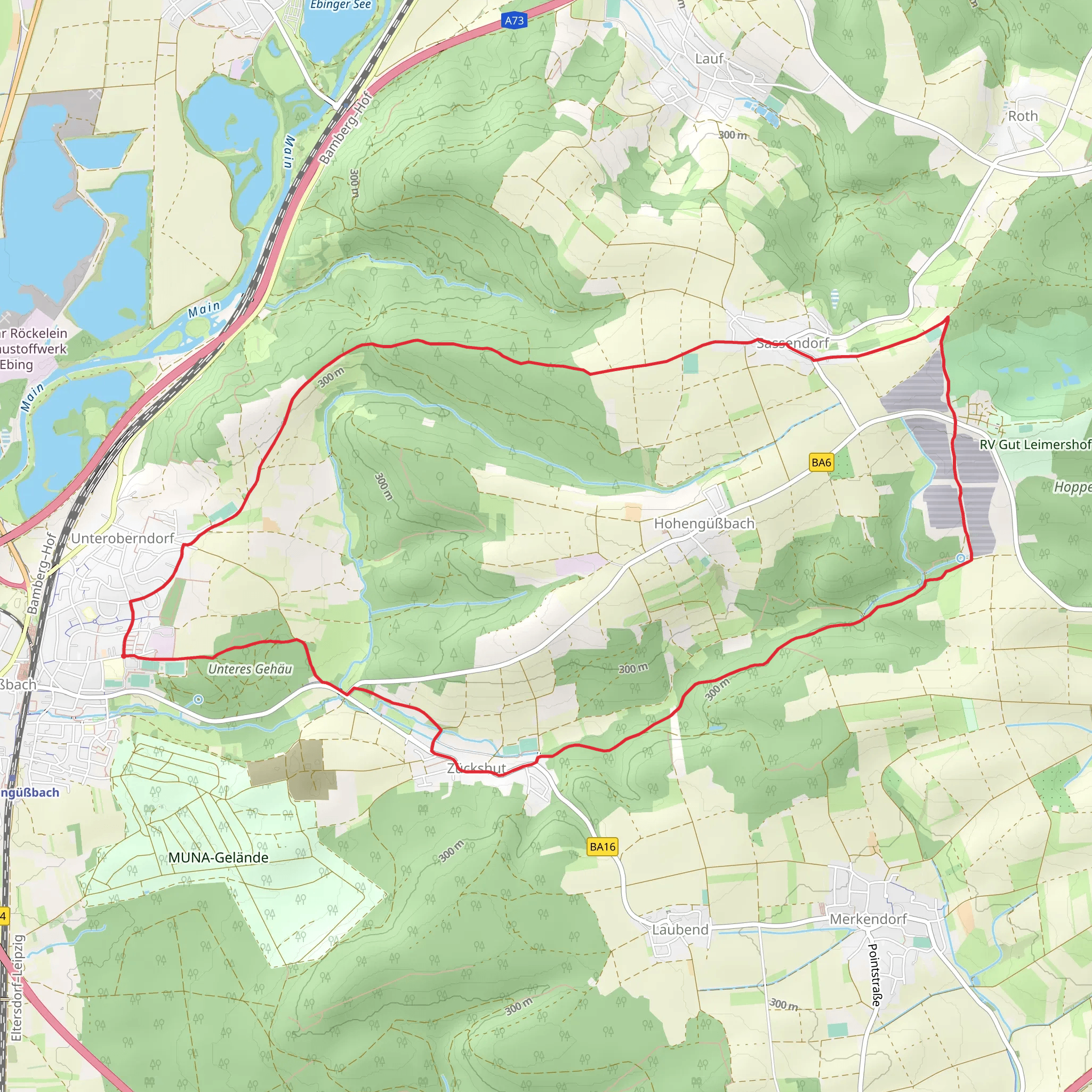
Starting near the charming town of Bamberg, Germany, the Breitenguessbach Rundwanderweg is a delightful 13 km (8 miles) loop trail with an elevation gain of approximately 200 meters (656 feet). This trail offers a medium difficulty rating, making it suitable for moderately experienced hikers looking for a rewarding day hike.
Getting There
To reach the trailhead, you can either drive or use public transport. If driving, head towards Breitenguessbach, which is easily accessible from Bamberg via the A73 motorway. For those using public transport, take a train from Bamberg to Breitenguessbach station. From the station, the trailhead is just a short walk away.
Trail Overview
The trail begins in the picturesque village of Breitenguessbach, known for its traditional Franconian architecture and serene atmosphere. As you set off, you'll initially walk through the village streets before transitioning into lush, green countryside.
Key Landmarks and Sections
Breitenguessbach Village
At the start, take some time to explore Breitenguessbach. The village is home to several historical buildings, including the St. Leonhard Church, which dates back to the 14th century. The half-timbered houses and cobblestone streets offer a glimpse into the region's rich history.
Forested Pathways
Around the 3 km (1.8 miles) mark, you'll enter a dense forest area. The canopy provides ample shade, making this section particularly pleasant during warmer months. Keep an eye out for local wildlife such as deer and various bird species. The forest floor is often carpeted with wildflowers in spring, adding a splash of color to your hike.
Open Fields and Meadows
As you exit the forest around the 6 km (3.7 miles) point, the trail opens up into expansive fields and meadows. This section offers panoramic views of the surrounding countryside. The gentle rolling hills are characteristic of the Franconian landscape. Here, you might encounter local farmers working the land, a testament to the region's agricultural heritage.
Historical Sites
Around the 9 km (5.6 miles) mark, you'll come across the ruins of an old mill, a relic from the 18th century. This site offers a great spot for a short break and some exploration. The mill once played a crucial role in the local economy, grinding grain for the surrounding villages.
Navigation and Safety
The trail is well-marked with signs at regular intervals, but it's always a good idea to have a reliable navigation tool. The HiiKER app is highly recommended for this purpose, providing detailed maps and real-time location tracking to ensure you stay on course.
Final Stretch
The last 4 km (2.5 miles) of the trail take you back towards Breitenguessbach. This section is relatively flat and easy, allowing you to cool down as you approach the end of your hike. You'll pass through more open fields and small wooded areas before re-entering the village.
Flora and Fauna
Throughout the hike, you'll encounter a variety of plant and animal life. The mixed deciduous forests are home to oak, beech, and pine trees. In the meadows, look for wildflowers such as daisies, poppies, and cornflowers. Birdwatchers will appreciate the diversity of species, including woodpeckers, finches, and occasionally, birds of prey like hawks and eagles.
Practical Tips
- Wear sturdy hiking boots, as some sections can be uneven and muddy, especially after rain.
- Bring sufficient water and snacks, as there are limited facilities along the trail.
- Check the weather forecast before setting out, as conditions can change rapidly.
This trail offers a perfect blend of natural beauty, historical intrigue, and moderate physical challenge, making it a must-visit for hikers in the Bamberg region.
Comments and Reviews
User comments, reviews and discussions about the Breitenguessbach Rundwanderweg, Germany.
average rating out of 5
0 rating(s)
