Download
Preview
Add to list
More
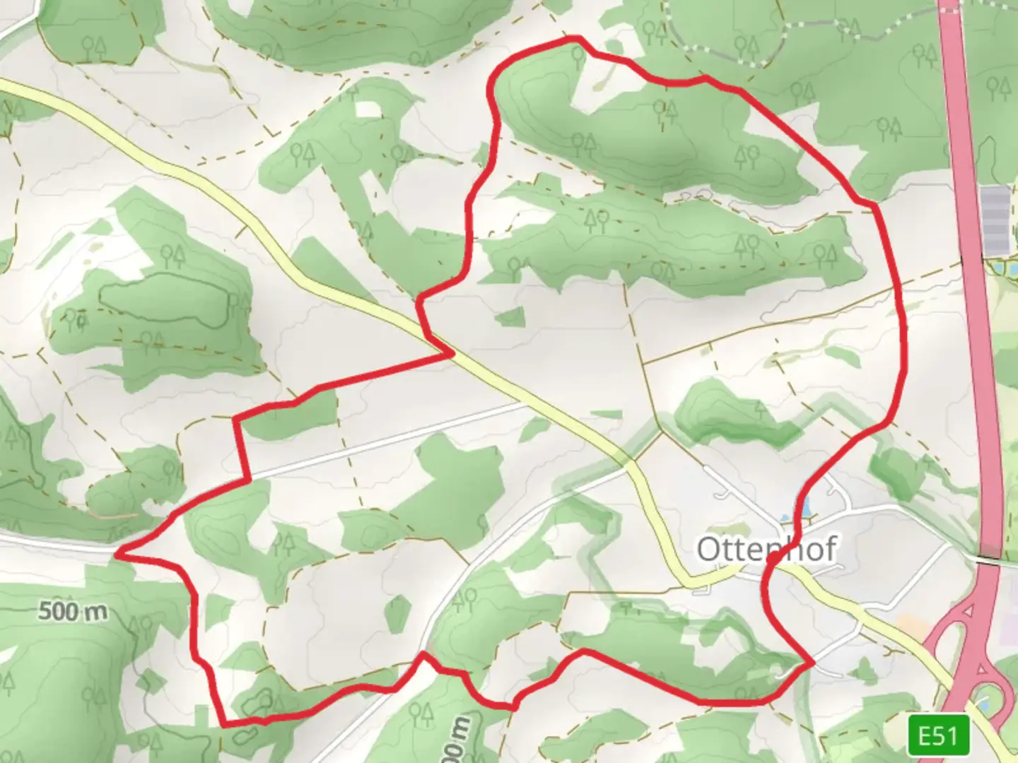
6.5 km
~1 hrs 40 min
221 m
Loop
“The 7 km Rundweg um Ottenhof trail offers scenic views, historical landmarks, and abundant wildlife near Bayreuth.”
Starting near Bayreuth, Germany, the Rundweg um Ottenhof is a delightful loop trail that spans approximately 7 km (4.3 miles) with an elevation gain of around 200 meters (656 feet). This medium-difficulty trail offers a mix of natural beauty, historical landmarks, and opportunities for wildlife spotting, making it a rewarding experience for hikers of various skill levels.
Getting There
To reach the trailhead, you can either drive or use public transport. If driving, set your GPS to Ottenhof, a small village near Bayreuth. There is ample parking available near the village center. For those using public transport, take a train to Bayreuth Hauptbahnhof and then a local bus towards Ottenhof. The bus ride is scenic and takes you through the charming Franconian countryside.
Trail Overview
The trail begins in the quaint village of Ottenhof, where you can find a few local shops and cafes to grab a quick snack or coffee before you start. As you leave the village, the path gently ascends through mixed forests and open meadows, offering panoramic views of the surrounding landscape.
Key Landmarks and Points of Interest
- Ottenhof Village: The starting point itself is a picturesque Franconian village with traditional half-timbered houses. It's worth taking a few moments to explore the village before or after your hike.
- Forest Sections: About 2 km (1.2 miles) into the hike, you'll enter a dense forest area. This section is particularly beautiful in autumn when the leaves change color. Keep an eye out for local wildlife such as deer and various bird species.
- Meadow Views: Around the 4 km (2.5 miles) mark, the trail opens up into expansive meadows. This is a great spot to take a break and enjoy the views. On clear days, you can see the distant hills of the Franconian Switzerland region.
- Historical Sites: Near the 5 km (3.1 miles) point, you'll come across a small chapel that dates back to the 18th century. This chapel is a serene spot for reflection and offers a glimpse into the region's historical and cultural heritage.
Navigation and Safety
The trail is well-marked with signs and markers, but it's always a good idea to have a reliable navigation tool. The HiiKER app is highly recommended for this trail, as it provides detailed maps and real-time updates. Make sure to wear sturdy hiking boots, as some sections can be muddy, especially after rain.
Flora and Fauna
The Rundweg um Ottenhof is rich in biodiversity. The forested sections are home to oak, beech, and pine trees, while the meadows are dotted with wildflowers in the spring and summer. Birdwatchers will be delighted by the variety of species, including woodpeckers, finches, and occasionally, birds of prey.
Final Stretch
As you loop back towards Ottenhof, the trail descends gently, offering a relaxing end to your hike. The final kilometer (0.6 miles) takes you through a mix of forest and open fields, eventually leading you back to the village.
This trail offers a perfect blend of natural beauty, historical interest, and moderate physical challenge, making it a must-visit for hikers in the Bayreuth area.

Comments and Reviews
User comments, reviews and discussions about the Rundweg um Ottenhof, Germany.
average rating out of 5
0 rating(s)