Download
3D Flyover
Add to list
More
3.9 km
~1 hrs 14 min
279 m
Loop
“Explore the scenic Marxenhoehe and Kneifelspitzweg Loop for stunning views and a moderate hiking challenge.”
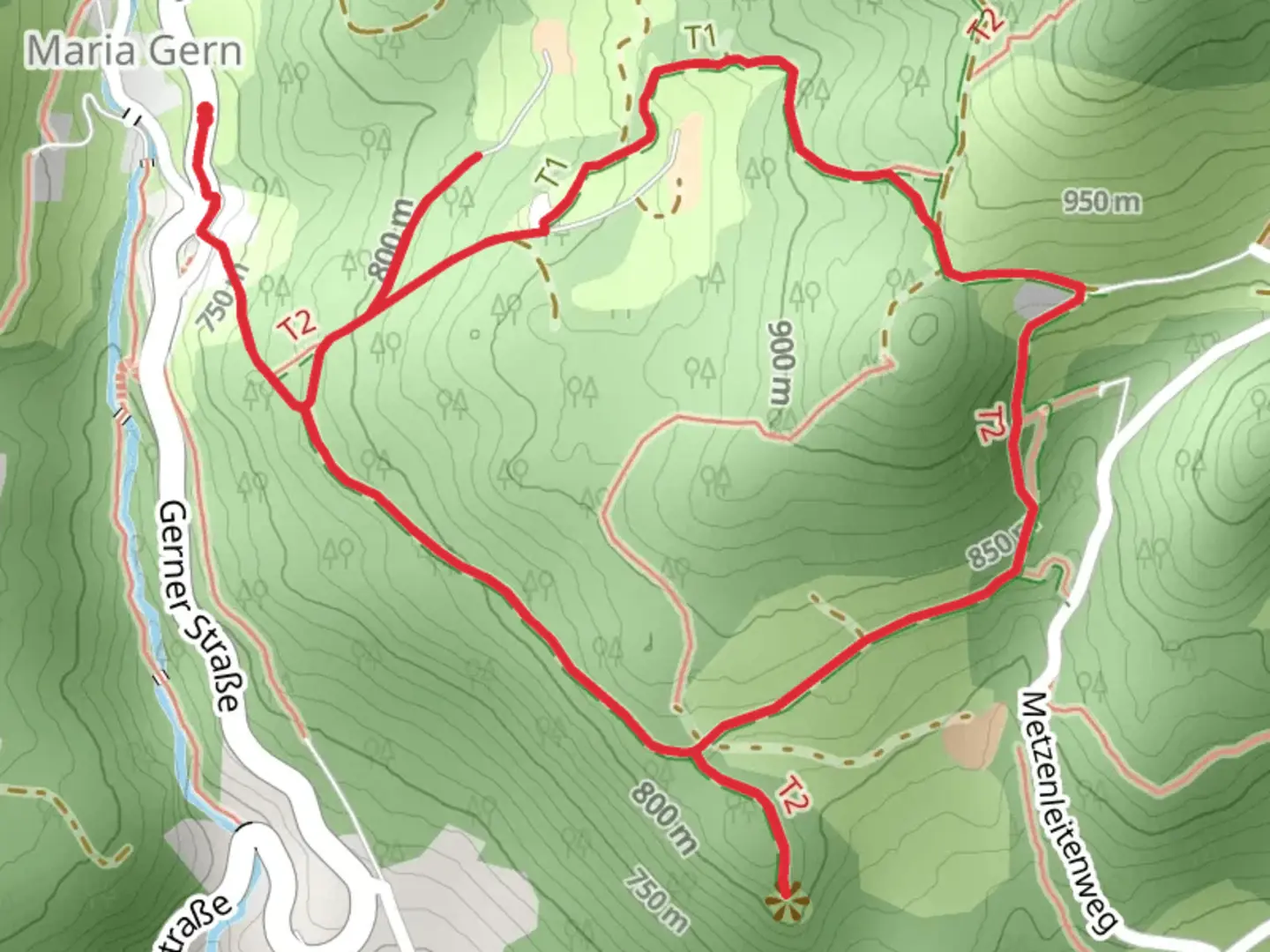
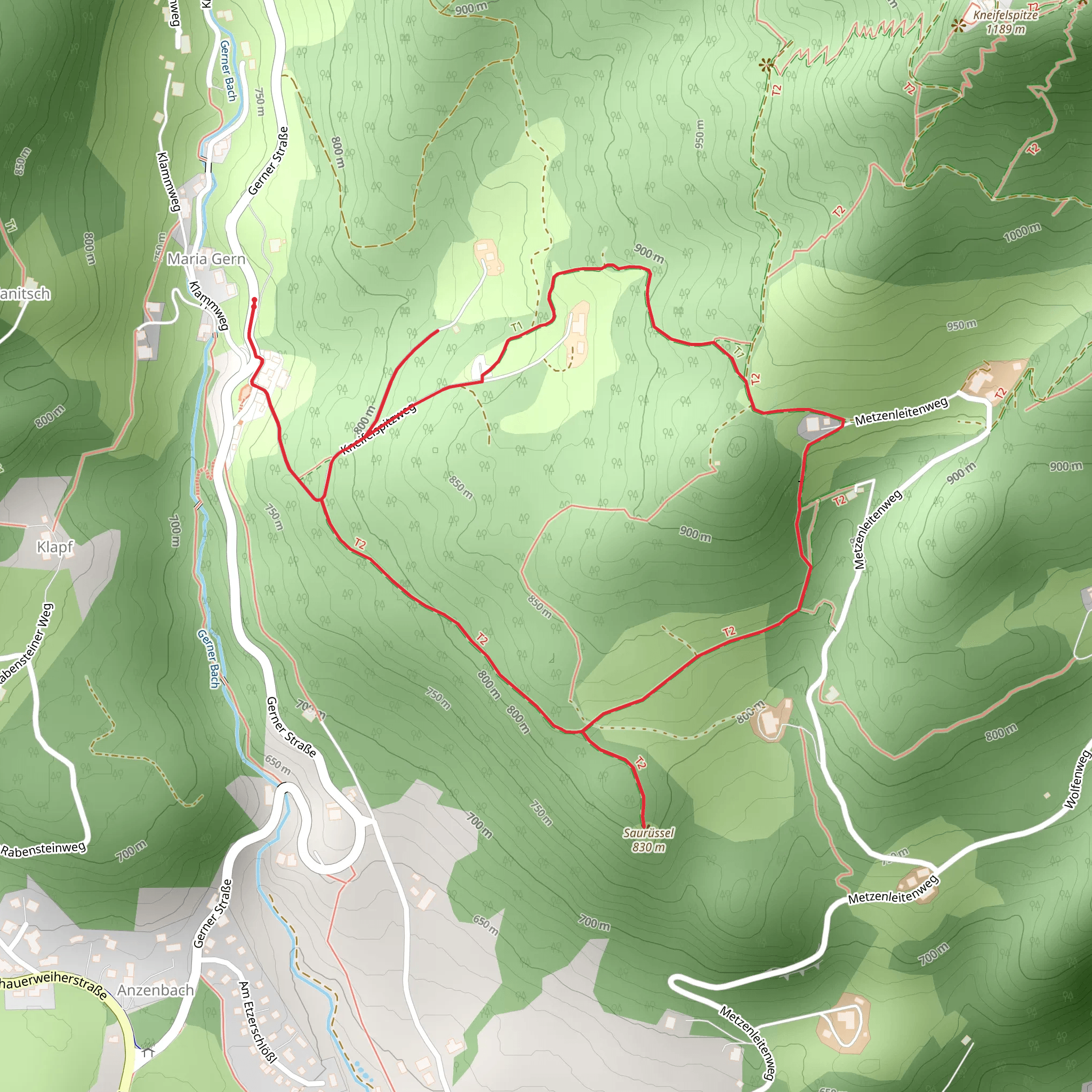
Starting near Berchtesgadener Land in Germany, the Marxenhoehe and Kneifelspitzweg Loop is a delightful 4 km (2.5 miles) trail with an elevation gain of approximately 200 meters (656 feet). This loop trail is rated as medium difficulty, making it suitable for moderately experienced hikers.
Getting There
To reach the trailhead, you can either drive or use public transport. If you're driving, head towards Berchtesgadener Land and look for parking near the trailhead. For those using public transport, take a train or bus to Berchtesgaden Hauptbahnhof. From there, you can catch a local bus or taxi to the starting point of the trail.
Trail Overview
The trail begins with a gentle ascent through a lush forest, offering a serene atmosphere with the sounds of chirping birds and rustling leaves. As you progress, the path becomes steeper, leading you to the first significant landmark, Marxenhoehe. This viewpoint offers stunning panoramic views of the surrounding valleys and mountains, making it a perfect spot for a short break and some photography.
Key Landmarks and Points of Interest
- Marxenhoehe Viewpoint: Approximately 1.5 km (0.9 miles) into the hike, you'll reach Marxenhoehe. This viewpoint provides breathtaking vistas of the Berchtesgadener Land region, including the iconic Watzmann Mountain.
- Kneifelspitzweg: Continuing from Marxenhoehe, the trail leads you to Kneifelspitzweg. This section of the trail is known for its diverse flora, including wildflowers and various tree species. Keep an eye out for local wildlife such as deer and various bird species.
- Kneifelspitze Summit: At around the 3 km (1.9 miles) mark, you'll reach the Kneifelspitze summit. The summit offers a 360-degree view of the surrounding landscape, including the Berchtesgaden Alps and the town of Berchtesgaden itself. There is also a small chapel at the summit, adding a touch of historical significance to your hike.
Historical Significance
The Berchtesgadener Land region is rich in history. The area was once a favorite retreat for Bavarian royalty and has been a popular destination for hikers and nature enthusiasts for centuries. The Kneifelspitze summit, in particular, has historical significance due to the small chapel located there, which dates back to the early 20th century.
Navigation and Safety
For navigation, it is highly recommended to use the HiiKER app, which provides detailed maps and real-time updates. The trail is well-marked, but having a reliable navigation tool will ensure you stay on track and can enjoy your hike without any worries.
Flora and Fauna
The trail is home to a variety of plant and animal species. In the spring and summer months, you'll find an array of wildflowers, while the forested sections are rich with evergreen and deciduous trees. Wildlife sightings may include deer, foxes, and a variety of bird species, making it a rewarding experience for nature lovers.
Final Stretch
The final stretch of the trail descends back towards the starting point, offering a gentle and relaxing end to your hike. The loop nature of the trail ensures that you return to your starting location, making logistics simple and straightforward.
This trail offers a perfect blend of natural beauty, moderate physical challenge, and historical interest, making it a must-visit for hikers exploring the Berchtesgadener Land region.
What to expect?
Activity types
Comments and Reviews
User comments, reviews and discussions about the Marxenhoehe and Kneifelspitzweg Loop, Germany.
4.67
average rating out of 5
3 rating(s)
