Download
3D Flyover
Add to list
More
175.7 km
~7 days
3334 m
Multi-Day
“Hike the historic Pandurensteig trail, a Bavarian journey of heritage, diverse landscapes, and rewarding elevation.”
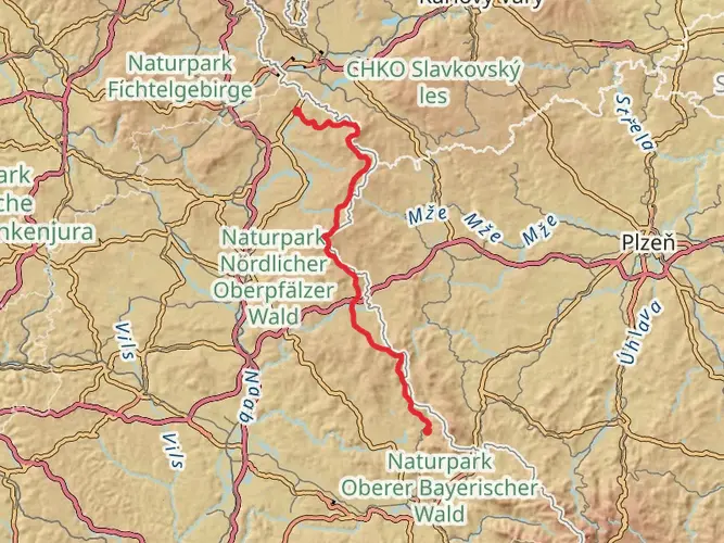
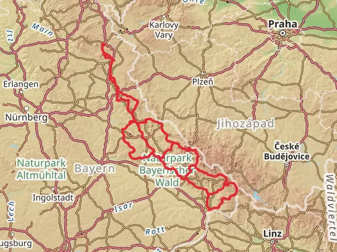
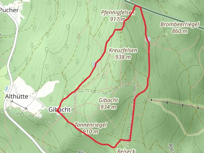
Embarking on the Pandurensteig trail, hikers will traverse a scenic route of approximately 176 kilometers (around 109 miles) with an elevation gain of about 3300 meters (roughly 10,827 feet). This point-to-point trail, nestled in the Upper Palatinate region of Bavaria, Germany, begins near the town of Cham and stretches through the Bavarian Forest, concluding in the historic town of Eslarn.
Getting to the Trailhead
To reach the starting point near Cham, hikers can utilize public transportation by taking a train to the Cham railway station. From there, local buses or taxis can bridge the gap to the trailhead. For those driving, parking is available in the vicinity of Cham, allowing for a convenient start to the journey.
Navigating the Trail
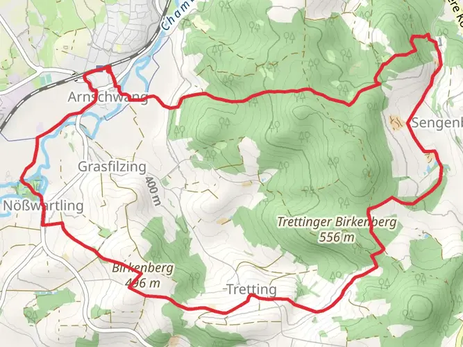
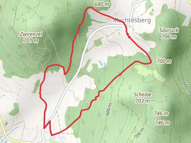
As you set out from the trailhead, the path will lead you through a mosaic of dense forests, rolling hills, and pastoral landscapes. The trail is well-marked, but carrying a reliable navigation tool like HiiKER is advisable to ensure you stay on course and can anticipate upcoming changes in terrain or elevation.
Historical Significance and Landmarks
The Pandurensteig is steeped in history, taking its name from the Pandurs, Croatian soldiers who marched through the region in the 18th century during the War of the Austrian Succession. As you hike, you'll encounter landmarks that echo the past, such as the Nepomuk Chapel, the historic town of Waldmünchen, and the ruins of Schwarzenburg Castle. Each of these sites offers a glimpse into the region's rich heritage.
Natural Beauty and Wildlife
The trail meanders through the Bavarian Forest, a haven for diverse flora and fauna. Expect to walk through serene forested areas, home to species such as red deer, wild boar, and various birds of prey. The changing seasons paint the landscape with different hues, from the vibrant greens of spring to the golden tones of autumn.
Elevation and Difficulty
While the Pandurensteig is rated as medium difficulty, it's important to prepare for the cumulative elevation gain. The trail includes several ascents and descents, with the most significant elevation changes occurring in the first half of the hike. Proper conditioning and pacing are key to enjoying the journey.
Accommodation and Resupply Points
Throughout the trail, there are opportunities to rest and resupply in small towns and villages. Hikers can find guesthouses, inns, and shops to replenish provisions. It's recommended to plan overnight stays in advance, especially during peak hiking seasons.
Weather and Preparation
The weather in the Upper Palatinate can be unpredictable, so hikers should be prepared for varying conditions. Layered clothing, waterproof gear, and sturdy hiking boots are essential. Additionally, carrying enough water and snacks to sustain you between resupply points is crucial.
By preparing adequately and respecting the trail's natural and historical significance, hikers can fully immerse themselves in the beauty and challenge of the Pandurensteig.

Frequently asked questions
How long is the Pandurensteig and how many days does it usually take to hike?
The Pandurensteig is 175.71 km long with 3,334 meters of total ascent, so it is firmly a multi-day long-distance hike rather than a day walk. Most hikers break a route of this length into roughly 7 to 10 days, depending on daily mileage, weather, and how much time is spent in trail towns such as Cham and at historic stops along the way.
Where does the Pandurensteig start and finish?
The Pandurensteig is a point-to-point trail in Bavaria that runs across the Upper Palatinate and Bavarian Forest region. It is commonly described as starting around Waldmünchen and passing through Cham before continuing westward through the Bavarian Forest to Passau, while some route summaries focus on the Cham area because that is the district used for the hike listing.
Is the Pandurensteig difficult?
The Pandurensteig is generally rated medium difficulty, but the challenge comes from its length more than from any single alpine section. Covering about 176 km with 3,334 meters of climbing, it suits hikers who are comfortable with repeated full days on foot over forest tracks, rolling hills, and longer stage distances.
Can the Pandurensteig be done with overnight stops along the route?
Yes. The Pandurensteig is set up as a stage-based long-distance hike, and the route passes through or near settlements where overnight stays are practical, including places such as Waldmünchen, Cham, and other Bavarian Forest communities. That makes it realistic to divide the full 175.71 km into consecutive walking days instead of treating it as a continuous through-hike without lodging.
How do hikers get to the Pandurensteig trailhead near Cham?
Cham is one of the key access points for the Pandurensteig and is served by rail, making it one of the simplest places to join the route without a car. From Cham station, the trail area can be reached by local transport or taxi, and drivers can usually find parking in town before starting a point-to-point walk.
What are the main highlights on the Pandurensteig?
The Pandurensteig combines long forest sections, low mountain scenery, and historic places tied to the old Pandur marches through eastern Bavaria. Notable places associated with the route include Cham, Waldmünchen, the ruins of Weißenstein Castle, stretches near the Großer Pfahl quartz ridge, and scenic viewpoints in the Bavarian Forest.
Is the Pandurensteig suitable for mountain bikes?
The Pandurensteig is primarily known and promoted as a long-distance hiking trail, not as a dedicated MTB route. Some forest roads and wider sections in the region may be rideable, but anyone planning to bike the Pandurensteig needs to check local access rules section by section, because a signed hiking trail is not automatically an official mountain-bike trail.
Comments and Reviews
User comments, reviews and discussions about the Pandurensteig, Germany.
4.83
average rating out of 5
6 rating(s)