Download
3D Flyover
Add to list
More
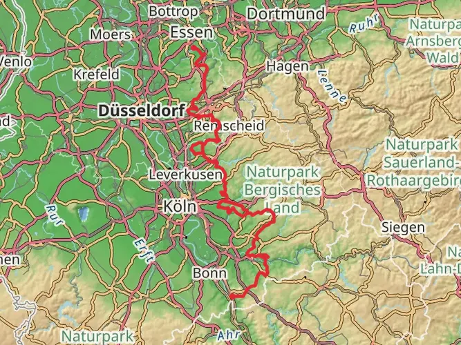
254.0 km
~10 days
4586 m
Multi-Day
“Embark on the historic Kölner Weg, a scenic and culturally rich hiking trail through Germany's picturesque landscapes.”
Spanning approximately 254 kilometers (about 158 miles) with an elevation gain of around 4500 meters (roughly 14,764 feet), the Kölner Weg offers a medium-difficulty hiking experience that takes you through the varied landscapes near Cologne, Germany. This point-to-point trail is a journey through history, nature, and the cultural heart of the region.
Getting to the Trailhead
The trailhead for the Kölner Weg is conveniently located near Cologne, a city well-connected by Germany's extensive public transport network. Hikers can take a train or bus to Cologne and then use local transport to reach the starting point of the trail. For those driving, parking is available near the trailhead, which is situated on the outskirts of the city.
Trail Overview
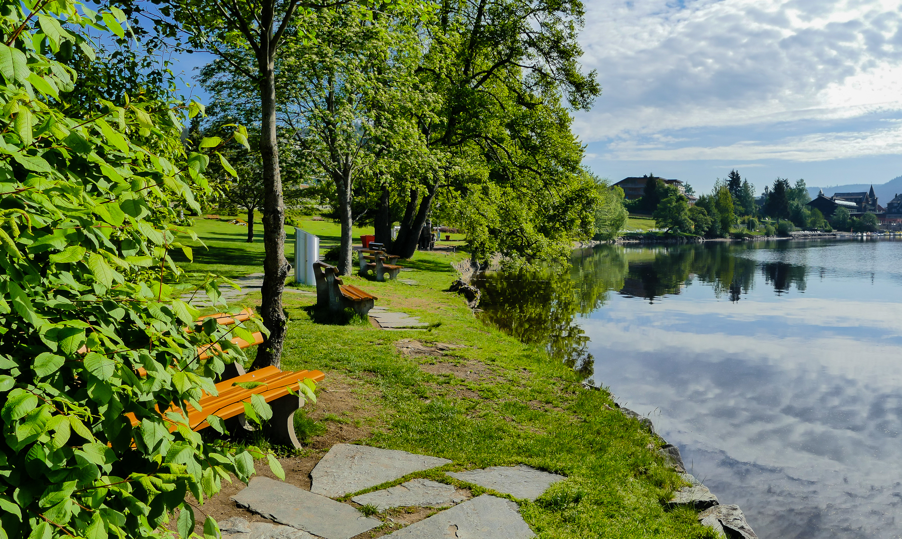
As you embark on the Kölner Weg, you'll traverse a mix of terrains, including lush forests, open meadows, and rolling hills. The trail is well-marked, but carrying a navigation tool like HiiKER on your smartphone can help ensure you stay on the right path.
Historical Significance
The region is steeped in history, and as you hike, you'll encounter various landmarks that tell the story of the area's past. Castles, ancient ruins, and historical towns dot the landscape, offering a glimpse into the life and architecture of bygone eras.
Natural Highlights
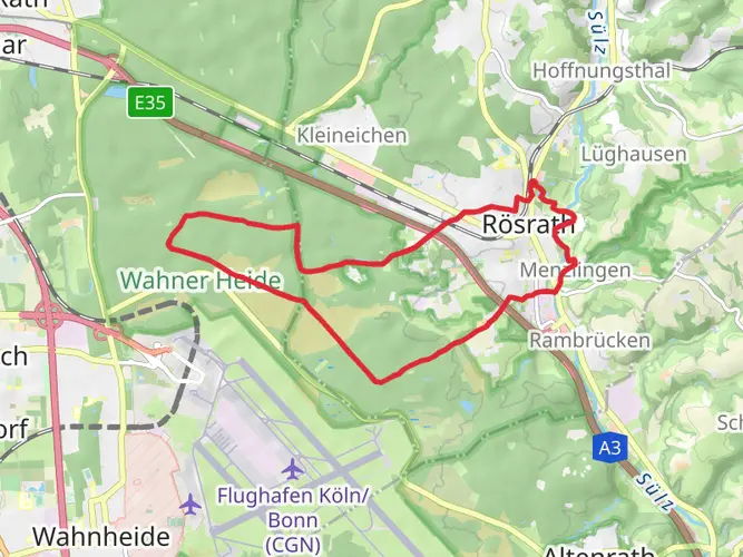
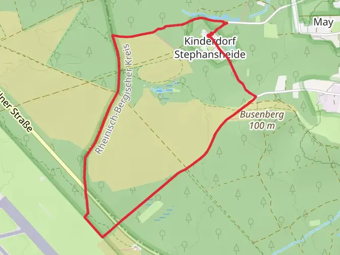
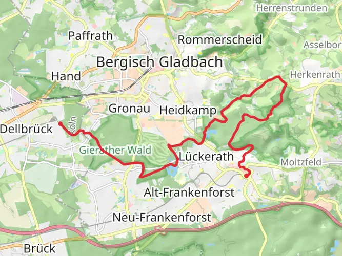
The Kölner Weg is a haven for nature enthusiasts. The trail takes you through the picturesque Bergisches Land, an area known for its natural beauty and wildlife. Keep an eye out for local bird species and other wildlife that inhabit the dense woodlands and the serene river valleys you'll pass through.
Landmarks and Points of Interest
Throughout your journey, you'll come across several significant landmarks. Notable points include historical mills, traditional half-timbered houses, and majestic churches that have stood for centuries. Each of these sites offers a unique photo opportunity and a chance to rest and reflect on the journey.
Elevation and Terrain
The trail's elevation gain is gradual, with the most significant ascents occurring in the first half of the hike. The terrain varies from soft forest floor to rocky paths, so wearing sturdy hiking boots is advisable. The highest points on the trail provide panoramic views of the surrounding countryside, making the climbs well worth the effort.
Preparing for the Hike
Given the trail's length and varied terrain, it's essential to prepare adequately. Pack enough water and food for the duration of your hike, and consider the weather conditions, as they can change rapidly in this region. Layered clothing will help you adapt to temperature fluctuations throughout the day.
Wildlife and Flora
The Kölner Weg is home to a diverse range of flora and fauna. Spring and summer are particularly vibrant, with wildflowers blooming along the trail. The forests are a mix of deciduous and coniferous trees, providing a habitat for various bird species and small mammals.
Accommodations and Amenities
For those looking to complete the trail over several days, there are numerous accommodation options along the route, including guesthouses, inns, and campsites. It's advisable to book in advance, especially during peak hiking seasons.
Conclusion
By following these insights into the Kölner Weg, hikers can prepare for an enriching experience that combines the beauty of nature with the depth of historical culture. Whether you're seeking a multi-day adventure or a series of day hikes, this trail offers something for every enthusiast.

Frequently asked questions
How long is the Kölner Weg and how many days does the Kölner Weg usually take?
The Kölner Weg is 253.97 km long, so it is firmly a multi-day long-distance hike rather than a day walk. At a typical touring pace, most hikers would split it into roughly 13 stages, which usually means about 10 to 14 days on the trail depending on daily mileage, weather, and overnight stops.
How difficult is the Kölner Weg hike near Cologne?
The Kölner Weg is generally rated medium difficulty. The full route packs in 4,586 m of elevation gain over nearly 254 km, so the challenge comes less from technical ground and more from the cumulative distance, repeated climbs, and the stamina needed to keep moving for multiple days.
Where does the Kölner Weg start and how do hikers reach the Kölner Weg from Cologne?
The Kölner Weg begins at Königsforst on the eastern edge of Cologne. A practical public-transport approach is to travel into Cologne and then take Stadtbahn line 9 from Neumarkt to the final stop at Königsforst, which is used as the start for Stage 1 of the route.
How is the Kölner Weg divided into Etappen?
The Kölner Weg is commonly walked in stages rather than as one continuous push. Published stage breakdowns divide the route into about 13 etappen, with individual days varying in length; Stage 1 from Cologne-Rath-Heumar and Königsforst to the Rösrath area is about 15 km, while later stages continue deeper into the Bergisches Land and surrounding uplands.
What kind of scenery does the Kölner Weg pass through after leaving Cologne?
The Kölner Weg leaves the Cologne urban edge quickly and moves into more natural terrain, including the Königsforst and the wider Bergisches Land. Along the route, the landscape shifts between forest tracks, open meadows, rolling hills, and historic settlements, giving the trail a mix of woodland walking and cultural landmarks.
Is the Kölner Weg a loop or a point-to-point long-distance trail?
The Kölner Weg is a point-to-point multi-day trail, not a circular walk. That matters for planning because the finish is not back at the start, so transport, baggage, and overnight logistics usually need to be organized stage by stage rather than around a single base.
Comments and Reviews
User comments, reviews and discussions about the Kölner Weg, Germany.
4.8
average rating out of 5
5 rating(s)