Download
3D Flyover
Add to list
More
8.2 km
~2 hrs
226 m
Loop
“Embark on the Igelborner Hoehe Loop for scenic views, moderate hiking, and historical intrigue near Donnersbergkreis.”
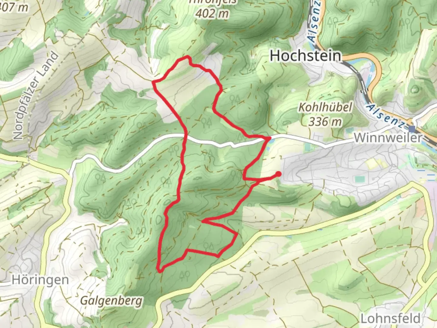
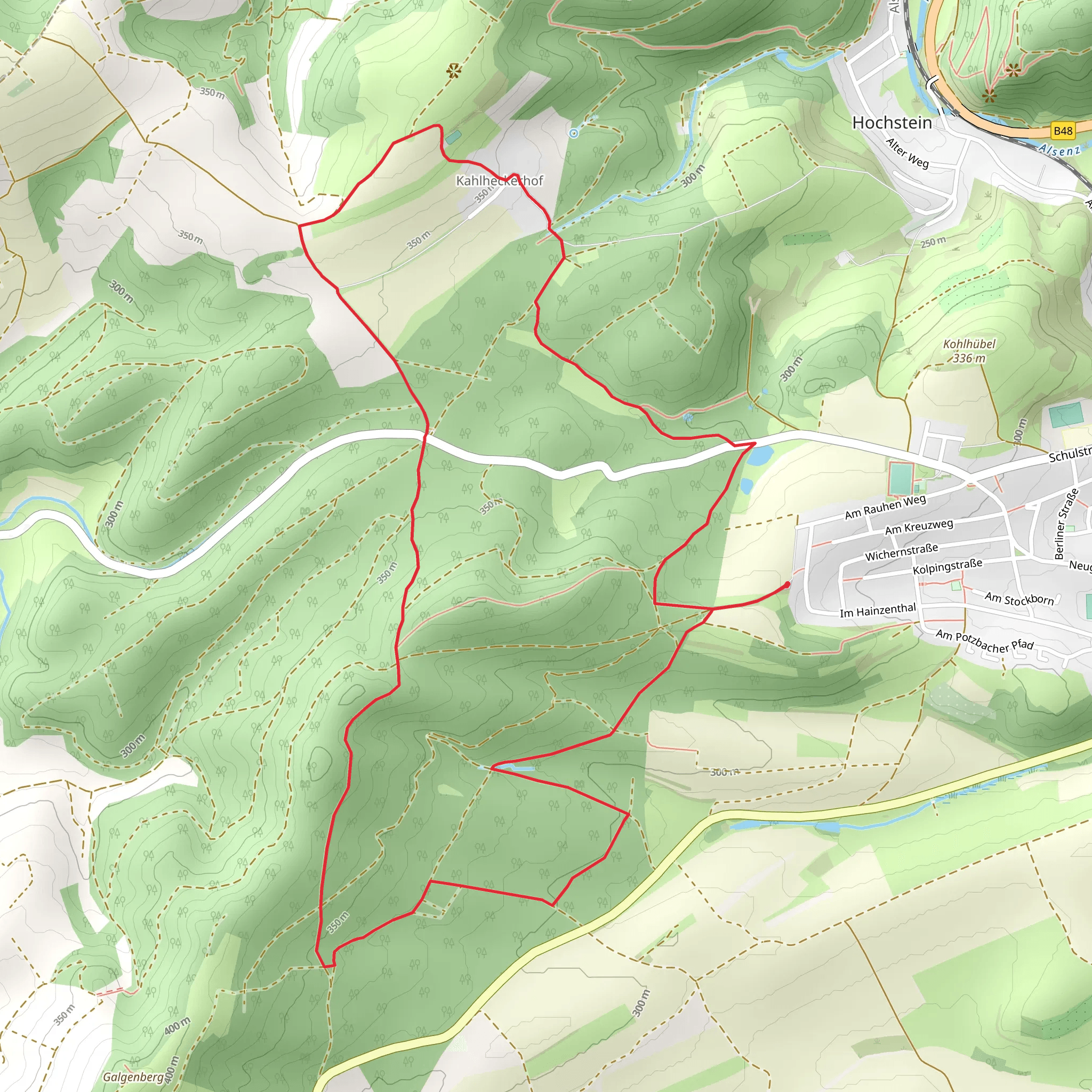
Starting your adventure near Donnersbergkreis, Germany, the Igelborner Hoehe Loop via Pfaelzerwald Blauer Punkt is an 8 km (approximately 5 miles) loop trail with an elevation gain of around 200 meters (656 feet). This medium-difficulty trail offers a blend of natural beauty, historical significance, and a moderate challenge suitable for most hikers.
Getting There
To reach the trailhead, you can either drive or use public transport. If driving, set your GPS to Donnersbergkreis, and look for parking near the village of Dannenfels, which is the closest significant landmark. For those using public transport, take a train to Kirchheimbolanden and then a bus to Dannenfels. From there, it's a short walk to the trailhead.
Trail Navigation
The trail is well-marked with blue dots, known locally as "Blauer Punkt." For precise navigation, consider using the HiiKER app, which provides detailed maps and real-time GPS tracking.
Trail Highlights
Initial Ascent
Starting from Dannenfels, the trail begins with a gentle ascent through dense forest. The initial 2 km (1.2 miles) will take you through a mix of deciduous and coniferous trees, offering a serene and shaded environment. Keep an eye out for local wildlife such as deer and various bird species.
Igelborner Hoehe
At around the 3 km (1.8 miles) mark, you'll reach Igelborner Hoehe, the highest point of the trail. Here, you can enjoy panoramic views of the surrounding Palatinate Forest (Pfaelzerwald) and the distant Donnersberg, the highest peak in the region. This is a great spot for a short break and some photography.
Historical Significance
The area around Donnersbergkreis is rich in history. The Donnersberg itself was a significant site during the Celtic period, and remnants of ancient fortifications can still be found. While the trail doesn't directly pass these sites, the proximity adds a layer of historical intrigue to your hike.
Mid-Trail Descent
After reaching Igelborner Hoehe, the trail begins a gradual descent. The next 2 km (1.2 miles) will take you through more open terrain, including meadows and small clearings. This section offers a different perspective of the landscape, with wildflowers in bloom during the spring and summer months.
Final Stretch
The last 3 km (1.8 miles) loop back towards Dannenfels, taking you through a mix of forest and open fields. This section is relatively flat, making for an easy and relaxing end to your hike. As you approach the village, you'll pass by some traditional German houses and possibly encounter locals going about their daily routines.
Practical Tips
- Footwear: Given the mixed terrain, sturdy hiking boots are recommended.
- Weather: Check the weather forecast before you go, as conditions can change rapidly in the forest.
- Supplies: Bring enough water and snacks, as there are no facilities along the trail.
- Wildlife: Be respectful of the local wildlife and maintain a safe distance.
This trail offers a well-rounded hiking experience with a mix of natural beauty, moderate physical challenge, and a touch of historical significance. Whether you're a seasoned hiker or a casual walker, the Igelborner Hoehe Loop via Pfaelzerwald Blauer Punkt is a rewarding adventure.
What to expect?
Activity types
Comments and Reviews
User comments, reviews and discussions about the Igelborner Hoehe Loop via Pfaelzerwald Blauer Punkt, Germany.
4.25
average rating out of 5
4 rating(s)
