Download
3D Flyover
Add to list
More
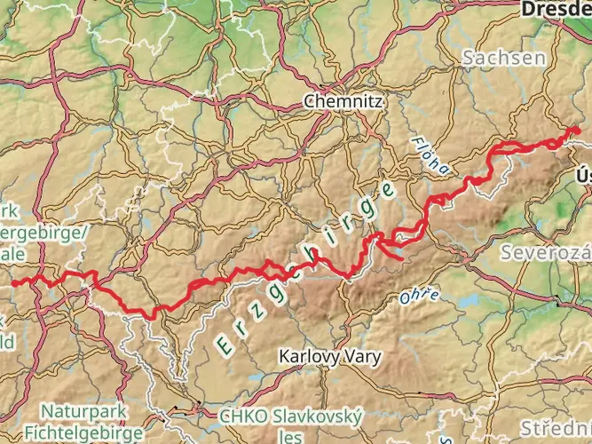
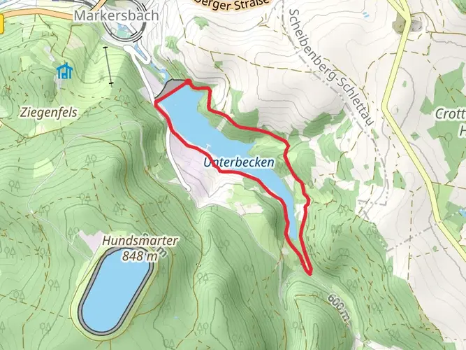
123.9 km
~5 days
1566 m
Multi-Day
“Embark on the Zschopautal-Wanderweg for a historical hike through Saxony's enchanting landscapes.”
The Zschopautal-Wanderweg is a scenic trail that meanders through the heart of Saxony, offering hikers a blend of natural beauty and historical intrigue. Spanning approximately 124 kilometers (about 77 miles) with an elevation gain of around 1500 meters (roughly 4921 feet), this point-to-point trail begins near the town of Wolkenstein in the Erzgebirgskreis region of Germany.
Getting to the Trailhead
To reach the starting point of the Zschopautal-Wanderweg, hikers can drive to Wolkenstein, which is accessible via the B101 highway. For those relying on public transport, regional trains and buses serve the area, with the Wolkenstein train station being the closest stop to the trailhead. From there, it's a short walk to where the trail begins.
Navigating the Trail
The trail is well-marked, guiding hikers through lush forests, rolling hills, and alongside the Zschopau River, which is a constant companion on this journey. Hikers can rely on the HiiKER app for detailed maps and navigation assistance, ensuring they stay on the right path.
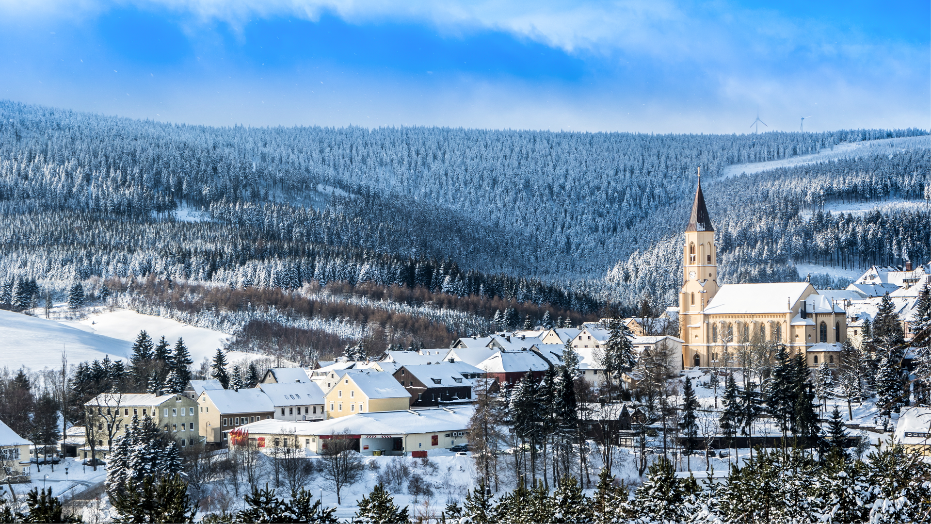
Historical Significance and Landmarks
As you traverse the Zschopautal-Wanderweg, you'll be walking through a region steeped in history. The trail passes by numerous castles, fortresses, and ruins, such as the impressive Schloss Wildeck in Zschopau and the ruins of the Lichtenwalde Castle. These landmarks not only provide a glimpse into the past but also serve as excellent vantage points for panoramic views of the surrounding landscape.
Natural Beauty and Wildlife
The trail offers a diverse array of flora and fauna. The mixed forests are home to a variety of bird species, while the open meadows are often dotted with wildflowers in the spring and summer months. Deer, foxes, and other wildlife can be spotted in the quieter sections of the trail.
Trail Sections and Elevation
The trail can be divided into manageable sections for those who prefer to tackle it in stages. The first section from Wolkenstein to Zschopau covers about 20 kilometers (12.4 miles) with a moderate elevation gain, passing through the picturesque town of Scharfenstein. The middle sections of the trail offer a mix of flat and hilly terrain, with the river valley providing a relatively gentle walk. The final stretch leading to the end point near Drebach is where hikers will encounter the majority of the elevation gain, with steep ascents that reward with sweeping views.
Preparation and Planning
Hikers should come prepared with sturdy footwear, as the trail can be rocky and uneven in places. Weather in the region can be variable, so layered clothing is recommended. There are several towns and villages along the route where hikers can resupply, but carrying enough water and snacks for each day's hike is advisable. It's also worth noting that some sections of the trail may be more remote, so planning accommodation in advance is recommended for multi-day treks.
Conclusion
The Zschopautal-Wanderweg is a trail that offers something for every hiker. Whether you're interested in the natural landscape, the wildlife, or the rich history of the region, this trail provides an immersive experience through one of Germany's most picturesque valleys. With careful planning and a spirit of adventure, hikers will find this trail to be a rewarding journey through Saxony's diverse terrain.

Frequently asked questions
How long is the Zschopautal-Wanderweg and how many days does the full hike usually take?
The Zschopautal-Wanderweg is 123.91 km long with 1,566 m of total ascent, so it fits best as a multi-day hike rather than a single long outing. Most walkers break a route of this length into roughly 5 to 8 days, depending on daily mileage, lodging plans, and how much time is spent in towns and at castle stops along the Zschopau valley.
Is the Zschopautal-Wanderweg difficult, or is it suitable for less experienced hikers?
The Zschopautal-Wanderweg is generally rated easy, which makes it more approachable than many long-distance routes in upland Germany. The challenge comes more from the overall 123.91 km distance than from steep climbing, with 1,566 m of elevation gain spread across the full route through the Zschopau valley.
Where does the Zschopautal-Wanderweg start, and can the trailhead be reached by train?
The route begins near Wolkenstein in Erzgebirgskreis, and Wolkenstein is one of the rail-served places on the Zschopau valley line. That makes train access practical for the opening section, and several other stations along the valley can also be used to join or leave the route on shorter sections.
Does the Zschopautal-Wanderweg pass Kriebstein Reservoir or Burg Kriebstein?
Yes. The Zschopautalweg reaches the Kriebstein area, and the signed walking network around Talsperre Kriebstein overlaps with the Zschopautalweg near the reservoir. That section is known for views over the Zschopau and for access to Burg Kriebstein, one of the best-known landmarks on the lower valley.
Can the Zschopautal-Wanderweg be hiked in sections around Lichtenwalde or Zschopau?
Yes. The Zschopautal-Wanderweg works well as a section hike, and the valley has several rail-linked access points including Zschopau and Niederwiesa for the Lichtenwalde side of the route. Around Zschopau, local walking networks and the main valley trail make it easy to plan shorter day hikes instead of tackling the full 123.91 km.
What kind of scenery and landmarks are on the Zschopautal-Wanderweg?
The Zschopautal-Wanderweg follows the Zschopau valley through a mix of river scenery, wooded slopes, small towns, and historic sites in Saxony. Notable places associated with the route and valley include Wolkenstein, Zschopau, Schloss Wildeck, the Kriebstein reservoir area, and castle landscapes around Lichtenwalde and the middle Zschopau corridor.
Is the Zschopautal-Wanderweg the same as the Zschopautal cycle route?
No. The Zschopautal-Wanderweg is a long-distance hiking route, while the Zschopautalradweg is the valley’s cycling route. They follow the same river corridor in places, but they are different routes designed for different users, so walkers should follow the hiking waymarks rather than the bike-route signs.
Comments and Reviews
User comments, reviews and discussions about the Zschopautal-Wanderweg, Germany.
4.4
average rating out of 5
5 rating(s)