Download
3D Flyover
Add to list
More
8.2 km
~3 hrs 9 min
913 m
Out and Back
“Discover Bavaria's stunning landscapes on the moderately challenging Zundereck via Archtalschluchtweg trail near Garmisch-Partenkirchen.”
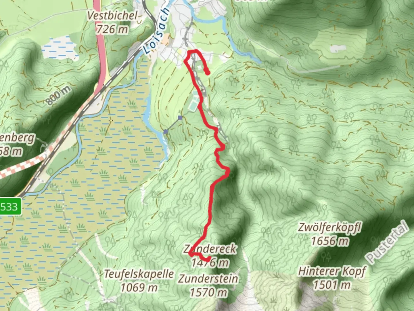
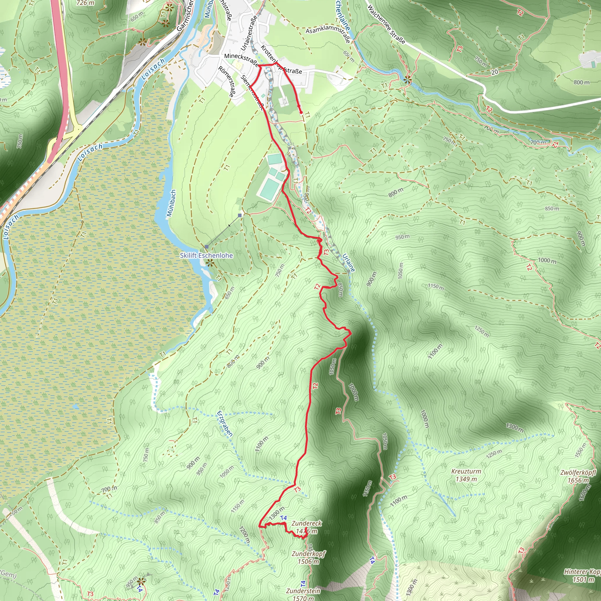
Starting near the picturesque town of Garmisch-Partenkirchen, Germany, the Zundereck via Archtalschluchtweg trail offers an invigorating hike through some of Bavaria's most stunning landscapes. This out-and-back trail spans approximately 8 kilometers (around 5 miles) with an elevation gain of about 900 meters (approximately 2,950 feet), making it a moderately challenging adventure suitable for hikers with a reasonable level of fitness.
Getting There
To reach the trailhead, you can either drive or use public transportation. If you're driving, head towards Garmisch-Partenkirchen and look for parking near the base of the trail. For those using public transport, take a train to Garmisch-Partenkirchen station. From there, local buses or a short taxi ride will get you to the trailhead.
Trail Overview
The trail begins with a gentle ascent through lush forests, offering a serene start to your hike. As you progress, the path becomes steeper, winding its way through the Archtalschlucht gorge. This section is particularly scenic, with towering rock formations and the soothing sound of the Archtal stream accompanying you.
Key Landmarks and Points of Interest
Archtalschlucht Gorge
Approximately 2 kilometers (1.2 miles) into the hike, you'll enter the Archtalschlucht gorge. This natural wonder is characterized by its dramatic cliffs and cascading waterfalls. The trail here can be narrow and rocky, so take your time and watch your footing.
Zundereck Summit
After navigating the gorge, the trail continues to climb steadily towards the Zundereck summit. At around the 4-kilometer (2.5-mile) mark, you'll reach the peak. The summit offers panoramic views of the surrounding Bavarian Alps, including the iconic Zugspitze, Germany's highest peak. This is an excellent spot to take a break, enjoy a snack, and soak in the breathtaking scenery.
Flora and Fauna
The trail is rich in biodiversity. In the lower forested sections, you'll encounter a variety of trees, including spruce, fir, and beech. As you ascend, the vegetation becomes sparser, giving way to alpine meadows dotted with wildflowers in the warmer months. Wildlife enthusiasts might spot deer, chamois, and a variety of bird species, including the golden eagle.
Historical Significance
Garmisch-Partenkirchen and its surrounding areas have a rich history dating back to Roman times. The town itself was a significant trading post in the Middle Ages. During your hike, you'll be walking through landscapes that have been traversed for centuries, adding a layer of historical depth to your adventure.
Navigation and Safety
Given the trail's moderate difficulty, it's advisable to use a reliable navigation tool like HiiKER to stay on track. The path is generally well-marked, but sections through the gorge can be tricky. Ensure you have sturdy hiking boots, sufficient water, and weather-appropriate clothing. The trail can be slippery after rain, so check the weather forecast before setting out.
Final Stretch
The return journey follows the same path, allowing you to revisit the beautiful landscapes from a different perspective. The descent through the gorge and forest is a rewarding way to end your hike, bringing you back to the trailhead near Garmisch-Partenkirchen.
This hike offers a perfect blend of natural beauty, moderate physical challenge, and historical intrigue, making it a must-do for anyone visiting the Bavarian Alps.
What to expect?
Activity types
Comments and Reviews
User comments, reviews and discussions about the Zundereck via Archtalschluchtweg, Germany.
average rating out of 5
0 rating(s)
