Download
3D Flyover
Add to list
More
107.5 km
~4 days
1728 m
Multi-Day
“Embark on the Wiedweg trail for a historic and scenic hike along the Wied River Valley.”
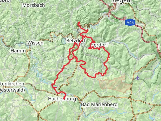
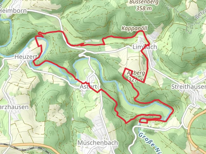
The Wiedweg trail, spanning approximately 107 kilometers (about 66 miles) with an elevation gain of around 1700 meters (approximately 5577 feet), offers a medium-difficulty hiking experience through the picturesque landscapes of Germany. Starting near Hachenburg, a charming town in the Westerwald region, the trail is a point-to-point journey that unfolds the beauty of the Wied River Valley.
Getting to the Trailhead
To reach the starting point of the Wiedweg trail, hikers can drive to Hachenburg, which is well-connected by road. For those preferring public transport, Hachenburg is accessible by train, with the nearest station being Hachenburg Bahnhof. From there, the trailhead is just a short walk or taxi ride away.
Navigating the Trail
Hikers can rely on HiiKER to navigate the trail, ensuring they stay on the right path and can plan their stops accordingly. The app provides detailed maps and waypoints, which are essential for a trail of this length.
Trail Highlights and Landmarks
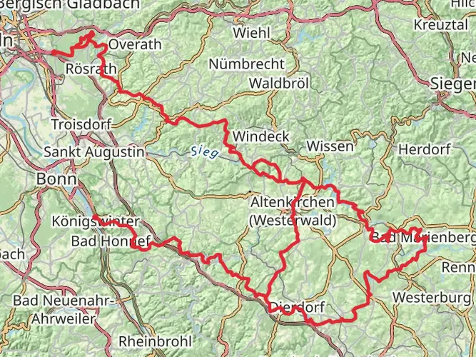
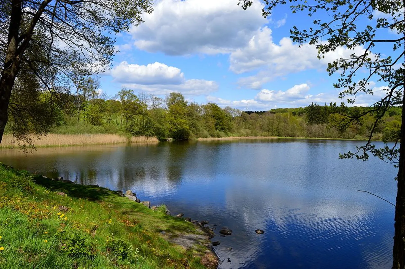
As you embark on the Wiedweg trail, you'll traverse a variety of landscapes, including lush forests, open meadows, and serene riverbanks. The trail closely follows the Wied River, providing a constant companion in the form of its gentle waters.
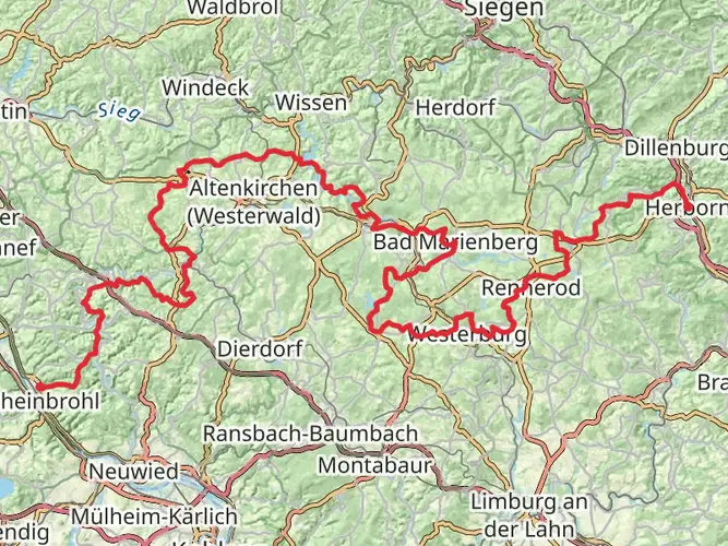
Around the 20-kilometer (12.4 miles) mark, you'll encounter the historic town of Altenkirchen, where you can explore local architecture and perhaps restock on supplies. The trail continues to wind through small villages and hamlets, each offering a glimpse into the rural life of the region.
At approximately the halfway point, near the 53-kilometer (33 miles) mark, the trail reaches the town of Neustadt (Wied), where hikers can take a break to enjoy local cuisine and hospitality.
Flora and Fauna
The Wiedweg trail is a haven for nature enthusiasts. The region is home to a diverse range of wildlife, including deer, foxes, and a variety of bird species. The changing seasons bring different flora to life, with spring and summer offering a display of wildflowers and autumn presenting a tapestry of fall colors.
Historical Significance
The Westerwald region is steeped in history, with the trail passing through areas that have been inhabited since ancient times. Hikers will find themselves walking paths that have been trodden for centuries, and the towns along the route often feature historical buildings and monuments that tell the story of the area's past.
Preparing for the Hike
Given the trail's length and varied terrain, it's important to prepare adequately. Hikers should pack sufficient water, food, and clothing for changing weather conditions. It's also advisable to plan for overnight stays, whether in designated camping areas or local accommodations, as completing the trail will take several days.
Conclusion
The Wiedweg trail offers a rich hiking experience that combines natural beauty with cultural and historical exploration. With proper preparation and the use of navigation tools like HiiKER, hikers can look forward to an unforgettable journey through one of Germany's most scenic regions.

Frequently asked questions
How many stages does the Wiedweg have, and how long is each stage?
The Wiedweg is commonly split into 7 to 8 stages depending on the guide used. A current stage breakdown lists Hachenburg to Linden at about 10 km, Linden to Höchstenbach 16 km, Höchstenbach to Altenkirchen 16 km, Altenkirchen to Oberlahr 16 km, Oberlahr to Neustadt (Wied) 14 km, Neustadt (Wied) to Roßbach/Wied 17 km, Roßbach/Wied to Niederbreitbach 10 km, and Niederbreitbach to Irlich 19 km.
Where does the Wiedweg start and finish?
The Wiedweg begins near the source of the Wied by Linden in the Westerwald and follows the river downstream toward Neuwied on the Rhine. The full route is about 107.45 km long, and the lower end of the trail reaches the Neuwied area near the river mouth.
What is Wiedweg Etappe 1, and how hard is the first stage?
Wiedweg Etappe 1 runs from Hachenburg to Linden and is usually listed at about 10 km with roughly 182 m of climbing and 46 m of descent. It is generally rated moderate, making it a manageable opening day rather than the hardest section of the route.
What is Wiedweg Etappe 3, and where does it go?
One common stage plan lists Wiedweg Etappe 3 from Höchstenbach to Altenkirchen at about 16 km with around 233 m of ascent and 299 m of descent. Some guides use a slightly different split and place Stage 3 from Höchstenbach to Almersbach at roughly 15.9 km, so stage names can vary even though the overall route stays the same.
Can the Wiedweg be reached by public transportation from Hachenburg?
Yes. Hachenburg has a rail station, Hachenburg Bahnhof, and stage access is possible by local bus from the town. For the Linden start near the Wied source, published route information notes an approximately 8-minute walk from Hachenburg station to the Markt stop, then a bus connection onward to Linden (Westerwald).
Is the Wiedweg a difficult long-distance hike?
The Wiedweg is generally a medium-difficulty multi-day trail. Over 107.45 km it gains about 1,728 m, so it is more about steady daily mileage and repeated ups and downs than high alpine terrain.
What landscapes and landmarks does the Wiedweg pass on the way from Hachenburg?
The Wiedweg follows the Wied through the Westerwald and passes a mix of forest, meadows, river scenery, and small towns. Early sections include the Wied source near Linden, the Dreifelder Weiher area, the Upper Wied valley, and the Steinebach sculpture park before the route continues toward places such as Altenkirchen, Oberlahr, Neustadt (Wied), Niederbreitbach, and Neuwied.
Comments and Reviews
User comments, reviews and discussions about the Wiedweg, Germany.
4.67
average rating out of 5
6 rating(s)