Download
3D Flyover
Add to list
More
5.3 km
~1 hrs 24 min
218 m
Point-to-Point
“Discover lush forests, historical remnants, and panoramic views on the moderately challenging Steinnickelskopf via Taunusklub Route.”
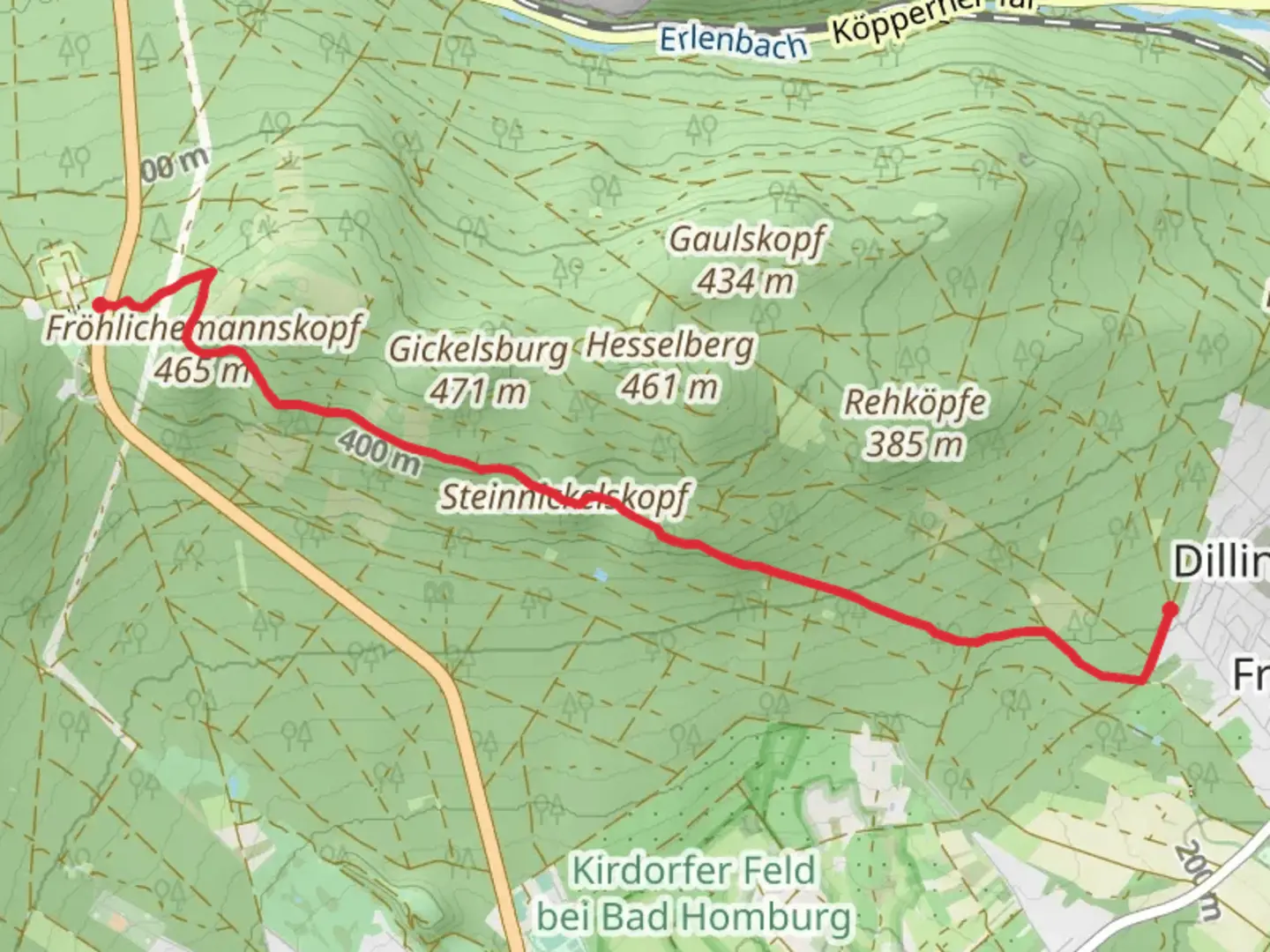
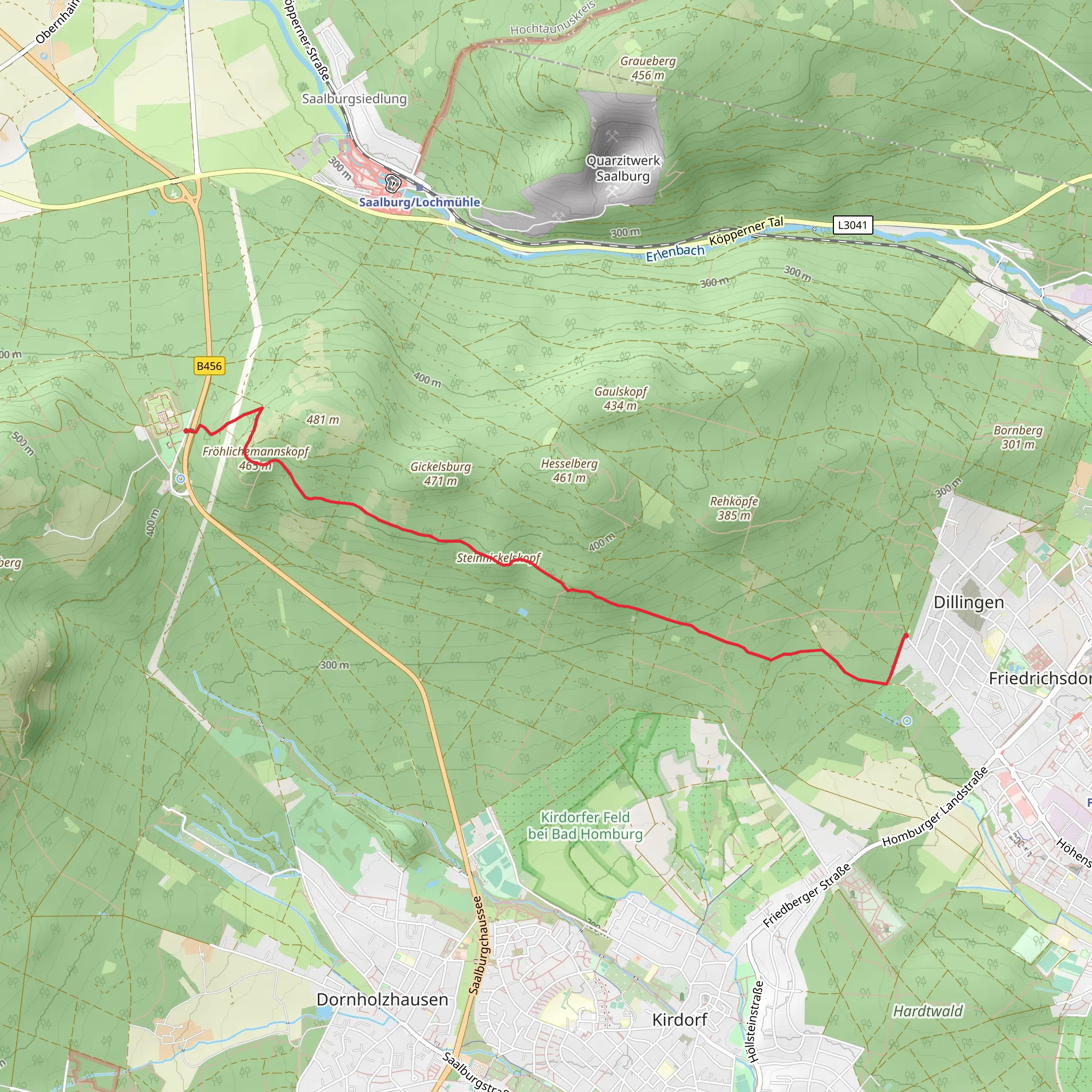
Starting near Hochtaunuskreis, Germany, the Steinnickelskopf via Taunusklub Route offers a delightful 5 km (approximately 3.1 miles) point-to-point hike with an elevation gain of around 200 meters (656 feet). This trail is rated medium in difficulty, making it suitable for moderately experienced hikers.
Getting There
To reach the trailhead, you can drive or use public transportation. If driving, set your GPS to Hochtaunuskreis, and look for parking options near the starting point. For those using public transport, take a train to Bad Homburg station, which is the nearest major station. From there, you can catch a local bus to the vicinity of Hochtaunuskreis. The bus routes and schedules can be checked on local transit websites or apps.
Trail Navigation
For navigation, it is highly recommended to use the HiiKER app, which provides detailed maps and real-time updates. This will help you stay on track and ensure you don't miss any key points along the way.
Trail Highlights
As you embark on the trail, you'll find yourself surrounded by the lush greenery of the Taunus mountain range. The trail meanders through dense forests, offering a serene atmosphere and the occasional chirping of birds. Keep an eye out for local wildlife such as deer and various bird species that inhabit the area.
Historical Significance
The Taunus region is steeped in history, dating back to Roman times. The area was once part of the Roman Limes, a frontier boundary of the Roman Empire. As you hike, you may come across remnants of ancient Roman structures, adding a historical dimension to your journey.
Key Landmarks
- Steinnickelskopf Summit: Approximately 2.5 km (1.55 miles) into the hike, you'll reach the Steinnickelskopf summit. At an elevation of around 500 meters (1640 feet), this spot offers panoramic views of the surrounding landscape. It's an excellent place to take a break and soak in the scenery.
- Taunusklub Shelter: About 3.5 km (2.17 miles) into the hike, you'll find a shelter maintained by the Taunusklub. This is a great spot to rest, have a snack, and enjoy the tranquility of the forest.
Flora and Fauna
The trail is rich in diverse flora, including oak, beech, and pine trees. During spring and summer, the forest floor is adorned with wildflowers, adding a splash of color to your hike. The fauna includes small mammals like squirrels and foxes, and if you're lucky, you might spot a red deer.
Final Stretch
The final stretch of the trail descends gently, leading you through more forested areas before reaching the endpoint. The descent offers a different perspective of the landscape, with occasional clearings that provide glimpses of the distant hills.
Safety and Preparation
Given the medium difficulty rating, ensure you wear sturdy hiking boots and carry sufficient water and snacks. Weather in the Taunus region can be unpredictable, so pack a light rain jacket and check the forecast before heading out. Using the HiiKER app will help you stay informed about any trail conditions or updates.
This hike offers a perfect blend of natural beauty, historical intrigue, and moderate physical challenge, making it a rewarding experience for those who venture onto the Steinnickelskopf via Taunusklub Route.
What to expect?
Activity types
Comments and Reviews
User comments, reviews and discussions about the Steinnickelskopf via Taunusklub Route, Germany.
4.8
average rating out of 5
5 rating(s)
