Download
3D Flyover
Add to list
More
7.8 km
~1 hrs 50 min
169 m
Loop
“Explore 8 km of natural beauty, historical ruins, and diverse wildlife on the Huetterer Rundwanderweg Ost loop trail.”
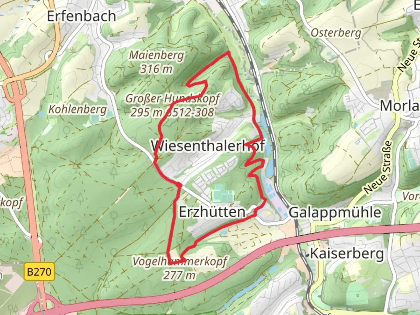
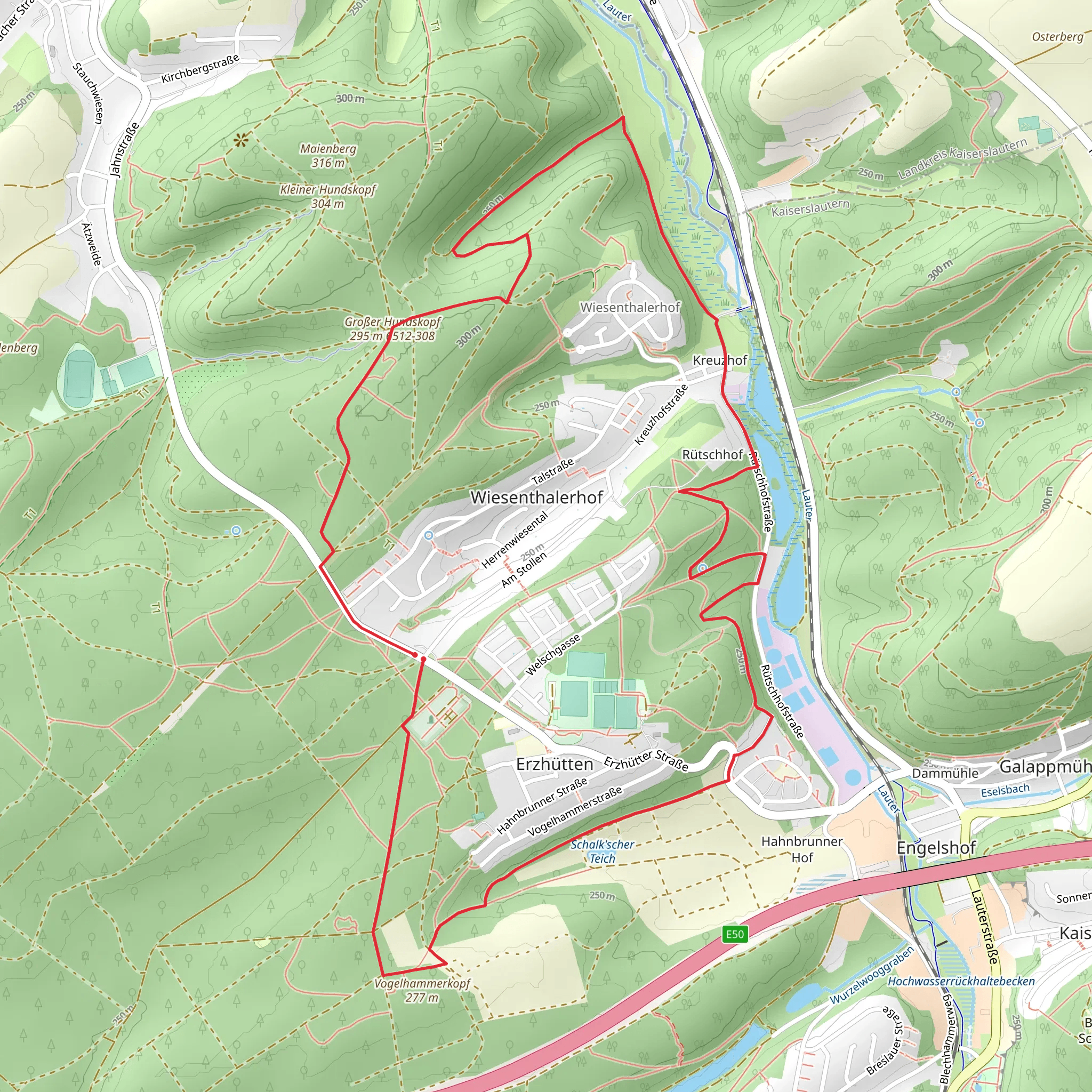
Starting near Kaiserslautern, Germany, the Huetterer Rundwanderweg Ost is an 8 km (approximately 5 miles) loop trail with an elevation gain of around 100 meters (328 feet). This medium-difficulty trail offers a delightful mix of natural beauty, historical landmarks, and opportunities for wildlife spotting.
Getting There
To reach the trailhead, you can either drive or use public transport. If driving, set your GPS to the nearest known address: Kaiserslautern, Germany. For those using public transport, take a train or bus to Kaiserslautern Hauptbahnhof (Main Station). From there, local buses or a short taxi ride will get you to the trailhead.
Trail Overview
The trail begins near the outskirts of Kaiserslautern, leading you through a variety of landscapes including dense forests, open meadows, and gentle hills. The initial section is relatively flat, making it a good warm-up before you start gaining elevation.
Points of Interest
Forested Areas
As you enter the forested sections, you'll be surrounded by towering trees and the sounds of local wildlife. Keep an eye out for deer, foxes, and a variety of bird species. The forest floor is often carpeted with wildflowers in the spring and summer, adding a splash of color to your hike.
Historical Landmarks
About 3 km (1.86 miles) into the hike, you'll come across remnants of old stone structures. These ruins date back to medieval times and offer a glimpse into the region's rich history. Take a moment to explore and imagine what life might have been like centuries ago.
Scenic Overlooks
Roughly halfway through the trail, you'll reach a scenic overlook that offers panoramic views of the surrounding countryside. This is a great spot to take a break, have a snack, and enjoy the scenery. The elevation gain to this point is about 50 meters (164 feet), making it a moderate climb.
Wildlife and Flora
The trail is home to a diverse range of flora and fauna. Depending on the season, you might see wild boars, rabbits, and various bird species. The flora includes oak, beech, and pine trees, as well as a variety of shrubs and wildflowers.
Navigation
To ensure you stay on track, it's advisable to use a reliable navigation tool like HiiKER. The trail is well-marked, but having a digital map can provide extra peace of mind.
Final Stretch
The last 2 km (1.24 miles) of the trail take you through more open terrain, offering a different perspective of the landscape. The path gradually descends back towards the starting point, making for a pleasant and easy finish to your hike.
Practical Tips
- Wear sturdy hiking boots, as some sections can be uneven.
- Bring plenty of water and snacks, especially if you plan to take breaks.
- Check the weather forecast before heading out, as conditions can change rapidly.
- If hiking in the fall or winter, be prepared for muddy or slippery sections.
This trail offers a balanced mix of natural beauty, historical intrigue, and moderate physical challenge, making it a rewarding experience for hikers of all levels.
Comments and Reviews
User comments, reviews and discussions about the Huetterer Rundwanderweg Ost, Germany.
average rating out of 5
0 rating(s)
