Download
3D Flyover
Add to list
More
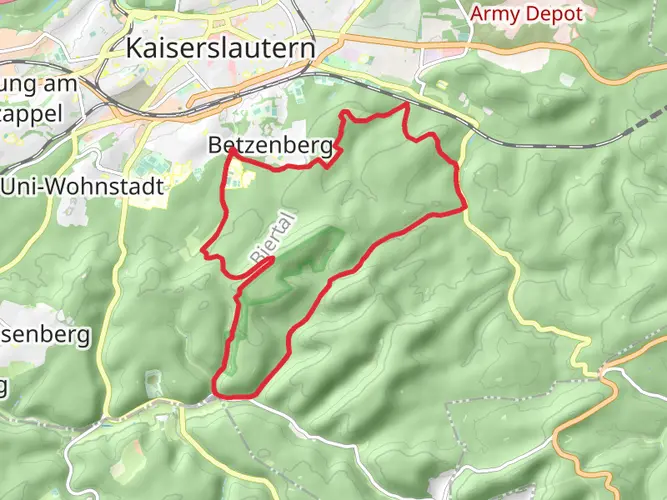
141.4 km
~6 days
3050 m
Multi-Day
“Embark on the Pfälzer Waldpfad for a historic, scenic hike through Germany's largest forest.”
Embarking on the Pfälzer Waldpfad, hikers will traverse approximately 141 kilometers (about 87.6 miles) through the heart of the Palatinate Forest, the largest contiguous forest in Germany. With an elevation gain of around 3000 meters (nearly 9843 feet), the trail offers a medium difficulty level, making it accessible to hikers with a reasonable level of fitness and experience.
Getting to the Trailhead
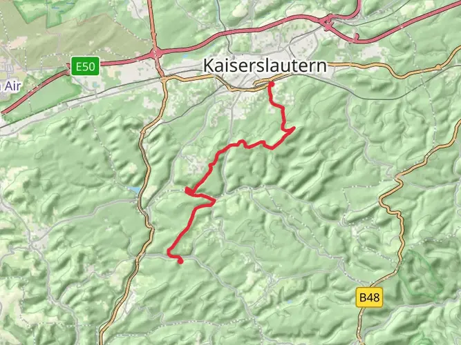
The journey begins near Kaiserslautern, a city easily accessible by public transport or car. For those arriving by train, Kaiserslautern Hauptbahnhof (the main train station) serves as a central hub with connections from various German cities. From the station, local buses can take you closer to the trailhead. If driving, parking is available in areas near the trail's starting point. Utilizing the HiiKER app will help in pinpointing the exact starting location and provide navigation throughout the hike.
Navigating the Pfälzer Waldpfad
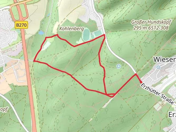
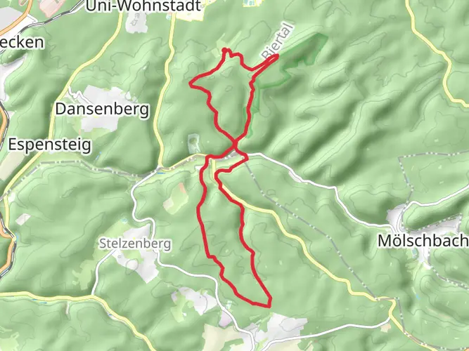
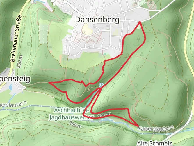
The trail is a point-to-point trek, winding through dense forests, over gentle hills, and past sandstone cliffs. It is well-marked with clear signage, making navigation straightforward. However, carrying a digital map on HiiKER is advisable for real-time tracking and additional trail information.
Landmarks and Natural Beauty
As you set out, the path leads you through picturesque woodlands, punctuated by castle ruins that whisper tales of the region's rich history. Notable historical landmarks include the ruins of Gräfenstein Castle, which dates back to the 13th century, and the impressive Berwartstein Castle, still partially inhabited today.
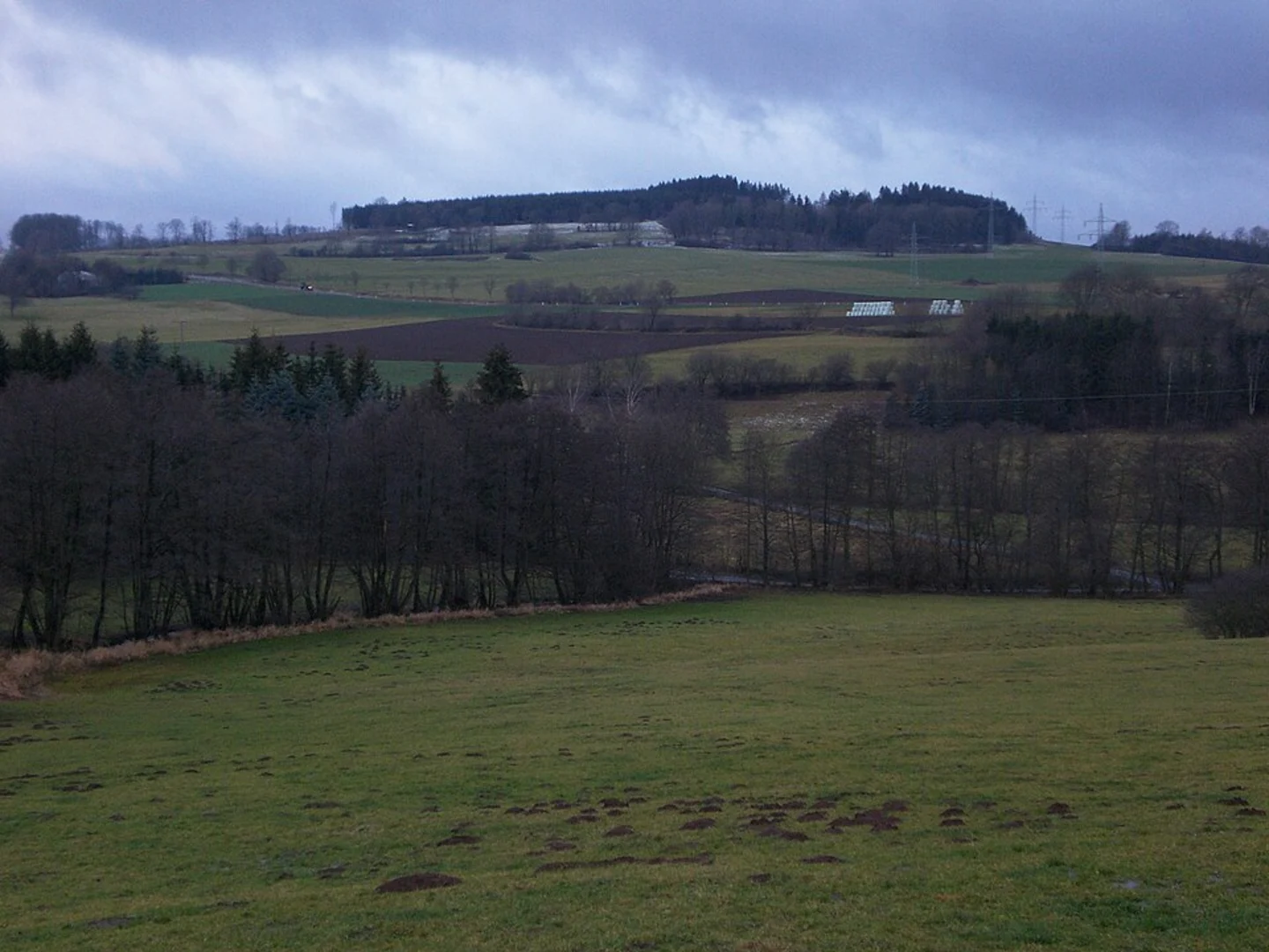
The trail offers an immersive experience in nature, with opportunities to spot local wildlife such as deer, foxes, and a variety of bird species. The diverse landscape is home to unique flora, including orchids and other wildflowers that bloom in the understory.
Cultural Highlights
The Pfälzer Waldpfad is not just a natural escape but also a cultural journey. The trail meanders through charming villages where hikers can experience Palatinate hospitality. Local cuisine, particularly the region's wines and hearty dishes, provides a delightful way to refuel.
Preparation and Planning
Before setting out, hikers should ensure they have appropriate gear for the trail's varying terrain and weather conditions. Sturdy hiking boots, weather-appropriate clothing, and a reliable backpack are essential. It's also important to carry enough water and snacks, although there are opportunities to restock at villages along the route.
Given the trail's length, planning for overnight stays is necessary. The path is dotted with hiker-friendly accommodations, including inns and designated camping areas. Booking in advance is recommended, especially during peak hiking seasons.
Conclusion
The Pfälzer Waldpfad is a journey through time, nature, and culture. With its moderate difficulty, it promises an enriching experience for those who come prepared. Whether you're drawn by the historical castles, the lush forest canopies, or the warm local communities, this trail is a testament to the enduring beauty of the Palatinate region.

Frequently asked questions
How long is the Pfälzer Waldpfad and how many days does the full hike usually take?
The Pfälzer Waldpfad is 141.43 km long with about 3,050 m of elevation gain, so it is firmly a multi-day route rather than a long day hike. The trail is commonly divided into 9 stages from Kaiserslautern to Schweigen-Rechtenbach, which puts most complete hikes at around 8 to 10 days depending on pace and overnight stops.
Where does the Pfälzer Waldpfad start and finish near Kaiserslautern?
The Pfälzer Waldpfad starts in Kaiserslautern and runs south through the Palatinate Forest to Schweigen-Rechtenbach on the German Wine Route. One of its standout logistics advantages is that the northern end begins at Kaiserslautern, a major rail hub with an ICE station, making the start unusually easy to reach for a long-distance trail.
What are the main highlights on the Pfälzer Waldpfad from Kaiserslautern to Schweigen-Rechtenbach?
The route crosses the Palatinate Forest biosphere landscape and is known for deep wooded valleys, red sandstone formations, and castle ruins rather than alpine terrain. Notable landmarks associated with the trail include the ruins of Gräfenstein Castle, the Drachenfels area near Busenberg, Burg Berwartstein, and the finish at the Deutsches Weintor in Schweigen-Rechtenbach.
Is the Pfälzer Waldpfad difficult, and how much climbing is on the route?
The Pfälzer Waldpfad is generally rated medium difficulty, but the challenge comes from its length and cumulative ascent rather than technical scrambling. Across 141.43 km, the trail gains about 3,050 m, so it suits hikers comfortable with repeated rolling climbs, long forest stages, and several consecutive days on foot.
Does the Pfälzer Waldpfad go to the highest point in the Palatinate Forest?
Yes. The route reaches the Kalmit, which at 673 m is the highest mountain in the Palatinate Forest. That gives the Pfälzer Waldpfad one of its signature high points before the trail continues toward the southern end at Schweigen-Rechtenbach.
Are there places to stay along the Pfälzer Waldpfad, or is it best done with overnight stops?
The Pfälzer Waldpfad is normally completed with overnight stops because 141.43 km is spread across multiple stages through towns, villages, and forest-edge settlements. Accommodation is typically arranged stage by stage between Kaiserslautern and Schweigen-Rechtenbach, which is why the trail is often described and planned as a 9-stage long-distance walk.
Comments and Reviews
User comments, reviews and discussions about the Pfälzer Waldpfad, Germany.
4.29
average rating out of 5
7 rating(s)