Download
3D Flyover
Add to list
More
85.0 km
~4 days
2107 m
Multi-Day
“Embark on the Habichtswaldsteig for a scenic and historic 85-km hiking adventure through Germany's nature.”
The Habichtswaldsteig is a captivating trail that meanders through the Habichtswald nature park, offering hikers a blend of natural beauty and historical intrigue. Spanning approximately 85 kilometers (about 53 miles) with an elevation gain of around 2100 meters (roughly 6890 feet), this point-to-point trail begins near the vibrant city of Kassel, Germany, and promises an adventure of medium difficulty for those who embark upon it.
Getting to the Trailhead To reach the starting point of the Habichtswaldsteig, hikers can utilize public transportation or drive. From Kassel, one can take a bus or tram to the town of Zierenberg, which is in close proximity to the trailhead. For those driving, parking is available in the area near Zierenberg. Hikers can use the HiiKER app to navigate to the exact starting location and plan their route accordingly.
Navigating the Trail The trail is well-marked with signage, making it easy to follow. Hikers should download the trail map on the HiiKER app to ensure they stay on the correct path, as the trail winds through diverse landscapes, including lush forests, open meadows, and rocky outcrops.
Landmarks and Historical Significance One of the most significant landmarks along the Habichtswaldsteig is the Hercules monument, an impressive statue located in Bergpark Wilhelmshöhe, a UNESCO World Heritage Site. This park is also home to the Wilhelmshöhe Palace and the Löwenburg Castle, offering a glimpse into the region's rich history.
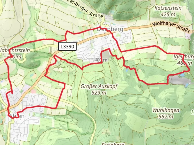
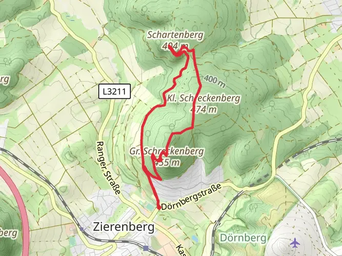
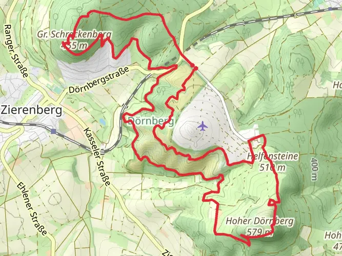
As hikers progress along the trail, they will encounter the Dörnberg, a natural reserve with a unique flora and fauna. The reserve is known for its orchid species and the rare European wildcat. The trail also passes through Erlenloch, a former basalt quarry that now serves as a geological educational site.
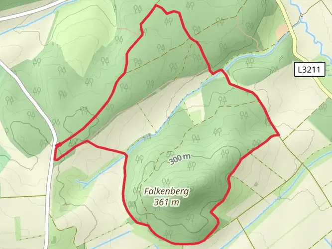
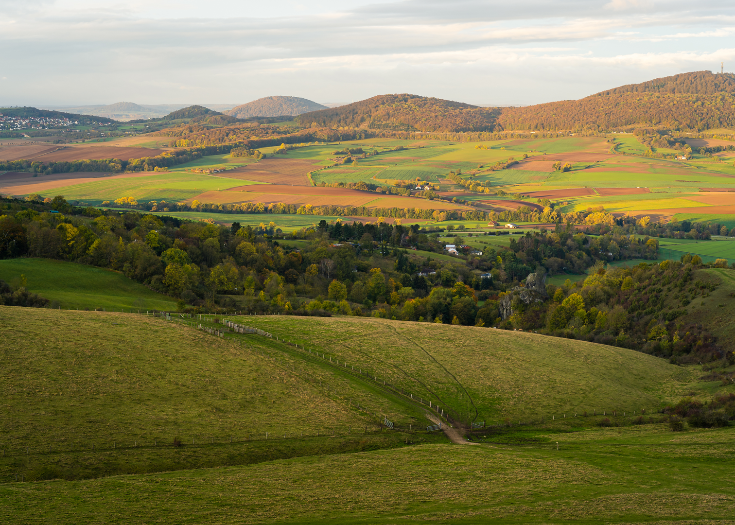
Nature and Wildlife The Habichtswaldsteig traverses through the Habichtswald, a region characterized by its mixed deciduous forests, home to a variety of wildlife including deer, foxes, and numerous bird species. The trail offers panoramic views of the surrounding landscape, especially from peaks like the Essigberg and Helfensteine.
Preparation and Planning Hikers should prepare for varying weather conditions and pack accordingly, as the trail can be quite exposed in certain areas. It is advisable to wear sturdy hiking boots due to the rocky and uneven terrain encountered on parts of the trail. Water sources are available at various points, but carrying sufficient water and snacks is recommended.
Accommodation and Rest Points Along the Habichtswaldsteig, there are several huts and shelters where hikers can rest. Additionally, the trail passes through small towns where one can find guesthouses and hotels for overnight stays. It is advisable to book accommodations in advance, especially during peak hiking seasons.
The Habichtswaldsteig offers a rewarding experience for those interested in the natural beauty and historical heritage of the region. With proper preparation and the use of navigation tools like HiiKER, hikers can enjoy a memorable journey through one of Germany's picturesque landscapes.

Frequently asked questions
How long is the Habichtswaldsteig and how hard is the full hike?
The Habichtswaldsteig is 84.96 km long with 2,107 meters of total ascent, so it is a demanding multi-day route rather than a casual day walk. It is generally treated as a difficult point-to-point hike running from Zierenberg to the Edersee, with repeated climbs through the Habichtswald hills.
How many stages does the Habichtswaldsteig have and where do they start and finish?
The Habichtswaldsteig is commonly divided into 4 main stages on the official route. It starts in Zierenberg and finishes at the Edersee, with stage breakdowns published for Etappen 1 to 4, making it practical to plan as a four-day crossing of the Naturpark Habichtswald.
Where does Habichtswaldsteig stage 1 start and what is stage 1 like?
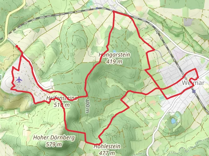
Stage 1 of the Habichtswaldsteig starts in Zierenberg, with the route beginning from the Marktplatz area. This opening section is one of the longer and tougher days at roughly 23.75 km, and it heads into the Dörnberg area with notable landmarks such as the Helfensteine and Hoher Dörnberg.
Is there an official Habichtswaldsteig map with the stages and route shown clearly?
Yes. The Naturpark Habichtswald publishes an official Habichtswaldsteig map that shows the full Etappentour, the individual stages 1 to 4, and the Extratouren. That is useful on this trail because the route covers a long point-to-point line from Zierenberg to the Edersee rather than a single loop.
What are the Habichtswaldsteig Extratouren and is H6 part of the trail network?
The Habichtswaldsteig network includes the main long-distance route plus a set of signed Extratouren, which are separate circular walks linked to the wider trail system. H6 is one of them and is officially listed as Habichtswaldsteig Extratour H6, called Im Tal der Quellen, so it is part of the branded Habichtswaldsteig hiking network but not one of the 4 main through-stages.
Where does the Habichtswaldsteig start and finish?
The Habichtswaldsteig begins in Zierenberg near Kassel and runs west and southwest through the Habichtswald landscape to the Edersee. The finish is in the Hemfurth-Edersee area by the lake, after crossing to the Edersee end of the route.
Can the Habichtswaldsteig be reached by public transportation from Kassel?
Yes. Zierenberg, the eastern start of the Habichtswaldsteig, is the usual access point from the Kassel area, and the trail is promoted with public transportation links to start and finish portals and other stops along the route. That makes it realistic to begin the hike without a car, especially for stage-based trips.
Comments and Reviews
User comments, reviews and discussions about the Habichtswaldsteig, Germany.
4.67
average rating out of 5
9 rating(s)