Download
3D Flyover
Add to list
More
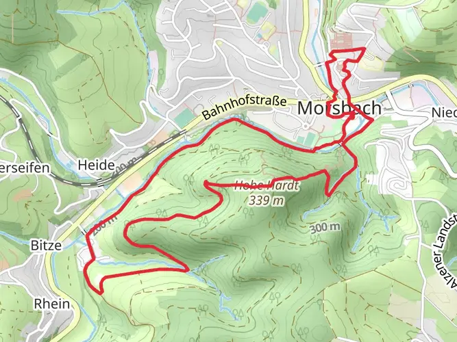
83.0 km
~4 days
2168 m
Multi-Day
“Embark on the Druidensteig for a historical hike through Germany's enchanting landscapes and diverse wildlife.”
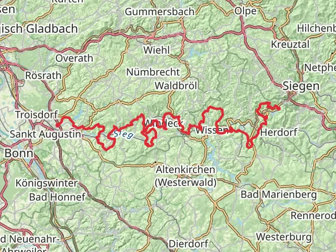
Spanning approximately 83 kilometers (about 51.6 miles) with an elevation gain of around 2100 meters (approximately 6890 feet), the Druidensteig is a point-to-point trail that offers a medium difficulty rating for hikers. The trailhead is conveniently located near Kirchen (Sieg) in Germany, a region steeped in history and natural beauty.
Getting to the Trailhead
To reach the starting point of the Druidensteig, hikers can use public transportation by catching a train to Kirchen (Sieg), which is well-connected to major cities. From the train station, the trailhead is accessible by a short taxi ride or a local bus, depending on the schedule. For those driving, parking is available near the trailhead, which is situated close to the town center of Kirchen (Sieg).
Trail Overview
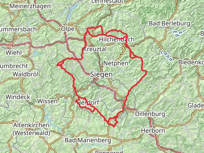
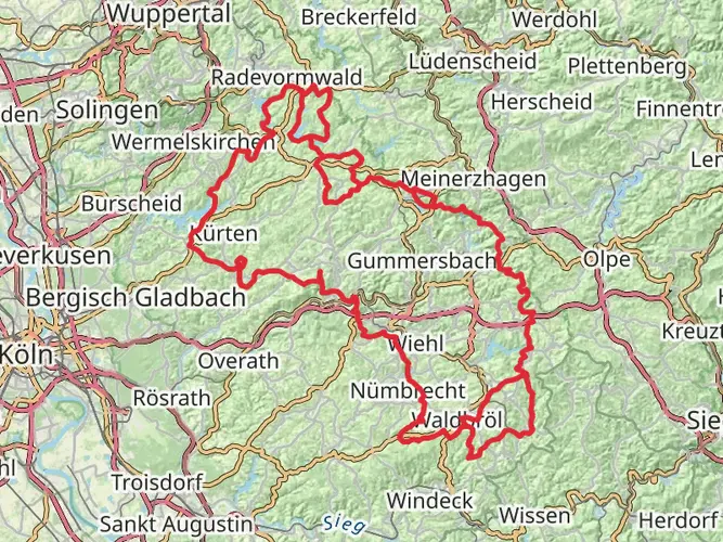
The Druidensteig trail meanders through the Westerwald and Rothaargebirge mountain ranges, offering a diverse landscape that includes dense forests, rolling hills, and serene river valleys. The trail is well-marked, and hikers can use the HiiKER app for navigation to ensure they stay on the correct path.
Historical Significance and Landmarks
The region is rich in history, with the trail's name itself, "Druidensteig," hinting at its ancient past, where it is believed that Druids once roamed these lands. As hikers progress along the trail, they will encounter various landmarks that echo the area's historical significance, including old mills, traditional half-timbered houses, and remnants of historical trade routes.
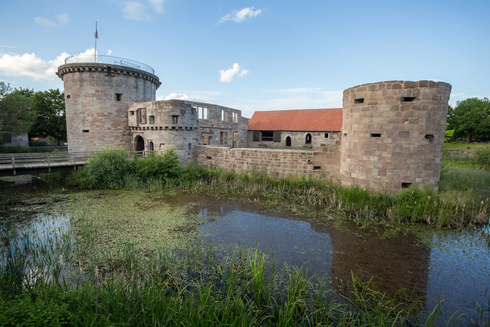
One of the significant landmarks along the Druidensteig is the Freusburg Castle, located approximately 5 kilometers (about 3.1 miles) from the trailhead. This medieval castle, perched on a hill overlooking the Sieg River, offers a glimpse into the region's feudal past and provides panoramic views of the surrounding countryside.
Natural Features and Wildlife
The trail offers an immersive experience into the natural world, with opportunities to observe a variety of wildlife, including deer, birds of prey, and smaller forest creatures. The diverse flora along the route changes with the seasons, offering a colorful display of wildflowers in spring and a rich tapestry of autumnal hues in the fall.
Elevation and Terrain
The Druidensteig is characterized by its undulating terrain, with the elevation gain spread out across the length of the trail. Hikers will encounter a mix of ascents and descents, with some steep sections that contribute to the trail's medium difficulty rating. The highest point of the trail is reached at around the halfway mark, providing a rewarding challenge for those who undertake the journey.
Preparation and Planning
Hikers planning to tackle the Druidensteig should be well-prepared with appropriate gear, including sturdy hiking boots, weather-appropriate clothing, and sufficient water and food supplies. It's advisable to check the weather forecast in advance and plan for contingencies, as conditions can change rapidly in the mountains.
Given the trail's length, some may choose to complete it in sections over several days. There are various accommodation options along the route, including guesthouses and campsites, allowing for a comfortable multi-day hiking experience.
Conclusion
The Druidensteig is a trail that offers a rich tapestry of natural beauty, historical landmarks, and a varied landscape that will engage hikers of all levels. With careful preparation and an adventurous spirit, those who embark on this journey will be rewarded with an unforgettable hiking experience.

Frequently asked questions
Where is the Druidensteig in Germany, and where does the Druidensteig start and finish?
The Druidensteig is a long-distance hiking trail in the northern Westerwald region of Germany. The route begins near Freusburg by Kirchen (Sieg) and runs for about 82.99 km to Hachenburg, linking the Sieg valley with the uplands and forested ridges farther east.
Is the Druidensteig a multi-day hiking trail or a circular walk?
The Druidensteig is a point-to-point multi-day trail, not a loop. It covers roughly 82.99 km with 2,168 m of ascent, so it is usually walked over several days rather than as a single-day out-and-back or a Rundweg.
How many stages does the Druidensteig have, and how long is each day?
The Druidensteig is commonly divided into six stages. With a total length of about 83 km, that works out to an average of roughly 13 to 14 km per day, although individual stages vary depending on where the overnight stops are set between Kirchen (Sieg) and Hachenburg.
How much elevation gain does the Druidensteig have?
The Druidensteig has 2,168 m of total elevation gain across its 82.99 km route. That amount of climbing, spread over a medium-difficulty multi-day trail, means the route includes repeated ascents and descents rather than one single sustained climb.
Can the Druidensteig be started from Kirchen (Sieg) by train?
Yes. Kirchen (Sieg) station is used as a practical access point for the western end of the Druidensteig, and the town is promoted locally as a starting point for stages on the trail. From the station, the route area around Freusburg and Kirchen can be reached with a short local transfer or walk depending on the chosen start.
What are the main highlights on the Druidensteig near Kirchen (Sieg) and along the route?
Highlights associated with the Druidensteig include Freusburg near Kirchen (Sieg), broad Westerwald viewpoints, mining heritage sites, and the finish area around the Landschaftsmuseum in Hachenburg. The trail is also closely associated with the Druidenstein area above Kirchen, one of the best-known landmarks tied to the route.
Comments and Reviews
User comments, reviews and discussions about the Druidensteig, Germany.
4.63
average rating out of 5
8 rating(s)