Download
Preview
Add to list
More
14.5 km
~3 hrs 32 min
385 m
Loop
“Embark on a 14 km journey through Eifel's scenic cliffs, ancient ruins, and vibrant wildlife.”
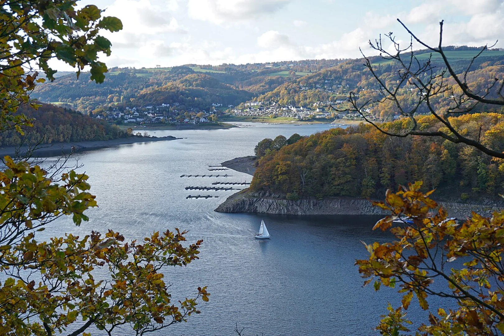
Starting your adventure near Kreis Düren, Germany, the Eifeler Steikueste and Wildnis Loop Trail offers a captivating 14 km (approximately 8.7 miles) journey through the scenic Eifel region. With an elevation gain of around 300 meters (984 feet), this medium-difficulty loop trail promises a blend of natural beauty and historical intrigue.
Getting There
To reach the trailhead, you can drive or use public transport. If driving, set your GPS to the vicinity of Kreis Düren. For those opting for public transport, take a train to Düren station and then a local bus towards Heimbach, alighting near the trailhead.
Trail Highlights
Scenic Landscapes
The trail meanders through a diverse landscape, featuring dense forests, open meadows, and rugged rock formations. Early in the hike, you'll encounter the striking Eifeler Steikueste, a series of dramatic cliffs that offer panoramic views of the surrounding countryside. These cliffs are particularly stunning at sunrise or sunset, casting long shadows and highlighting the rugged terrain.
Flora and Fauna
As you progress, the trail takes you through sections of ancient woodland, home to a variety of wildlife. Keep an eye out for deer, wild boar, and a plethora of bird species. The forest floor is often carpeted with wildflowers in spring and summer, adding a splash of color to your hike.
Historical Significance
The Eifel region is steeped in history, and this trail is no exception. Midway through the hike, you'll come across remnants of ancient Roman settlements. These archaeological sites offer a glimpse into the past, with well-preserved foundations and artifacts that speak to the area's long history of human habitation.
Navigation and Waypoints
Using HiiKER for navigation is highly recommended. The app provides detailed maps and real-time updates, ensuring you stay on track. Key waypoints include: - Eifeler Steikueste Cliffs (approx. 3 km/1.9 miles from the start): A perfect spot for a break and some photography. - Ancient Roman Ruins (approx. 7 km/4.3 miles from the start): Take some time to explore and appreciate the historical context. - Wildnis Area (approx. 10 km/6.2 miles from the start): A dense forest section that feels almost untouched by modern civilization.
Elevation Profile
The trail features a moderate elevation gain of 300 meters (984 feet). The initial ascent to the Eifeler Steikueste cliffs is the most challenging part, but the effort is well worth it for the views. After this, the trail undulates gently, with a few short, steep sections as you approach the Wildnis area.
Practical Tips
- Footwear: Sturdy hiking boots are recommended due to the rocky and uneven terrain.
- Weather: Check the weather forecast before you go. The trail can be slippery after rain, especially in the forested sections.
- Supplies: Carry enough water and snacks, as there are no facilities along the trail.
- Wildlife: Be respectful of the wildlife. Keep a safe distance and avoid feeding any animals.
This trail offers a perfect blend of natural beauty, wildlife, and historical intrigue, making it a rewarding experience for any hiker.

What to expect?
Activity types
Comments and Reviews
User comments, reviews and discussions about the Eifeler Steikueste and Wildnis Loop Trail, Germany.
4.67
average rating out of 5
3 rating(s)